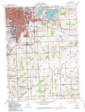
Lima Topo Map Ohio
To zoom in, hover over the map of Lima
USGS Topo Quad 40084f1 - 1:24,000 scale
| Topo Map Name: | Lima |
| USGS Topo Quad ID: | 40084f1 |
| Print Size: | ca. 21 1/4" wide x 27" high |
| Southeast Coordinates: | 40.625° N latitude / 84° W longitude |
| Map Center Coordinates: | 40.6875° N latitude / 84.0625° W longitude |
| U.S. State: | OH |
| Filename: | o40084f1.jpg |
| Download Map JPG Image: | Lima topo map 1:24,000 scale |
| Map Type: | Topographic |
| Topo Series: | 7.5´ |
| Map Scale: | 1:24,000 |
| Source of Map Images: | United States Geological Survey (USGS) |
| Alternate Map Versions: |
Lima OH 1961, updated 1962 Download PDF Buy paper map Lima OH 1961, updated 1972 Download PDF Buy paper map Lima OH 1961, updated 1983 Download PDF Buy paper map Lima OH 1961, updated 1983 Download PDF Buy paper map Lima OH 2010 Download PDF Buy paper map Lima OH 2013 Download PDF Buy paper map Lima OH 2016 Download PDF Buy paper map |
1:24,000 Topo Quads surrounding Lima
> Back to 40084e1 at 1:100,000 scale
> Back to 40084a1 at 1:250,000 scale
> Back to U.S. Topo Maps home
Lima topo map: Gazetteer
Lima: Airports
Lima Allen County Airport elevation 291m 954′Lima Memorial Hospital Heliport elevation 268m 879′
Saint Ritas Medical Center Heliport elevation 263m 862′
Lima: Canals
Crosley Ditch elevation 276m 905′Lima: Crossings
Interchange 120 elevation 267m 875′Interchange 122 elevation 274m 898′
Interchange 124 elevation 275m 902′
Interchange 125 elevation 270m 885′
Lima: Dams
Ferguson Upground Reservoir Dam elevation 276m 905′Lost Creek Upground Reservoir Dam elevation 269m 882′
Metzger Upground Reservoir Dam elevation 281m 921′
Schoonover Lake Dam elevation 267m 875′
Lima: Parks
Collett Street Park elevation 259m 849′Cook Park elevation 268m 879′
Foundry Park elevation 269m 882′
Hoover Park elevation 259m 849′
Industry Park elevation 258m 846′
Lima Stadium elevation 261m 856′
Lincoln Park elevation 264m 866′
Schoonover Park elevation 265m 869′
Lima: Populated Places
Green Acres elevation 285m 935′Lima elevation 268m 879′
Rousculp elevation 292m 958′
South Warsaw elevation 282m 925′
Yoder elevation 292m 958′
Lima: Post Offices
Lima Post Office elevation 270m 885′Rousculp Post Office (historical) elevation 292m 958′
South Warsaw Post Office (historical) elevation 282m 925′
Yoder Post Office (historical) elevation 293m 961′
Lima: Reservoirs
Ferguson Reservoir elevation 276m 905′Lost Creek Reservoir elevation 269m 882′
Metzger Reservoir elevation 281m 921′
Schoonover Lake elevation 267m 875′
Twin Lake Reservoir elevation 262m 859′
Lima: Streams
Camp Creek elevation 276m 905′Little Wrestle Creek elevation 287m 941′
Lost Creek elevation 261m 856′
Wrestle Creek elevation 277m 908′
Lima digital topo map on disk
Buy this Lima topo map showing relief, roads, GPS coordinates and other geographical features, as a high-resolution digital map file on DVD:
Northern Illinois, Northern Indiana & Southwestern Michigan
Buy digital topo maps: Northern Illinois, Northern Indiana & Southwestern Michigan


