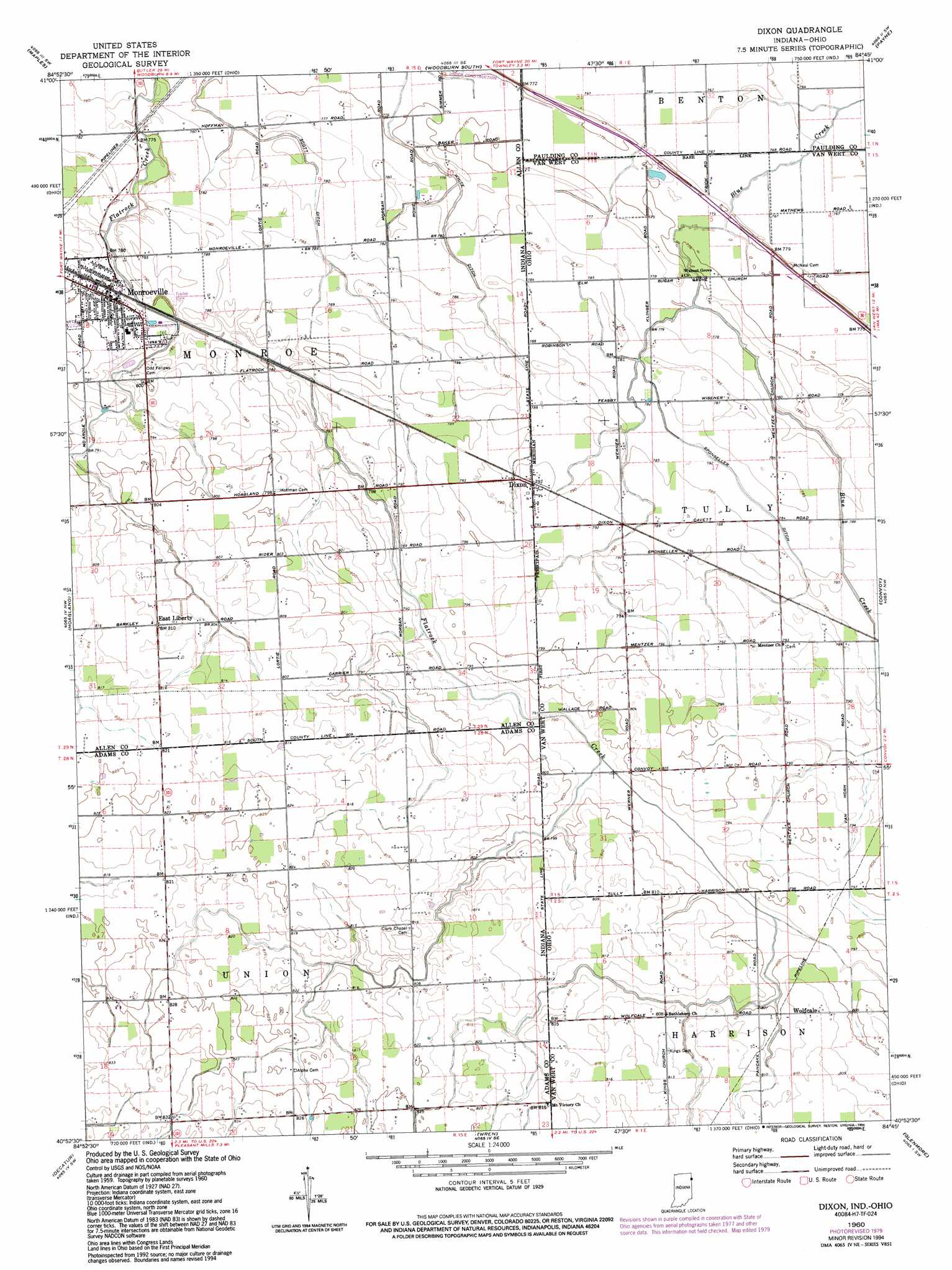
Dixon Topo Map Indiana
To zoom in, hover over the map of Dixon
USGS Topo Quad 40084h7 - 1:24,000 scale
| Topo Map Name: | Dixon |
| USGS Topo Quad ID: | 40084h7 |
| Print Size: | ca. 21 1/4" wide x 27" high |
| Southeast Coordinates: | 40.875° N latitude / 84.75° W longitude |
| Map Center Coordinates: | 40.9375° N latitude / 84.8125° W longitude |
| U.S. States: | IN, OH |
| Filename: | o40084h7.jpg |
| Download Map JPG Image: | Dixon topo map 1:24,000 scale |
| Map Type: | Topographic |
| Topo Series: | 7.5´ |
| Map Scale: | 1:24,000 |
| Source of Map Images: | United States Geological Survey (USGS) |
| Alternate Map Versions: |
Dixon IN 1960, updated 1961 Download PDF Buy paper map Dixon IN 1960, updated 1963 Download PDF Buy paper map Dixon IN 1960, updated 1972 Download PDF Buy paper map Dixon IN 1960, updated 1980 Download PDF Buy paper map Dixon IN 1960, updated 1994 Download PDF Buy paper map Dixon IN 2010 Download PDF Buy paper map Dixon IN 2013 Download PDF Buy paper map Dixon IN 2016 Download PDF Buy paper map |
1:24,000 Topo Quads surrounding Dixon
Cedarville |
Grabill |
Woodburn North |
Antwerp |
Paulding |
Fort Wayne East |
Maples |
Woodburn South |
Payne |
Latty |
Poe |
Hoagland |
Dixon |
Convoy |
Scott |
Preble |
Decatur |
Wren |
Glenmore |
Van Wert |
Linn Grove |
Berne |
Willshire |
Rockford |
Mendon |
> Back to 40084e1 at 1:100,000 scale
> Back to 40084a1 at 1:250,000 scale
> Back to U.S. Topo Maps home
Dixon topo map: Gazetteer
Dixon: Canals
Scott Ditch elevation 240m 787′Sponseller Ditch elevation 238m 780′
Dixon: Populated Places
Dixon elevation 241m 790′East Liberty elevation 247m 810′
Monroeville elevation 240m 787′
Wolfcale elevation 247m 810′
Dixon: Post Offices
Dixon Post Office (historical) elevation 241m 790′Wolfcale Post Office (historical) elevation 246m 807′
Dixon digital topo map on disk
Buy this Dixon topo map showing relief, roads, GPS coordinates and other geographical features, as a high-resolution digital map file on DVD:
Northern Illinois, Northern Indiana & Southwestern Michigan
Buy digital topo maps: Northern Illinois, Northern Indiana & Southwestern Michigan