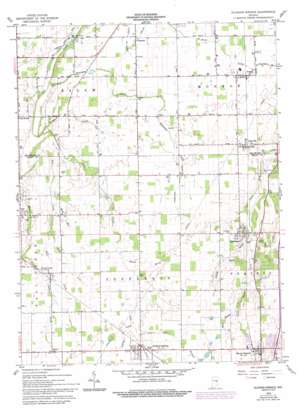
Sulphur Springs Topo Map Indiana
To zoom in, hover over the map of Sulphur Springs
USGS Topo Quad 40085a4 - 1:24,000 scale
| Topo Map Name: | Sulphur Springs |
| USGS Topo Quad ID: | 40085a4 |
| Print Size: | ca. 21 1/4" wide x 27" high |
| Southeast Coordinates: | 40° N latitude / 85.375° W longitude |
| Map Center Coordinates: | 40.0625° N latitude / 85.4375° W longitude |
| U.S. State: | IN |
| Filename: | o40085a4.jpg |
| Download Map JPG Image: | Sulphur Springs topo map 1:24,000 scale |
| Map Type: | Topographic |
| Topo Series: | 7.5´ |
| Map Scale: | 1:24,000 |
| Source of Map Images: | United States Geological Survey (USGS) |
| Alternate Map Versions: |
Sulphur Springs IN 1960, updated 1979 Download PDF Buy paper map Sulphur Springs IN 1960, updated 1982 Download PDF Buy paper map Sulpher Springs IN 1960, updated 1994 Download PDF Buy paper map Sulphur Springs IN 2010 Download PDF Buy paper map Sulphur Springs IN 2013 Download PDF Buy paper map Sulphur Springs IN 2016 Download PDF Buy paper map |
1:24,000 Topo Quads surrounding Sulphur Springs
> Back to 40085a1 at 1:100,000 scale
> Back to 40084a1 at 1:250,000 scale
> Back to U.S. Topo Maps home
Sulphur Springs topo map: Gazetteer
Sulphur Springs: Canals
Abshire Ditch elevation 308m 1010′Peckinpaugh Ditch elevation 305m 1000′
Sulphur Springs: Populated Places
Cowan elevation 302m 990′Cross Roads elevation 296m 971′
Honey Creek elevation 311m 1020′
Mount Summit elevation 333m 1092′
Oakville elevation 308m 1010′
Progress elevation 296m 971′
Springport elevation 324m 1062′
Sulphur Springs elevation 324m 1062′
Sulphur Springs: Streams
Bethel Brook elevation 309m 1013′Hillside Brook elevation 307m 1007′
Lake Branch elevation 317m 1040′
Mount Run elevation 314m 1030′
Port Run elevation 305m 1000′
Sharp Run elevation 297m 974′
Small Branch elevation 319m 1046′
Spring Run elevation 305m 1000′
Sulphur Drain elevation 316m 1036′
Summit Brook elevation 316m 1036′
Welsh Creek elevation 289m 948′
Williams Creek elevation 284m 931′
Sulphur Springs digital topo map on disk
Buy this Sulphur Springs topo map showing relief, roads, GPS coordinates and other geographical features, as a high-resolution digital map file on DVD:
Northern Illinois, Northern Indiana & Southwestern Michigan
Buy digital topo maps: Northern Illinois, Northern Indiana & Southwestern Michigan


