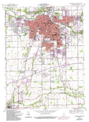
Anderson South Topo Map Indiana
To zoom in, hover over the map of Anderson South
USGS Topo Quad 40085a6 - 1:24,000 scale
| Topo Map Name: | Anderson South |
| USGS Topo Quad ID: | 40085a6 |
| Print Size: | ca. 21 1/4" wide x 27" high |
| Southeast Coordinates: | 40° N latitude / 85.625° W longitude |
| Map Center Coordinates: | 40.0625° N latitude / 85.6875° W longitude |
| U.S. State: | IN |
| Filename: | o40085a6.jpg |
| Download Map JPG Image: | Anderson South topo map 1:24,000 scale |
| Map Type: | Topographic |
| Topo Series: | 7.5´ |
| Map Scale: | 1:24,000 |
| Source of Map Images: | United States Geological Survey (USGS) |
| Alternate Map Versions: |
Anderson IN 1952, updated 1954 Download PDF Buy paper map Anderson South IN 1961, updated 1962 Download PDF Buy paper map Anderson South IN 1961, updated 1972 Download PDF Buy paper map Anderson South IN 1961, updated 1982 Download PDF Buy paper map Anderson South IN 1961, updated 1994 Download PDF Buy paper map Anderson South IN 2010 Download PDF Buy paper map Anderson South IN 2013 Download PDF Buy paper map Anderson South IN 2016 Download PDF Buy paper map |
1:24,000 Topo Quads surrounding Anderson South
> Back to 40085a1 at 1:100,000 scale
> Back to 40084a1 at 1:250,000 scale
> Back to U.S. Topo Maps home
Anderson South topo map: Gazetteer
Anderson South: Airports
Ace Airpark elevation 277m 908′Rolling Hills Convalescent Center Airport elevation 271m 889′
Anderson South: Canals
Michael Ditch elevation 266m 872′Orebaugh Ditch elevation 267m 875′
Pittsford Ditch elevation 268m 879′
Stanley Ditch elevation 265m 869′
Anderson South: Cliffs
White River Bluff elevation 270m 885′Anderson South: Parks
Circle Park elevation 269m 882′Denny Field elevation 270m 885′
Edgewater Park elevation 256m 839′
Fairview Park elevation 265m 869′
Falls Park elevation 256m 839′
Horne Park elevation 260m 853′
Hubbard Park elevation 257m 843′
Madison Park elevation 256m 839′
Meadowbrook Park elevation 267m 875′
Puiaski Park elevation 276m 905′
Riley Park elevation 255m 836′
Stanton Park elevation 272m 892′
Anderson South: Populated Places
Alliance elevation 279m 915′Anderson elevation 268m 879′
Brentwood elevation 268m 879′
Country Club Heights elevation 268m 879′
Crestlawn elevation 272m 892′
Eastern Heights elevation 272m 892′
Edgewood elevation 268m 879′
Elmhurst elevation 267m 875′
Emporia elevation 282m 925′
Extension Heights elevation 267m 875′
Fairfax elevation 274m 898′
Forest Hills elevation 269m 882′
Glyn Ellen elevation 273m 895′
Grandview elevation 267m 875′
Gridley elevation 275m 902′
Harmeson Heights elevation 270m 885′
Hillcrest elevation 265m 869′
Huntsville elevation 265m 869′
Irondale elevation 259m 849′
Lowmandale elevation 275m 902′
Meadowbrook elevation 272m 892′
New Columbus elevation 274m 898′
River Forest elevation 266m 872′
South Edgewood elevation 268m 879′
Western Village elevation 265m 869′
Woodlawn Heights elevation 264m 866′
Anderson South: Streams
Killbuck Creek elevation 252m 826′Prairie Creek elevation 254m 833′
Spring Branch elevation 259m 849′
Sugar Fork elevation 264m 866′
Anderson South digital topo map on disk
Buy this Anderson South topo map showing relief, roads, GPS coordinates and other geographical features, as a high-resolution digital map file on DVD:
Northern Illinois, Northern Indiana & Southwestern Michigan
Buy digital topo maps: Northern Illinois, Northern Indiana & Southwestern Michigan


