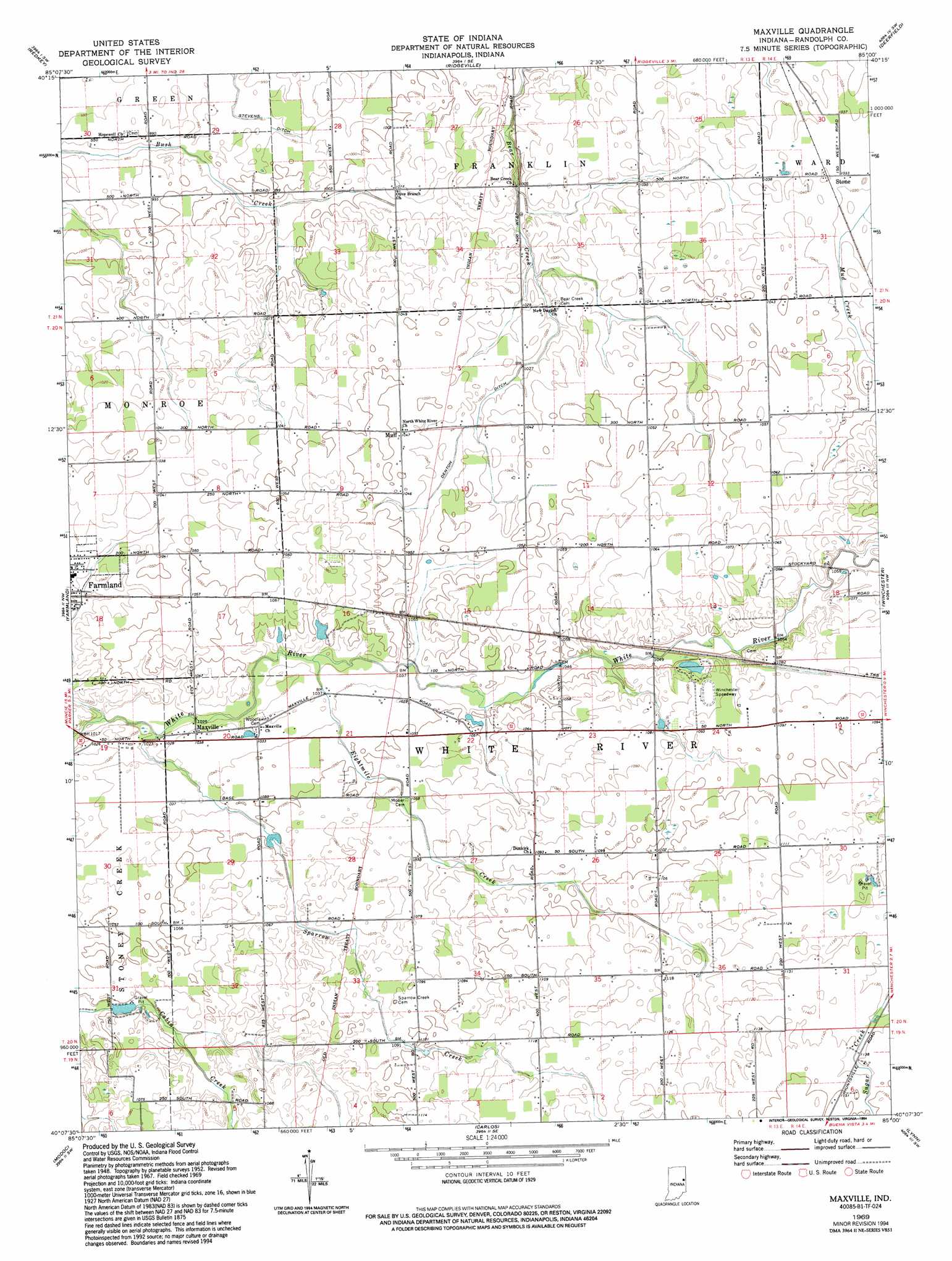
Maxville Topo Map Indiana
To zoom in, hover over the map of Maxville
USGS Topo Quad 40085b1 - 1:24,000 scale
| Topo Map Name: | Maxville |
| USGS Topo Quad ID: | 40085b1 |
| Print Size: | ca. 21 1/4" wide x 27" high |
| Southeast Coordinates: | 40.125° N latitude / 85° W longitude |
| Map Center Coordinates: | 40.1875° N latitude / 85.0625° W longitude |
| U.S. State: | IN |
| Filename: | o40085b1.jpg |
| Download Map JPG Image: | Maxville topo map 1:24,000 scale |
| Map Type: | Topographic |
| Topo Series: | 7.5´ |
| Map Scale: | 1:24,000 |
| Source of Map Images: | United States Geological Survey (USGS) |
| Alternate Map Versions: |
Maxville IN 1952, updated 1953 Download PDF Buy paper map Maxville IN 1969, updated 1970 Download PDF Buy paper map Maxville IN 1969, updated 1994 Download PDF Buy paper map Maxville IN 2010 Download PDF Buy paper map Maxville IN 2014 Download PDF Buy paper map Maxville IN 2016 Download PDF Buy paper map |
1:24,000 Topo Quads surrounding Maxville
Hartford City East |
Pennville |
Blaine |
Portland |
Fort Recovery |
Eaton |
Redkey |
Ridgeville |
Deerfield |
Cosmos |
Muncie East |
Farmland |
Maxville |
Winchester |
Union City |
Mount Pleasant |
Modoc |
Carlos |
Lynn |
Spartanburg |
New Castle East |
Hagerstown |
Greens Fork |
Fountain City |
Whitewater |
> Back to 40085a1 at 1:100,000 scale
> Back to 40084a1 at 1:250,000 scale
> Back to U.S. Topo Maps home
Maxville topo map: Gazetteer
Maxville: Canals
Denton Ditch elevation 313m 1026′Maxville: Populated Places
Maxville elevation 315m 1033′Mull elevation 318m 1043′
Stone elevation 315m 1033′
Maxville: Streams
Eightmile Creek elevation 314m 1030′Sparrow Creek elevation 309m 1013′
Maxville digital topo map on disk
Buy this Maxville topo map showing relief, roads, GPS coordinates and other geographical features, as a high-resolution digital map file on DVD:
Northern Illinois, Northern Indiana & Southwestern Michigan
Buy digital topo maps: Northern Illinois, Northern Indiana & Southwestern Michigan