Frankton Topo Map Indiana
To zoom in, hover over the map of Frankton
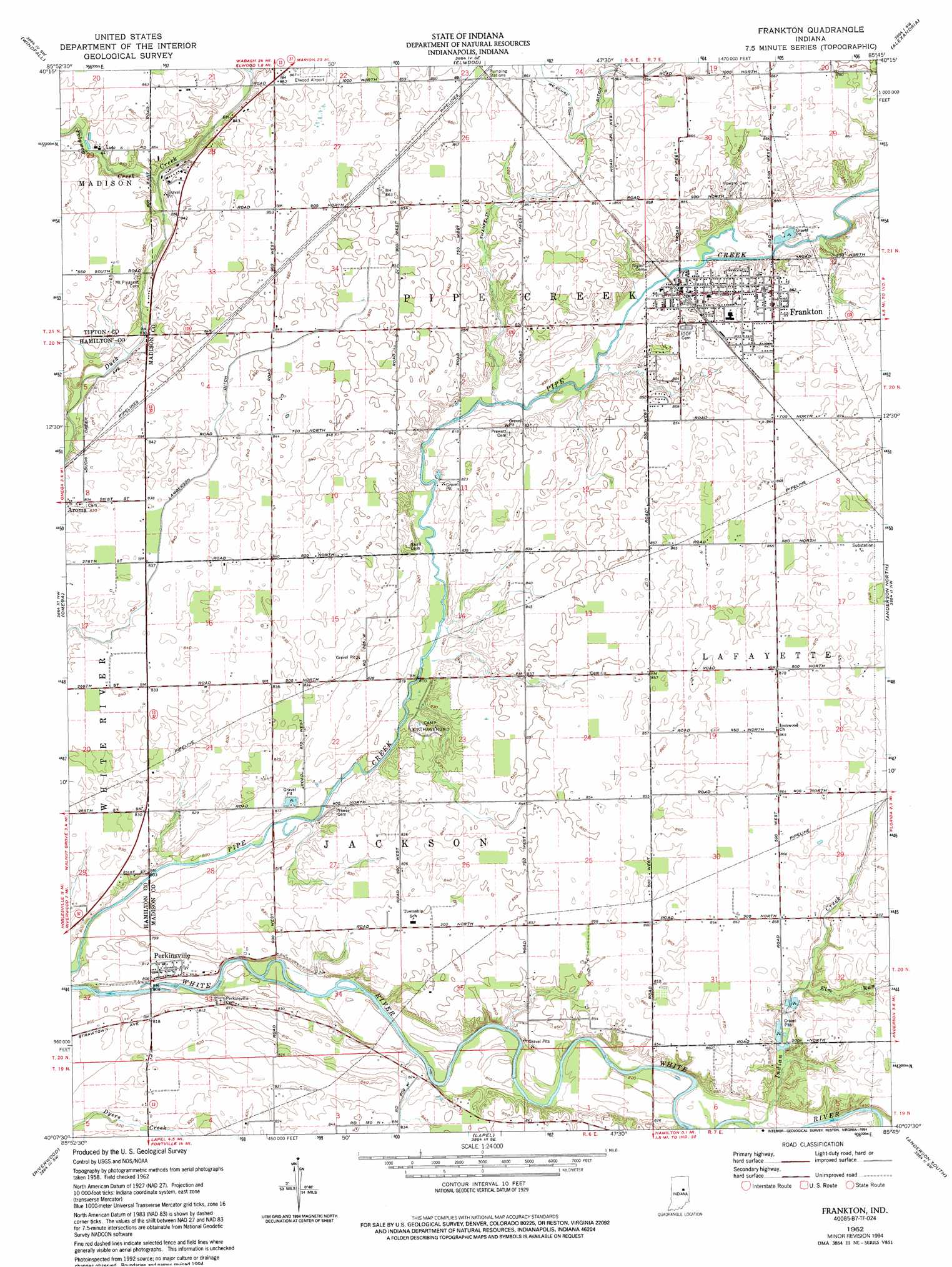
USGS Topo Quad 40085b7 - 1:24,000 scale
| Topo Map Name: | Frankton |
| USGS Topo Quad ID: | 40085b7 |
| Print Size: | ca. 21 1/4" wide x 27" high |
| Southeast Coordinates: | 40.125° N latitude / 85.75° W longitude |
| Map Center Coordinates: | 40.1875° N latitude / 85.8125° W longitude |
| U.S. State: | IN |
| Filename: | o40085b7.jpg |
| Download Map JPG Image: | Frankton topo map 1:24,000 scale |
| Map Type: | Topographic |
| Topo Series: | 7.5´ |
| Map Scale: | 1:24,000 |
| Source of Map Images: | United States Geological Survey (USGS) |
| Alternate Map Versions: |
Frankton IN 1962, updated 1963 Download PDF Buy paper map Frankton IN 1962, updated 1994 Download PDF Buy paper map Frankton IN 2010 Download PDF Buy paper map Frankton IN 2013 Download PDF Buy paper map Frankton IN 2016 Download PDF Buy paper map |
1:24,000 Topo Quads surrounding Frankton
Kokomo East |
Greentown |
Point Isabel |
Fairmount |
Gas City |
Tipton |
Windfall |
Elwood |
Alexandria |
Gaston |
Arcadia |
Omega |
Frankton |
Anderson North |
Gilman |
Noblesville |
Riverwood |
Lapel |
Anderson South |
Middletown |
Fishers |
Mccordsville |
Ingalls |
Pendleton |
Shirley |
> Back to 40085a1 at 1:100,000 scale
> Back to 40084a1 at 1:250,000 scale
> Back to U.S. Topo Maps home
Frankton topo map: Gazetteer
Frankton: Canals
Lamberson Ditch elevation 254m 833′McClure Ditch elevation 261m 856′
Frankton: Parks
Camp Kikthawenund elevation 256m 839′Frankton: Populated Places
Aroma elevation 253m 830′Frankton elevation 254m 833′
Perkinsville elevation 247m 810′
Frankton: Streams
Big Duck Creek elevation 254m 833′Elm Run elevation 254m 833′
Little Duck Creek elevation 254m 833′
Polywog Creek elevation 252m 826′
Frankton digital topo map on disk
Buy this Frankton topo map showing relief, roads, GPS coordinates and other geographical features, as a high-resolution digital map file on DVD:
Northern Illinois, Northern Indiana & Southwestern Michigan
Buy digital topo maps: Northern Illinois, Northern Indiana & Southwestern Michigan