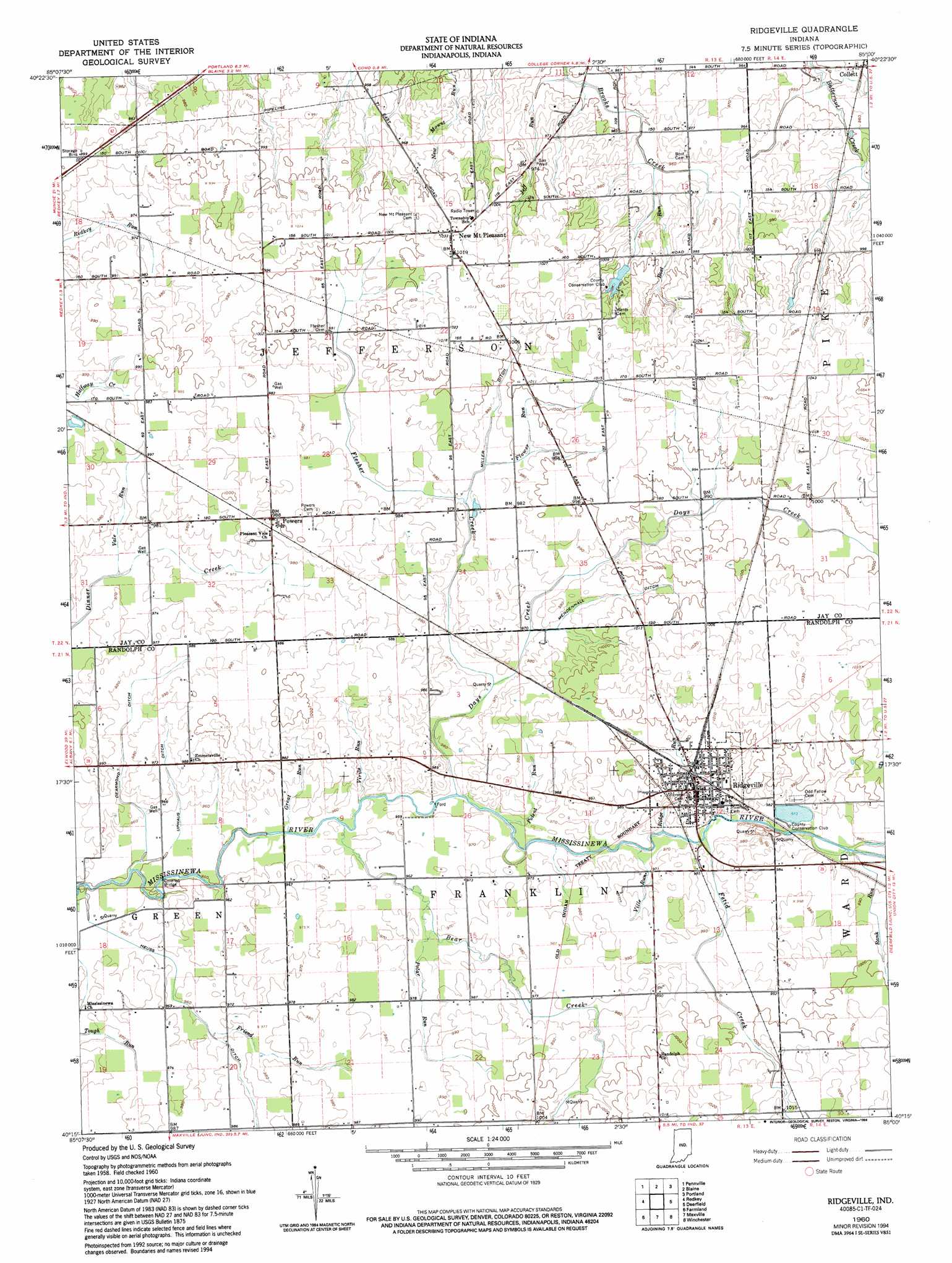
Ridgeville Topo Map Indiana
To zoom in, hover over the map of Ridgeville
USGS Topo Quad 40085c1 - 1:24,000 scale
| Topo Map Name: | Ridgeville |
| USGS Topo Quad ID: | 40085c1 |
| Print Size: | ca. 21 1/4" wide x 27" high |
| Southeast Coordinates: | 40.25° N latitude / 85° W longitude |
| Map Center Coordinates: | 40.3125° N latitude / 85.0625° W longitude |
| U.S. State: | IN |
| Filename: | o40085c1.jpg |
| Download Map JPG Image: | Ridgeville topo map 1:24,000 scale |
| Map Type: | Topographic |
| Topo Series: | 7.5´ |
| Map Scale: | 1:24,000 |
| Source of Map Images: | United States Geological Survey (USGS) |
| Alternate Map Versions: |
Ridgeville IN 1960, updated 1961 Download PDF Buy paper map Ridgeville IN 1960, updated 1961 Download PDF Buy paper map Ridgeville IN 1960, updated 1994 Download PDF Buy paper map Ridgeville IN 2010 Download PDF Buy paper map Ridgeville IN 2013 Download PDF Buy paper map Ridgeville IN 2016 Download PDF Buy paper map |
1:24,000 Topo Quads surrounding Ridgeville
Montpelier |
Petroleum |
Domestic |
Geneva |
New Corydon |
Hartford City East |
Pennville |
Blaine |
Portland |
Fort Recovery |
Eaton |
Redkey |
Ridgeville |
Deerfield |
Cosmos |
Muncie East |
Farmland |
Maxville |
Winchester |
Union City |
Mount Pleasant |
Modoc |
Carlos |
Lynn |
Spartanburg |
> Back to 40085a1 at 1:100,000 scale
> Back to 40084a1 at 1:250,000 scale
> Back to U.S. Topo Maps home
Ridgeville topo map: Gazetteer
Ridgeville: Airports
Windy P Ridge Airport elevation 317m 1040′Ridgeville: Canals
De Armond Ditch elevation 296m 971′Flesher Creek elevation 294m 964′
Heuss Ditch elevation 289m 948′
Mendenhall Ditch elevation 300m 984′
Miller Ditch elevation 302m 990′
Stevens Ditch elevation 294m 964′
Uphaus Ditch elevation 294m 964′
Ridgeville: Populated Places
New Mount Pleasant elevation 315m 1033′Powers elevation 303m 994′
Ridgeville elevation 304m 997′
Ridgeville: Streams
Bear Creek elevation 291m 954′Bost Run elevation 291m 954′
Days Creek elevation 292m 958′
Fetid Creek elevation 295m 967′
Friend Run elevation 294m 964′
Great Run elevation 290m 951′
Jeff Run elevation 287m 941′
Polar Run elevation 293m 961′
Potent Run elevation 292m 958′
Rank Run elevation 297m 974′
Ridge Run elevation 293m 961′
Vale Run elevation 294m 964′
Ville Run elevation 294m 964′
Virile Run elevation 292m 958′
Ridgeville digital topo map on disk
Buy this Ridgeville topo map showing relief, roads, GPS coordinates and other geographical features, as a high-resolution digital map file on DVD:
Northern Illinois, Northern Indiana & Southwestern Michigan
Buy digital topo maps: Northern Illinois, Northern Indiana & Southwestern Michigan