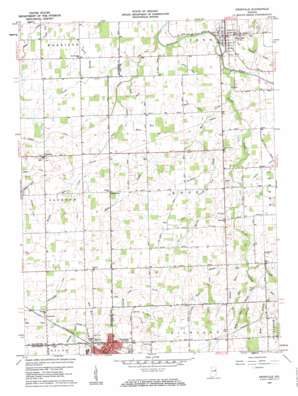
Pennville Topo Map Indiana
To zoom in, hover over the map of Pennville
USGS Topo Quad 40085d2 - 1:24,000 scale
| Topo Map Name: | Pennville |
| USGS Topo Quad ID: | 40085d2 |
| Print Size: | ca. 21 1/4" wide x 27" high |
| Southeast Coordinates: | 40.375° N latitude / 85.125° W longitude |
| Map Center Coordinates: | 40.4375° N latitude / 85.1875° W longitude |
| U.S. State: | IN |
| Filename: | o40085d2.jpg |
| Download Map JPG Image: | Pennville topo map 1:24,000 scale |
| Map Type: | Topographic |
| Topo Series: | 7.5´ |
| Map Scale: | 1:24,000 |
| Source of Map Images: | United States Geological Survey (USGS) |
| Alternate Map Versions: |
Pennville IN 1960, updated 1961 Download PDF Buy paper map Pennville IN 1960, updated 1961 Download PDF Buy paper map Pennville IN 2010 Download PDF Buy paper map Pennville IN 2013 Download PDF Buy paper map Pennville IN 2016 Download PDF Buy paper map |
1:24,000 Topo Quads surrounding Pennville
> Back to 40085a1 at 1:100,000 scale
> Back to 40084a1 at 1:250,000 scale
> Back to U.S. Topo Maps home
Pennville topo map: Gazetteer
Pennville: Airports
Kesler Field elevation 270m 885′Pennville: Canals
Allman Ditch elevation 269m 882′Bales Ditch elevation 270m 885′
Corwin Ditch elevation 269m 882′
Daily Ditch elevation 269m 882′
Gronendyke Ditch elevation 282m 925′
Hickman Ditch elevation 268m 879′
Hudson Ditch elevation 269m 882′
Jones Ditch elevation 269m 882′
Landon Ditch elevation 279m 915′
Lupton Ditch elevation 266m 872′
Rust Ditch elevation 284m 931′
Smith Hartman Ditch elevation 277m 908′
Twomile Ditch elevation 269m 882′
Whitacre Ditch elevation 274m 898′
Pennville: Populated Places
Converse elevation 282m 925′Dunkirk elevation 289m 948′
Pennville elevation 267m 875′
Ridertown elevation 279m 915′
Trenton elevation 274m 898′
Pennville: Streams
Belt Run elevation 279m 915′Bit Run elevation 277m 908′
Boot Run elevation 283m 928′
Brooks Creek elevation 262m 859′
Buckles Run elevation 279m 915′
Corrode Run elevation 280m 918′
Cowboy Run elevation 274m 898′
Crooked Creek elevation 268m 879′
Dunkirk Drain elevation 280m 918′
Harris Creek elevation 271m 889′
Holster Creek elevation 280m 918′
Mud Creek elevation 266m 872′
Oak Run elevation 276m 905′
Olive Branch elevation 269m 882′
Oval Run elevation 266m 872′
Phillips Run elevation 279m 915′
Priam Run elevation 272m 892′
Rope Branch elevation 279m 915′
Rustic Run elevation 275m 902′
Thong Run elevation 283m 928′
Wire Run elevation 268m 879′
Pennville digital topo map on disk
Buy this Pennville topo map showing relief, roads, GPS coordinates and other geographical features, as a high-resolution digital map file on DVD:
Northern Illinois, Northern Indiana & Southwestern Michigan
Buy digital topo maps: Northern Illinois, Northern Indiana & Southwestern Michigan


