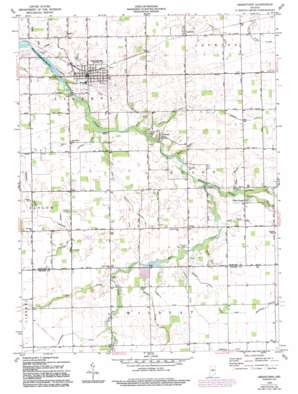
Greentown Topo Map Indiana
To zoom in, hover over the map of Greentown
USGS Topo Quad 40085d8 - 1:24,000 scale
| Topo Map Name: | Greentown |
| USGS Topo Quad ID: | 40085d8 |
| Print Size: | ca. 21 1/4" wide x 27" high |
| Southeast Coordinates: | 40.375° N latitude / 85.875° W longitude |
| Map Center Coordinates: | 40.4375° N latitude / 85.9375° W longitude |
| U.S. State: | IN |
| Filename: | o40085d8.jpg |
| Download Map JPG Image: | Greentown topo map 1:24,000 scale |
| Map Type: | Topographic |
| Topo Series: | 7.5´ |
| Map Scale: | 1:24,000 |
| Source of Map Images: | United States Geological Survey (USGS) |
| Alternate Map Versions: |
Greentown IN 1960, updated 1961 Download PDF Buy paper map Greentown IN 1960, updated 1982 Download PDF Buy paper map Greentown IN 1960, updated 1982 Download PDF Buy paper map Greentown IN 1960, updated 1994 Download PDF Buy paper map Greentown IN 2010 Download PDF Buy paper map Greentown IN 2013 Download PDF Buy paper map Greentown IN 2016 Download PDF Buy paper map |
1:24,000 Topo Quads surrounding Greentown
> Back to 40085a1 at 1:100,000 scale
> Back to 40084a1 at 1:250,000 scale
> Back to U.S. Topo Maps home
Greentown topo map: Gazetteer
Greentown: Airports
Hall Airport elevation 262m 859′Howard County Airport elevation 259m 849′
Nappanee Municipal Airport elevation 259m 849′
Greentown: Canals
Armstrong Ditch elevation 263m 862′Barrett Ditch elevation 258m 846′
Beard Ditch elevation 255m 836′
Brunk Ditch elevation 251m 823′
Conway Ditch elevation 263m 862′
Cottingham Ditch elevation 264m 866′
Duncan Ditch elevation 255m 836′
Freeman Ditch elevation 253m 830′
Gifford Ditch elevation 261m 856′
Hardin Ditch elevation 260m 853′
Legg Ditch elevation 259m 849′
Middle Fork Ditch elevation 255m 836′
Moon Barcley Ditch elevation 256m 839′
Overman Ditch elevation 260m 853′
Pickering Ditch elevation 259m 849′
Riggs Ditch elevation 260m 853′
Roberts Ditch elevation 257m 843′
Shockney Ditch elevation 263m 862′
Smith Ditch elevation 254m 833′
Tributary Number One elevation 259m 849′
Tributary Number Two elevation 259m 849′
Greentown: Populated Places
Greentown elevation 255m 836′Guy elevation 259m 849′
Jerome elevation 262m 859′
Phlox elevation 261m 856′
Sycamore elevation 260m 853′
West Liberty elevation 259m 849′
Greentown: Streams
Grassy Fork elevation 254m 833′Green Run elevation 248m 813′
Hook Run elevation 254m 833′
Irwin Creek elevation 256m 839′
Lawn Run elevation 248m 813′
Loop Drain elevation 249m 816′
Middle Fork elevation 254m 833′
Middle Fork Wildcat Creek elevation 255m 836′
Mud Creek elevation 252m 826′
Peck Run elevation 253m 830′
Pint Run elevation 250m 820′
Rome Run elevation 252m 826′
Sims Drain elevation 254m 833′
Turkey Creek elevation 257m 843′
Greentown digital topo map on disk
Buy this Greentown topo map showing relief, roads, GPS coordinates and other geographical features, as a high-resolution digital map file on DVD:
Northern Illinois, Northern Indiana & Southwestern Michigan
Buy digital topo maps: Northern Illinois, Northern Indiana & Southwestern Michigan


