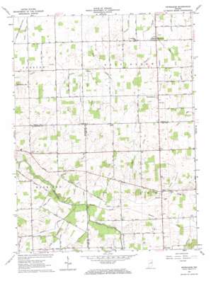
Petroleum Topo Map Indiana
To zoom in, hover over the map of Petroleum
USGS Topo Quad 40085e2 - 1:24,000 scale
| Topo Map Name: | Petroleum |
| USGS Topo Quad ID: | 40085e2 |
| Print Size: | ca. 21 1/4" wide x 27" high |
| Southeast Coordinates: | 40.5° N latitude / 85.125° W longitude |
| Map Center Coordinates: | 40.5625° N latitude / 85.1875° W longitude |
| U.S. State: | IN |
| Filename: | o40085e2.jpg |
| Download Map JPG Image: | Petroleum topo map 1:24,000 scale |
| Map Type: | Topographic |
| Topo Series: | 7.5´ |
| Map Scale: | 1:24,000 |
| Source of Map Images: | United States Geological Survey (USGS) |
| Alternate Map Versions: |
Petroleum IN 1962, updated 1964 Download PDF Buy paper map Petroleum IN 2010 Download PDF Buy paper map Petroleum IN 2013 Download PDF Buy paper map Petroleum IN 2016 Download PDF Buy paper map |
1:24,000 Topo Quads surrounding Petroleum
> Back to 40085e1 at 1:100,000 scale
> Back to 40084a1 at 1:250,000 scale
> Back to U.S. Topo Maps home
Petroleum topo map: Gazetteer
Petroleum: Canals
Beckler Ditch elevation 269m 882′Bloxsom Ditch elevation 263m 862′
Chaney Ditch elevation 263m 862′
Gieger Ditch elevation 261m 856′
Hickman Ditch elevation 266m 872′
McClain Ditch elevation 268m 879′
Miller Pugh Ditch elevation 266m 872′
Mulligan Ditch elevation 262m 859′
Sharpe Ditch elevation 269m 882′
Shinn Ditch elevation 266m 872′
Shook Ditch elevation 265m 869′
Slocum Ditch elevation 263m 862′
Warner Ditch elevation 260m 853′
Wilson Ditch elevation 264m 866′
Petroleum: Populated Places
Balbec elevation 269m 882′Fiat elevation 276m 905′
Nottingham elevation 270m 885′
Petroleum elevation 262m 859′
Petroleum: Streams
Beaver Creek elevation 261m 856′Bills Creek elevation 259m 849′
Haines Creek elevation 262m 859′
Mill Creek elevation 262m 859′
Stoney Creek elevation 258m 846′
Petroleum digital topo map on disk
Buy this Petroleum topo map showing relief, roads, GPS coordinates and other geographical features, as a high-resolution digital map file on DVD:
Northern Illinois, Northern Indiana & Southwestern Michigan
Buy digital topo maps: Northern Illinois, Northern Indiana & Southwestern Michigan


