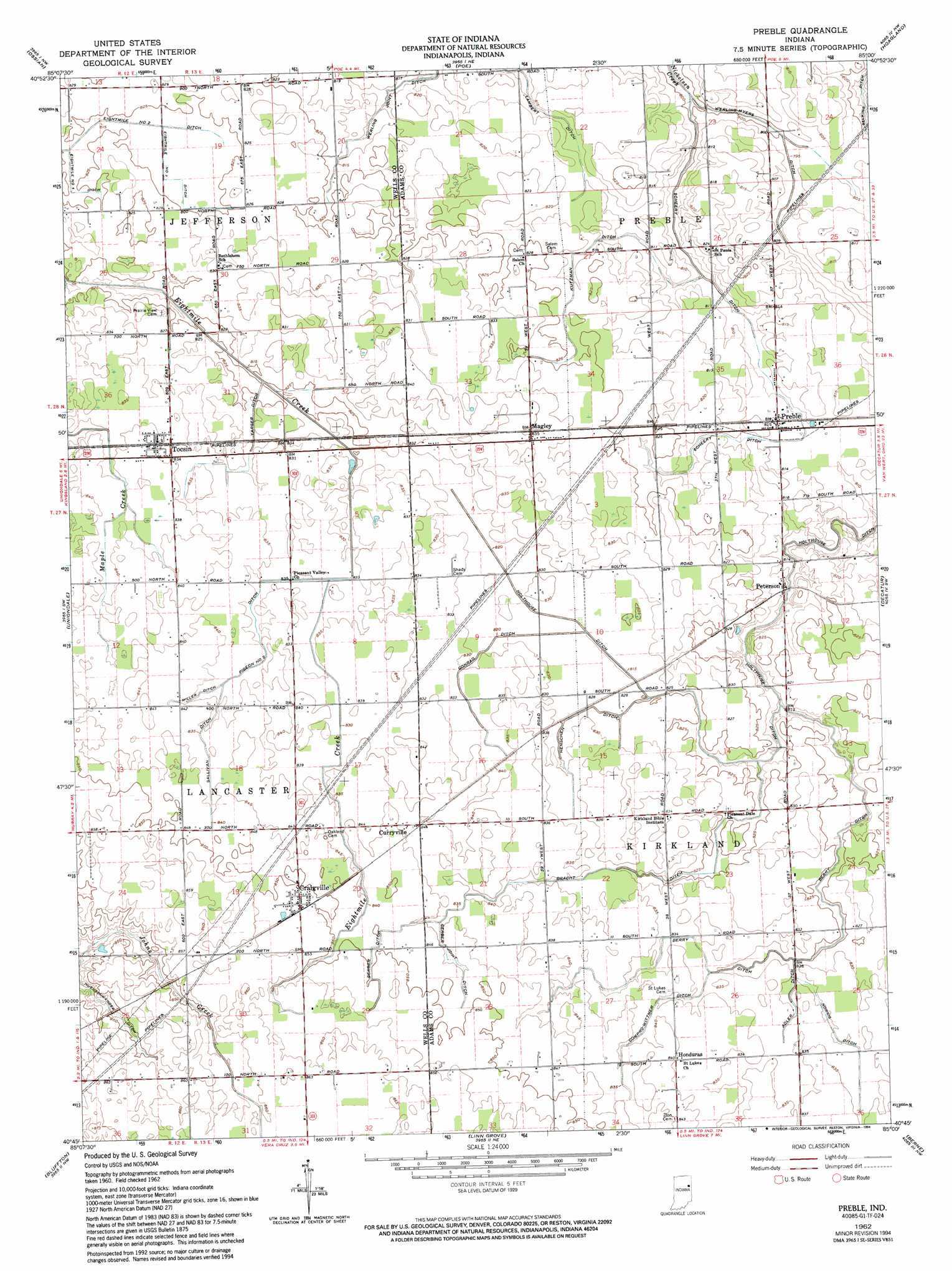
Preble Topo Map Indiana
To zoom in, hover over the map of Preble
USGS Topo Quad 40085g1 - 1:24,000 scale
| Topo Map Name: | Preble |
| USGS Topo Quad ID: | 40085g1 |
| Print Size: | ca. 21 1/4" wide x 27" high |
| Southeast Coordinates: | 40.75° N latitude / 85° W longitude |
| Map Center Coordinates: | 40.8125° N latitude / 85.0625° W longitude |
| U.S. State: | IN |
| Filename: | o40085g1.jpg |
| Download Map JPG Image: | Preble topo map 1:24,000 scale |
| Map Type: | Topographic |
| Topo Series: | 7.5´ |
| Map Scale: | 1:24,000 |
| Source of Map Images: | United States Geological Survey (USGS) |
| Alternate Map Versions: |
Preble IN 1962, updated 1963 Download PDF Buy paper map Preble IN 1962, updated 1994 Download PDF Buy paper map Preble IN 2010 Download PDF Buy paper map Preble IN 2013 Download PDF Buy paper map Preble IN 2016 Download PDF Buy paper map |
1:24,000 Topo Quads surrounding Preble
Arcola |
Fort Wayne West |
Fort Wayne East |
Maples |
Woodburn South |
Zanesville |
Ossian |
Poe |
Hoagland |
Dixon |
Markle |
Uniondale |
Preble |
Decatur |
Wren |
Liberty Center |
Bluffton |
Linn Grove |
Berne |
Willshire |
Montpelier |
Petroleum |
Domestic |
Geneva |
New Corydon |
> Back to 40085e1 at 1:100,000 scale
> Back to 40084a1 at 1:250,000 scale
> Back to U.S. Topo Maps home
Preble topo map: Gazetteer
Preble: Airports
The Lazy K Airport elevation 254m 833′Preble: Canals
Adler Ditch elevation 251m 823′Berry Ditch elevation 250m 820′
Bracht Ditch elevation 253m 830′
Compro-Wittmer Ditch elevation 253m 830′
Conrad Ditch elevation 251m 823′
Eightmile Number Four Ditch elevation 250m 820′
Eightmile Number Three Ditch elevation 251m 823′
Eightmile Number Two Ditch elevation 250m 820′
Gallivan Ditch elevation 256m 839′
Gerber Ditch elevation 258m 846′
Gerber Joint Ditch elevation 257m 843′
Henschen Ditch elevation 251m 823′
Kutzman Ditch elevation 247m 810′
Miller Ditch elevation 254m 833′
Norris Ditch elevation 253m 830′
Nuenschwander Ditch elevation 258m 846′
Pigeon Number Two Ditch elevation 253m 830′
Werling Myers Ditch elevation 244m 800′
Yarger Ditch elevation 251m 823′
Preble: Populated Places
Craigville elevation 259m 849′Curryville elevation 256m 839′
Honduras elevation 256m 839′
Magley elevation 254m 833′
Peterson elevation 249m 816′
Preble elevation 248m 813′
Tocsin elevation 254m 833′
Preble: Streams
Maple Creek elevation 250m 820′Preble digital topo map on disk
Buy this Preble topo map showing relief, roads, GPS coordinates and other geographical features, as a high-resolution digital map file on DVD:
Northern Illinois, Northern Indiana & Southwestern Michigan
Buy digital topo maps: Northern Illinois, Northern Indiana & Southwestern Michigan