Markle Topo Map Indiana
To zoom in, hover over the map of Markle
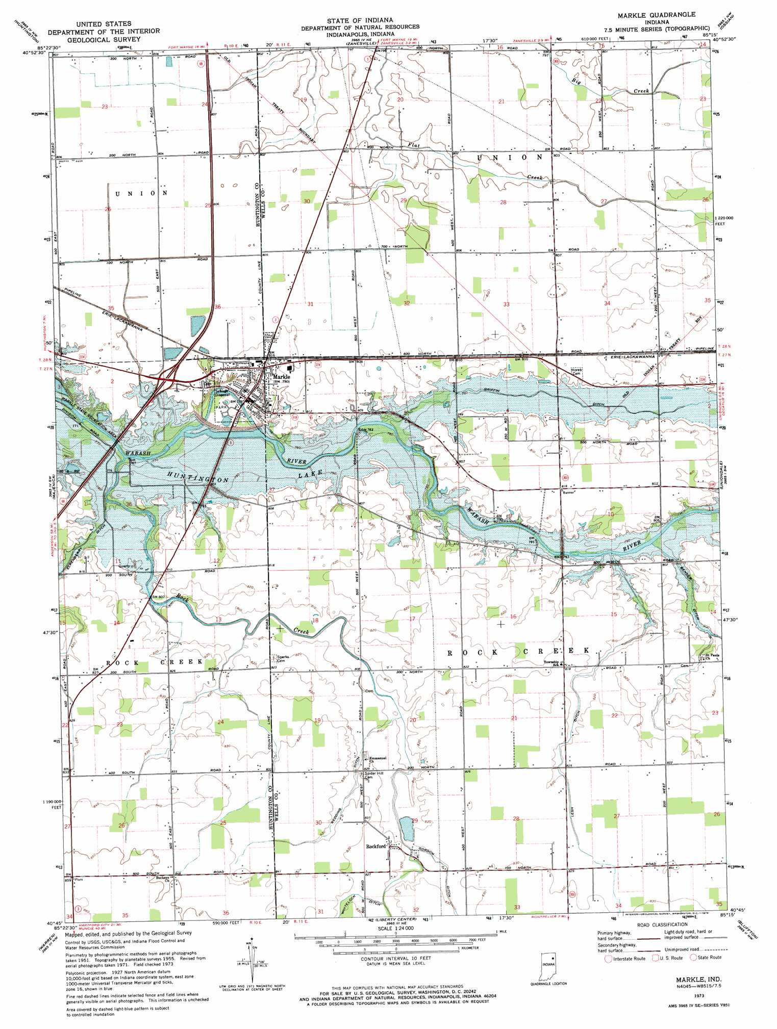
USGS Topo Quad 40085g3 - 1:24,000 scale
| Topo Map Name: | Markle |
| USGS Topo Quad ID: | 40085g3 |
| Print Size: | ca. 21 1/4" wide x 27" high |
| Southeast Coordinates: | 40.75° N latitude / 85.25° W longitude |
| Map Center Coordinates: | 40.8125° N latitude / 85.3125° W longitude |
| U.S. State: | IN |
| Filename: | o40085g3.jpg |
| Download Map JPG Image: | Markle topo map 1:24,000 scale |
| Map Type: | Topographic |
| Topo Series: | 7.5´ |
| Map Scale: | 1:24,000 |
| Source of Map Images: | United States Geological Survey (USGS) |
| Alternate Map Versions: |
Markle IN 1955, updated 1956 Download PDF Buy paper map Markle IN 1973, updated 1974 Download PDF Buy paper map Markle IN 1973, updated 1974 Download PDF Buy paper map Markle IN 2010 Download PDF Buy paper map Markle IN 2013 Download PDF Buy paper map Markle IN 2016 Download PDF Buy paper map |
1:24,000 Topo Quads surrounding Markle
South Whitley East |
Laud |
Arcola |
Fort Wayne West |
Fort Wayne East |
Bippus |
Huntington |
Zanesville |
Ossian |
Poe |
Andrews |
Majenica |
Markle |
Uniondale |
Preble |
Mount Etna |
Warren |
Liberty Center |
Bluffton |
Linn Grove |
Van Buren |
Roll |
Montpelier |
Petroleum |
Domestic |
> Back to 40085e1 at 1:100,000 scale
> Back to 40084a1 at 1:250,000 scale
> Back to U.S. Topo Maps home
Markle topo map: Gazetteer
Markle: Canals
Gordon Ditch elevation 250m 820′Griffin Ditch elevation 243m 797′
Lesh Ditch elevation 247m 810′
Redding Ditch elevation 250m 820′
Markle: Populated Places
Markle elevation 238m 780′Rockford elevation 251m 823′
Markle: Streams
Rock Creek elevation 231m 757′Markle digital topo map on disk
Buy this Markle topo map showing relief, roads, GPS coordinates and other geographical features, as a high-resolution digital map file on DVD:
Northern Illinois, Northern Indiana & Southwestern Michigan
Buy digital topo maps: Northern Illinois, Northern Indiana & Southwestern Michigan