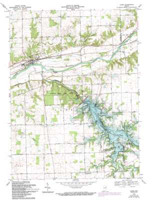
Lagro Topo Map Indiana
To zoom in, hover over the map of Lagro
USGS Topo Quad 40085g6 - 1:24,000 scale
| Topo Map Name: | Lagro |
| USGS Topo Quad ID: | 40085g6 |
| Print Size: | ca. 21 1/4" wide x 27" high |
| Southeast Coordinates: | 40.75° N latitude / 85.625° W longitude |
| Map Center Coordinates: | 40.8125° N latitude / 85.6875° W longitude |
| U.S. State: | IN |
| Filename: | o40085g6.jpg |
| Download Map JPG Image: | Lagro topo map 1:24,000 scale |
| Map Type: | Topographic |
| Topo Series: | 7.5´ |
| Map Scale: | 1:24,000 |
| Source of Map Images: | United States Geological Survey (USGS) |
| Alternate Map Versions: |
Lagro IN 1950, updated 1958 Download PDF Buy paper map Lagro IN 1951 Download PDF Buy paper map Lagro IN 1969, updated 1971 Download PDF Buy paper map Lagro IN 1969, updated 1988 Download PDF Buy paper map Lagro IN 1969, updated 1994 Download PDF Buy paper map Lagro IN 2010 Download PDF Buy paper map Lagro IN 2013 Download PDF Buy paper map Lagro IN 2016 Download PDF Buy paper map |
1:24,000 Topo Quads surrounding Lagro
> Back to 40085e1 at 1:100,000 scale
> Back to 40084a1 at 1:250,000 scale
> Back to U.S. Topo Maps home
Lagro topo map: Gazetteer
Lagro: Dams
Dick Thomas Pond Dam elevation 244m 800′Fearnow Lake Dam elevation 246m 807′
Hominy Ridge Lake Dam elevation 232m 761′
Salamonie Dam elevation 247m 810′
Lagro: Forests
Salamonie River State Forest elevation 239m 784′Lagro: Parks
Dora New Holland State Recreation Area elevation 242m 793′Mount Hope State Recreation Area elevation 247m 810′
Lagro: Pillars
Hanging Rock elevation 210m 688′Lagro: Populated Places
Lagro elevation 215m 705′Lincolnville elevation 252m 826′
Lagro: Reservoirs
Dick Thomas Pond elevation 244m 800′Fearnow Lake elevation 246m 807′
Hominy Ridge Lake elevation 230m 754′
Salamonie Lake elevation 247m 810′
Lagro: Streams
Back Creek elevation 231m 757′Indian Creek elevation 227m 744′
Lagro Creek elevation 206m 675′
Logan Creek elevation 237m 777′
Rager Creek elevation 206m 675′
Rockaway Creek elevation 228m 748′
Rush Creek elevation 226m 741′
Salamonie River elevation 204m 669′
Small Rush Creek elevation 230m 754′
Lagro: Valleys
Possum Hollow elevation 219m 718′Lagro digital topo map on disk
Buy this Lagro topo map showing relief, roads, GPS coordinates and other geographical features, as a high-resolution digital map file on DVD:
Northern Illinois, Northern Indiana & Southwestern Michigan
Buy digital topo maps: Northern Illinois, Northern Indiana & Southwestern Michigan


