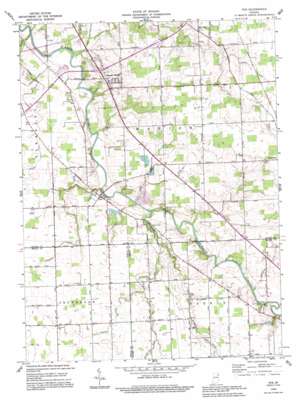
Poe Topo Map Indiana
To zoom in, hover over the map of Poe
USGS Topo Quad 40085h1 - 1:24,000 scale
| Topo Map Name: | Poe |
| USGS Topo Quad ID: | 40085h1 |
| Print Size: | ca. 21 1/4" wide x 27" high |
| Southeast Coordinates: | 40.875° N latitude / 85° W longitude |
| Map Center Coordinates: | 40.9375° N latitude / 85.0625° W longitude |
| U.S. State: | IN |
| Filename: | o40085h1.jpg |
| Download Map JPG Image: | Poe topo map 1:24,000 scale |
| Map Type: | Topographic |
| Topo Series: | 7.5´ |
| Map Scale: | 1:24,000 |
| Source of Map Images: | United States Geological Survey (USGS) |
| Alternate Map Versions: |
Poe IN 1962, updated 1962 Download PDF Buy paper map Poe IN 1962, updated 1963 Download PDF Buy paper map Poe IN 1962, updated 1979 Download PDF Buy paper map Poe IN 1994, updated 1995 Download PDF Buy paper map Poe IN 2010 Download PDF Buy paper map Poe IN 2013 Download PDF Buy paper map Poe IN 2016 Download PDF Buy paper map |
1:24,000 Topo Quads surrounding Poe
> Back to 40085e1 at 1:100,000 scale
> Back to 40084a1 at 1:250,000 scale
> Back to U.S. Topo Maps home
Poe topo map: Gazetteer
Poe: Bridges
Muldoon Bridge elevation 235m 770′Scheiman Bridge elevation 232m 761′
Poe: Canals
Ferguson Ditch elevation 240m 787′Gallmeyer Ditch elevation 236m 774′
Lambert Ditch elevation 235m 770′
Munch Ditch elevation 242m 793′
Paul Trier Ditch elevation 231m 757′
Simmerman Ditch elevation 243m 797′
Snyder Ditch elevation 241m 790′
Valentine Ditch elevation 236m 774′
Werling Joint Ditch elevation 249m 816′
Poe: Populated Places
Hessen Cassel elevation 242m 793′Middletown elevation 242m 793′
Poe elevation 242m 793′
Poe: Streams
Houk Ditch elevation 229m 751′Nickelsen Creek elevation 232m 761′
Poe digital topo map on disk
Buy this Poe topo map showing relief, roads, GPS coordinates and other geographical features, as a high-resolution digital map file on DVD:
Northern Illinois, Northern Indiana & Southwestern Michigan
Buy digital topo maps: Northern Illinois, Northern Indiana & Southwestern Michigan


