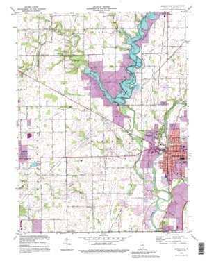
Noblesville Topo Map Indiana
To zoom in, hover over the map of Noblesville
USGS Topo Quad 40086a1 - 1:24,000 scale
| Topo Map Name: | Noblesville |
| USGS Topo Quad ID: | 40086a1 |
| Print Size: | ca. 21 1/4" wide x 27" high |
| Southeast Coordinates: | 40° N latitude / 86° W longitude |
| Map Center Coordinates: | 40.0625° N latitude / 86.0625° W longitude |
| U.S. State: | IN |
| Filename: | o40086a1.jpg |
| Download Map JPG Image: | Noblesville topo map 1:24,000 scale |
| Map Type: | Topographic |
| Topo Series: | 7.5´ |
| Map Scale: | 1:24,000 |
| Source of Map Images: | United States Geological Survey (USGS) |
| Alternate Map Versions: |
Noblesville IN 1953, updated 1955 Download PDF Buy paper map Noblesville IN 1960, updated 1961 Download PDF Buy paper map Noblesville IN 1960, updated 1969 Download PDF Buy paper map Noblesville IN 1969, updated 1971 Download PDF Buy paper map Noblesville IN 1969, updated 1981 Download PDF Buy paper map Noblesville IN 1969, updated 1987 Download PDF Buy paper map Noblesville IN 1992, updated 1995 Download PDF Buy paper map Noblesville IN 1998, updated 2002 Download PDF Buy paper map Noblesville IN 2010 Download PDF Buy paper map Noblesville IN 2013 Download PDF Buy paper map Noblesville IN 2016 Download PDF Buy paper map |
1:24,000 Topo Quads surrounding Noblesville
> Back to 40086a1 at 1:100,000 scale
> Back to 40086a1 at 1:250,000 scale
> Back to U.S. Topo Maps home
Noblesville topo map: Gazetteer
Noblesville: Areas
Fox Prairie elevation 240m 787′Noblesville: Bridges
Potter Bridge elevation 230m 754′Noblesville: Canals
Ingerman Ditch elevation 240m 787′Jones Ditch elevation 264m 866′
Mallery Granger Ditch elevation 243m 797′
Noblesville: Dams
Morse Reservoir Dam elevation 250m 820′Noblesville: Parks
Forest Park elevation 240m 787′Indianapolis Boys Club Camp elevation 260m 853′
Morse Park elevation 249m 816′
Noblesville Soccer Fields elevation 242m 793′
Seminary Park elevation 235m 770′
Tritown Park elevation 254m 833′
Noblesville: Populated Places
Cicero elevation 254m 833′Deming elevation 272m 892′
Federal Hill elevation 238m 780′
Hamilton Estates Mobile Home Park elevation 232m 761′
Monterey Village elevation 240m 787′
Noblesville elevation 233m 764′
West Noblesville elevation 232m 761′
Noblesville: Post Offices
Noblesville Post Office elevation 234m 767′Noblesville: Reservoirs
Morse Reservoir elevation 250m 820′Noblesville: Streams
Bear Slide Creek elevation 247m 810′Cicero Creek elevation 227m 744′
East Fork Sly Run elevation 229m 751′
Grassy Branch elevation 262m 859′
Hinkle Creek elevation 247m 810′
Overdorff Branch elevation 229m 751′
Stony Creek elevation 225m 738′
West Fork Sly Run elevation 248m 813′
Noblesville digital topo map on disk
Buy this Noblesville topo map showing relief, roads, GPS coordinates and other geographical features, as a high-resolution digital map file on DVD:
Northern Illinois, Northern Indiana & Southwestern Michigan
Buy digital topo maps: Northern Illinois, Northern Indiana & Southwestern Michigan


