Darlington Topo Map Indiana
To zoom in, hover over the map of Darlington
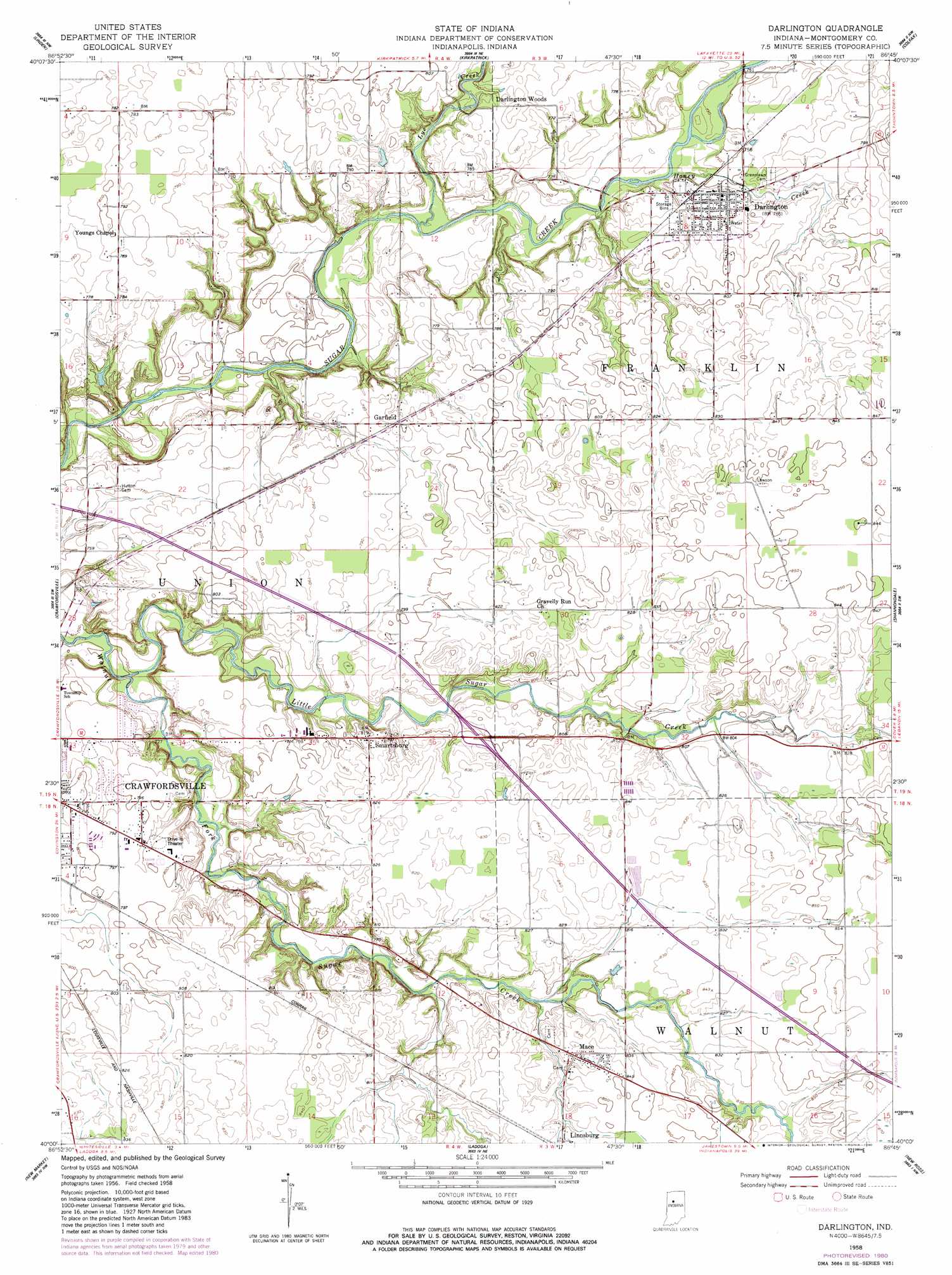
USGS Topo Quad 40086a7 - 1:24,000 scale
| Topo Map Name: | Darlington |
| USGS Topo Quad ID: | 40086a7 |
| Print Size: | ca. 21 1/4" wide x 27" high |
| Southeast Coordinates: | 40° N latitude / 86.75° W longitude |
| Map Center Coordinates: | 40.0625° N latitude / 86.8125° W longitude |
| U.S. State: | IN |
| Filename: | o40086a7.jpg |
| Download Map JPG Image: | Darlington topo map 1:24,000 scale |
| Map Type: | Topographic |
| Topo Series: | 7.5´ |
| Map Scale: | 1:24,000 |
| Source of Map Images: | United States Geological Survey (USGS) |
| Alternate Map Versions: |
Darlington IN 1958, updated 1959 Download PDF Buy paper map Darlington IN 1958, updated 1980 Download PDF Buy paper map Darlington IN 2010 Download PDF Buy paper map Darlington IN 2013 Download PDF Buy paper map Darlington IN 2016 Download PDF Buy paper map |
1:24,000 Topo Quads surrounding Darlington
Westpoint |
Romney |
Stockwell |
Mulberry |
Frankfort |
Wingate |
Linden |
Kirkpatrick |
Colfax |
Thorntown |
Waynetown |
Crawfordsville |
Darlington |
Shannondale |
Hazelrigg |
Alamo |
New Market |
Ladoga |
New Ross |
Lizton |
Bellmore |
Russellville |
Roachdale |
North Salem |
Danville |
> Back to 40086a1 at 1:100,000 scale
> Back to 40086a1 at 1:250,000 scale
> Back to U.S. Topo Maps home
Darlington topo map: Gazetteer
Darlington: Populated Places
Crawfordsville elevation 242m 793′Darlington elevation 232m 761′
Darlington Woods elevation 239m 784′
Garfield elevation 243m 797′
Linnsburg elevation 256m 839′
Mace elevation 256m 839′
Smartsburg elevation 249m 816′
Darlington: Streams
Honey Creek elevation 224m 734′Little Sugar Creek elevation 215m 705′
Lye Creek elevation 217m 711′
Darlington digital topo map on disk
Buy this Darlington topo map showing relief, roads, GPS coordinates and other geographical features, as a high-resolution digital map file on DVD:
Northern Illinois, Northern Indiana & Southwestern Michigan
Buy digital topo maps: Northern Illinois, Northern Indiana & Southwestern Michigan