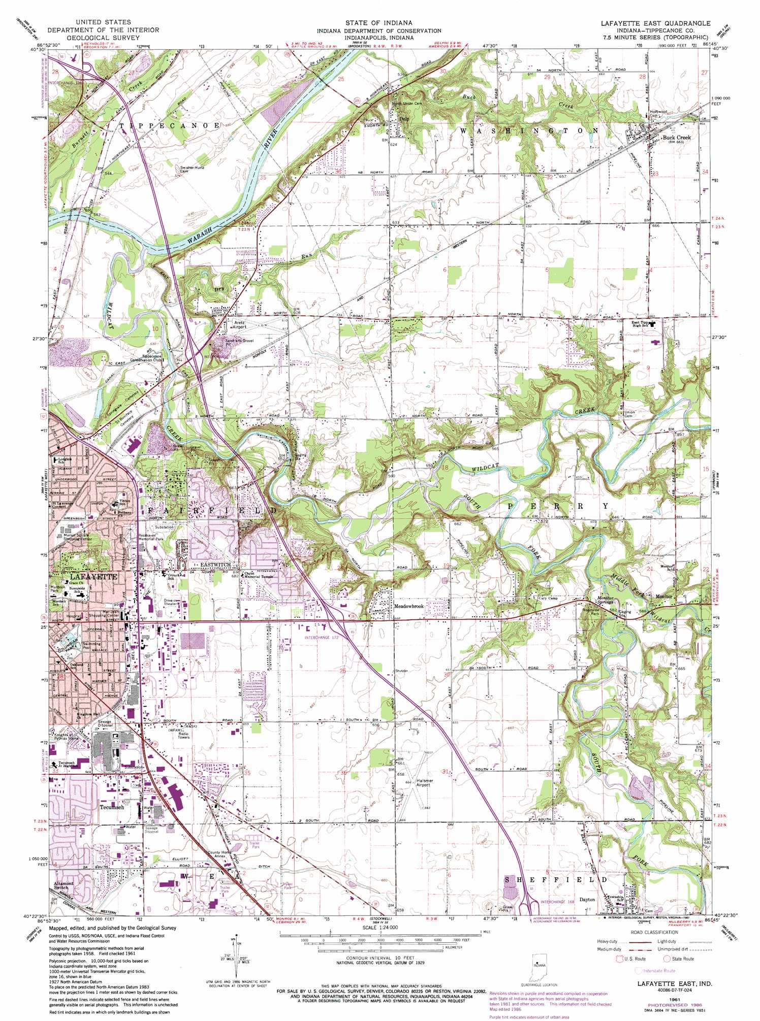
Lafayette East Topo Map Indiana
To zoom in, hover over the map of Lafayette East
USGS Topo Quad 40086d7 - 1:24,000 scale
| Topo Map Name: | Lafayette East |
| USGS Topo Quad ID: | 40086d7 |
| Print Size: | ca. 21 1/4" wide x 27" high |
| Southeast Coordinates: | 40.375° N latitude / 86.75° W longitude |
| Map Center Coordinates: | 40.4375° N latitude / 86.8125° W longitude |
| U.S. State: | IN |
| Filename: | o40086d7.jpg |
| Download Map JPG Image: | Lafayette East topo map 1:24,000 scale |
| Map Type: | Topographic |
| Topo Series: | 7.5´ |
| Map Scale: | 1:24,000 |
| Source of Map Images: | United States Geological Survey (USGS) |
| Alternate Map Versions: |
Lafayette East IN 1961, updated 1962 Download PDF Buy paper map Lafayette East IN 1961, updated 1966 Download PDF Buy paper map Lafayette East IN 1961, updated 1981 Download PDF Buy paper map Lafayette East IN 1961, updated 1987 Download PDF Buy paper map Lafayette East IN 1961, updated 1987 Download PDF Buy paper map Lafayette East IN 1998, updated 2001 Download PDF Buy paper map Lafayette East IN 2010 Download PDF Buy paper map Lafayette East IN 2013 Download PDF Buy paper map Lafayette East IN 2016 Download PDF Buy paper map |
1:24,000 Topo Quads surrounding Lafayette East
Templeton Ne |
Brookston Nw |
Monticello South |
Yeoman |
Burrows |
Round Grove |
Brookston Sw |
Brookston |
Delphi |
Flora |
Otterbein |
Lafayette West |
Lafayette East |
Pyrmont |
Rossville |
Westpoint |
Romney |
Stockwell |
Mulberry |
Frankfort |
Wingate |
Linden |
Kirkpatrick |
Colfax |
Thorntown |
> Back to 40086a1 at 1:100,000 scale
> Back to 40086a1 at 1:250,000 scale
> Back to U.S. Topo Maps home
Lafayette East topo map: Gazetteer
Lafayette East: Airports
Aretz Airport elevation 187m 613′Halsmer Airport elevation 202m 662′
Wildcat Air Landing Area elevation 203m 666′
Lafayette East: Canals
Elliott Ditch elevation 194m 636′Lafayette East: Crossings
Interchange 168 elevation 204m 669′Interchange 172 elevation 202m 662′
Interchange 175 elevation 164m 538′
Interchange 178 elevation 201m 659′
Lafayette East: Parks
Cary Camp elevation 199m 652′Columbian Park elevation 211m 692′
Murdock Park elevation 200m 656′
Lafayette East: Populated Places
Altamont Switch elevation 198m 649′Birmingham elevation 184m 603′
Buck Creek elevation 201m 659′
Delp elevation 190m 623′
Eastwitch elevation 205m 672′
Meadowbrook elevation 203m 666′
Monitor elevation 180m 590′
Tecumseh elevation 200m 656′
Lafayette East: Springs
Monitor Springs elevation 180m 590′Lafayette East: Streams
Burnett Creek elevation 159m 521′Dry Run elevation 160m 524′
Middle Fork Wildcat Creek elevation 173m 567′
South Fork Wildcat Creek elevation 167m 547′
Wildcat Creek elevation 156m 511′
Lafayette East digital topo map on disk
Buy this Lafayette East topo map showing relief, roads, GPS coordinates and other geographical features, as a high-resolution digital map file on DVD:
Northern Illinois, Northern Indiana & Southwestern Michigan
Buy digital topo maps: Northern Illinois, Northern Indiana & Southwestern Michigan