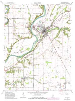
Delphi Topo Map Indiana
To zoom in, hover over the map of Delphi
USGS Topo Quad 40086e6 - 1:24,000 scale
| Topo Map Name: | Delphi |
| USGS Topo Quad ID: | 40086e6 |
| Print Size: | ca. 21 1/4" wide x 27" high |
| Southeast Coordinates: | 40.5° N latitude / 86.625° W longitude |
| Map Center Coordinates: | 40.5625° N latitude / 86.6875° W longitude |
| U.S. State: | IN |
| Filename: | o40086e6.jpg |
| Download Map JPG Image: | Delphi topo map 1:24,000 scale |
| Map Type: | Topographic |
| Topo Series: | 7.5´ |
| Map Scale: | 1:24,000 |
| Source of Map Images: | United States Geological Survey (USGS) |
| Alternate Map Versions: |
Delphi IN 1962, updated 1964 Download PDF Buy paper map Delphi IN 1962, updated 1980 Download PDF Buy paper map Delphi IN 2010 Download PDF Buy paper map Delphi IN 2013 Download PDF Buy paper map Delphi IN 2016 Download PDF Buy paper map |
1:24,000 Topo Quads surrounding Delphi
> Back to 40086e1 at 1:100,000 scale
> Back to 40086a1 at 1:250,000 scale
> Back to U.S. Topo Maps home
Delphi topo map: Gazetteer
Delphi: Airports
Delphi Municipal Airport elevation 203m 666′Delphi: Canals
Bowen Ditch elevation 161m 528′Julien Ditch elevation 179m 587′
Delphi: Parks
Delphi Courthouse Square Historic District elevation 176m 577′Delphi: Populated Places
Colburn elevation 202m 662′Delphi elevation 173m 567′
Harley elevation 211m 692′
Harley Siding elevation 209m 685′
Pittsburg elevation 168m 551′
Radnor elevation 210m 688′
Delphi: Streams
Bridge Creek elevation 159m 521′Bridge Creek elevation 168m 551′
Deer Creek elevation 159m 521′
Little Sugar Creek elevation 195m 639′
Pleasant Run elevation 163m 534′
Robinson Branch elevation 167m 547′
Sugar Creek Branch Number One elevation 204m 669′
Tannery Branch elevation 162m 531′
Delphi digital topo map on disk
Buy this Delphi topo map showing relief, roads, GPS coordinates and other geographical features, as a high-resolution digital map file on DVD:
Northern Illinois, Northern Indiana & Southwestern Michigan
Buy digital topo maps: Northern Illinois, Northern Indiana & Southwestern Michigan


