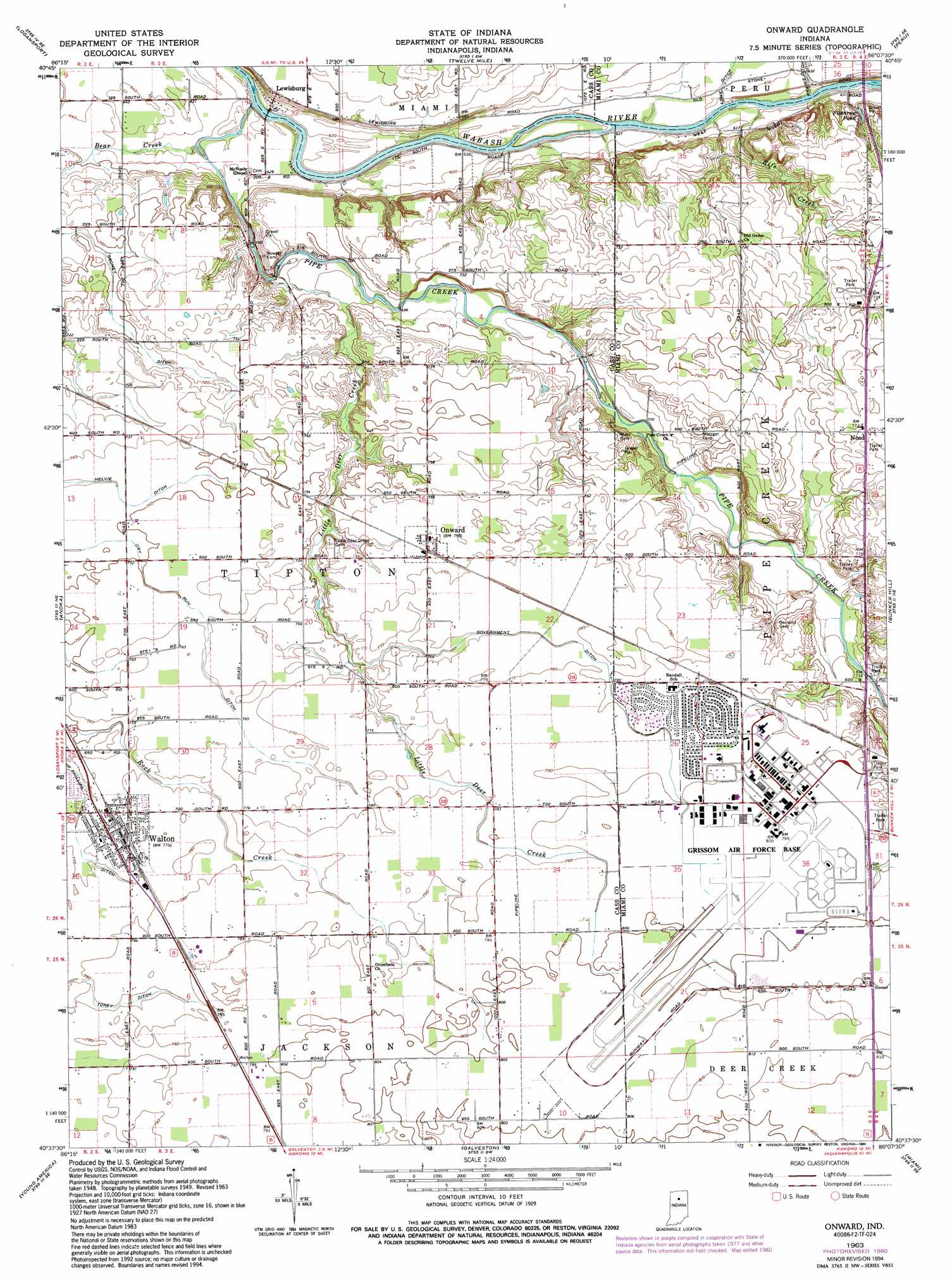
Onward Topo Map Indiana
To zoom in, hover over the map of Onward
USGS Topo Quad 40086f2 - 1:24,000 scale
| Topo Map Name: | Onward |
| USGS Topo Quad ID: | 40086f2 |
| Print Size: | ca. 21 1/4" wide x 27" high |
| Southeast Coordinates: | 40.625° N latitude / 86.125° W longitude |
| Map Center Coordinates: | 40.6875° N latitude / 86.1875° W longitude |
| U.S. State: | IN |
| Filename: | o40086f2.jpg |
| Download Map JPG Image: | Onward topo map 1:24,000 scale |
| Map Type: | Topographic |
| Topo Series: | 7.5´ |
| Map Scale: | 1:24,000 |
| Source of Map Images: | United States Geological Survey (USGS) |
| Alternate Map Versions: |
Onward IN 1951 Download PDF Buy paper map Onward IN 1963, updated 1964 Download PDF Buy paper map Onward IN 1963, updated 1980 Download PDF Buy paper map Onward IN 1963, updated 1994 Download PDF Buy paper map Onward IN 2010 Download PDF Buy paper map Onward IN 2013 Download PDF Buy paper map Onward IN 2016 Download PDF Buy paper map |
1:24,000 Topo Quads surrounding Onward
Grass Creek |
Fulton |
Macy |
Deedsville |
Roann |
Lucerne |
Logansport |
Twelve Mile |
Peru |
Richvalley |
Clymers |
Anoka |
Onward |
Bunker Hill |
Peoria |
Deer Creek |
Young America |
Galveston |
Miami |
Amboy |
Burlington |
Russiaville |
Kokomo West |
Kokomo East |
Greentown |
> Back to 40086e1 at 1:100,000 scale
> Back to 40086a1 at 1:250,000 scale
> Back to U.S. Topo Maps home
Onward topo map: Gazetteer
Onward: Airports
Headland Airport elevation 245m 803′Onward: Canals
Cromey Ditch elevation 211m 692′Dry Run Ditch elevation 232m 761′
Government Ditch elevation 238m 780′
Phillips Ditch elevation 233m 764′
Sixby Ditch elevation 218m 715′
Onward: Mines
Milner Quarry elevation 222m 728′Onward: Populated Places
Lewisburg elevation 207m 679′Nead elevation 234m 767′
Onward elevation 234m 767′
Walton elevation 235m 770′
Onward: Post Offices
Walton Post Office elevation 235m 770′Onward: Reservoirs
Plothrow Pond elevation 201m 659′Onward: Streams
Bear Creek elevation 190m 623′Little Deer Creek elevation 196m 643′
Pipe Creek elevation 188m 616′
Rife Creek elevation 187m 613′
Onward digital topo map on disk
Buy this Onward topo map showing relief, roads, GPS coordinates and other geographical features, as a high-resolution digital map file on DVD:
Northern Illinois, Northern Indiana & Southwestern Michigan
Buy digital topo maps: Northern Illinois, Northern Indiana & Southwestern Michigan