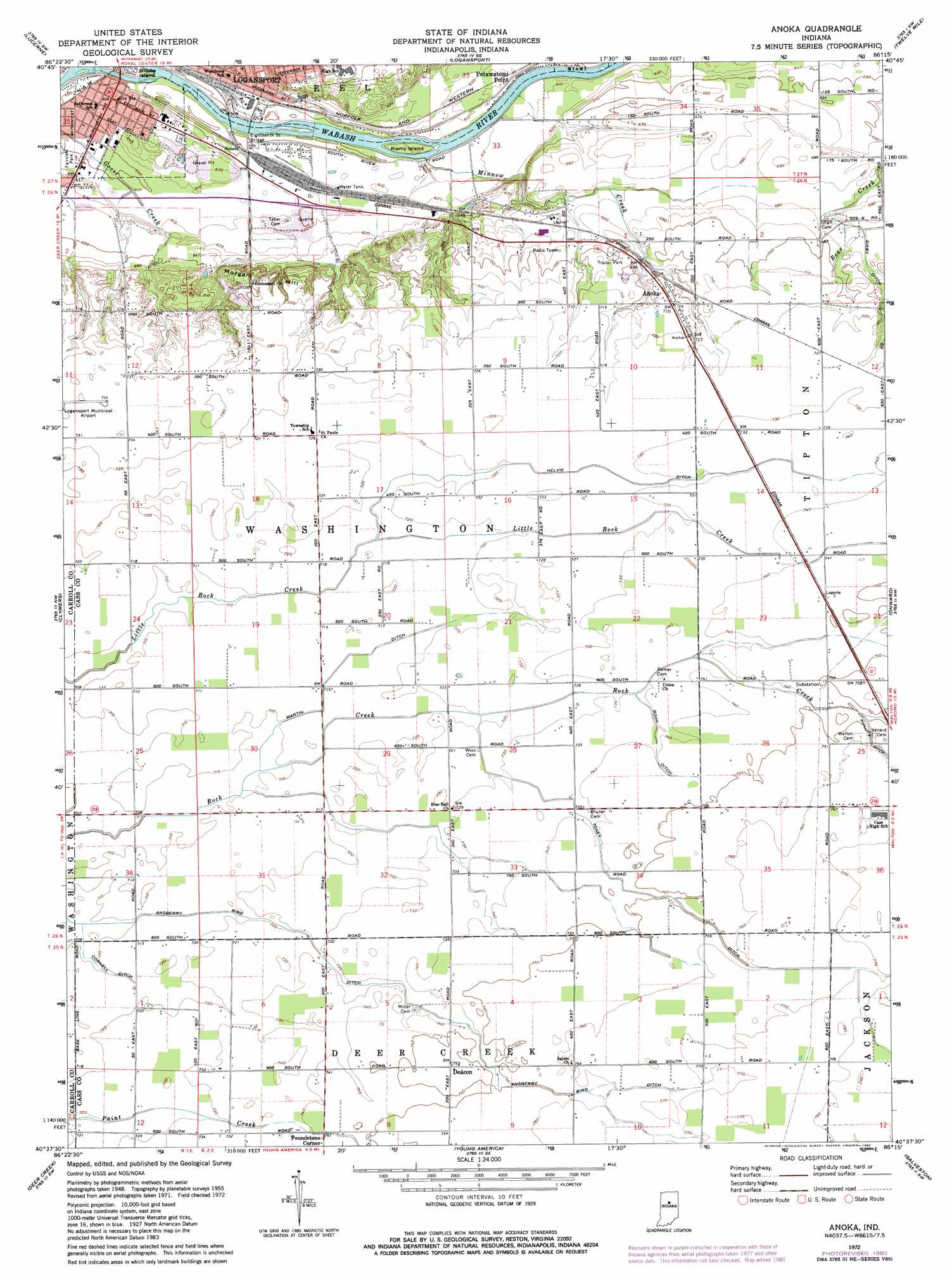
Anoka Topo Map Indiana
To zoom in, hover over the map of Anoka
USGS Topo Quad 40086f3 - 1:24,000 scale
| Topo Map Name: | Anoka |
| USGS Topo Quad ID: | 40086f3 |
| Print Size: | ca. 21 1/4" wide x 27" high |
| Southeast Coordinates: | 40.625° N latitude / 86.25° W longitude |
| Map Center Coordinates: | 40.6875° N latitude / 86.3125° W longitude |
| U.S. State: | IN |
| Filename: | o40086f3.jpg |
| Download Map JPG Image: | Anoka topo map 1:24,000 scale |
| Map Type: | Topographic |
| Topo Series: | 7.5´ |
| Map Scale: | 1:24,000 |
| Source of Map Images: | United States Geological Survey (USGS) |
| Alternate Map Versions: |
Anoka IN 1955, updated 1957 Download PDF Buy paper map Anoka IN 1972, updated 1974 Download PDF Buy paper map Anoka IN 1972, updated 1980 Download PDF Buy paper map Anoka IN 1972, updated 1980 Download PDF Buy paper map Anoka IN 2010 Download PDF Buy paper map Anoka IN 2013 Download PDF Buy paper map Anoka IN 2016 Download PDF Buy paper map |
1:24,000 Topo Quads surrounding Anoka
Star City |
Grass Creek |
Fulton |
Macy |
Deedsville |
Burnettsville |
Lucerne |
Logansport |
Twelve Mile |
Peru |
Burrows |
Clymers |
Anoka |
Onward |
Bunker Hill |
Flora |
Deer Creek |
Young America |
Galveston |
Miami |
Rossville |
Burlington |
Russiaville |
Kokomo West |
Kokomo East |
> Back to 40086e1 at 1:100,000 scale
> Back to 40086a1 at 1:250,000 scale
> Back to U.S. Topo Maps home
Anoka topo map: Gazetteer
Anoka: Bridges
Eighteenth Street Bridge elevation 185m 606′Anoka: Canals
Ansberry Bird Ditch elevation 222m 728′Bohn Ditch elevation 225m 738′
Cornell Ditch elevation 216m 708′
Cromley Ditch elevation 207m 679′
Helvie Ditch elevation 222m 728′
Martin Ditch elevation 217m 711′
Tolen Ditch elevation 228m 748′
Anoka: Islands
Biddle Island elevation 180m 590′Kienly Island elevation 184m 603′
Anoka: Parks
Fairview Park elevation 183m 600′Anoka: Populated Places
Anoka elevation 217m 711′Deacon elevation 230m 754′
Potawatomi Point elevation 186m 610′
Poundstone Corner elevation 226m 741′
Anoka: Streams
Minnow Creek elevation 181m 593′Anoka: Summits
Morgan Hill elevation 204m 669′Anoka digital topo map on disk
Buy this Anoka topo map showing relief, roads, GPS coordinates and other geographical features, as a high-resolution digital map file on DVD:
Northern Illinois, Northern Indiana & Southwestern Michigan
Buy digital topo maps: Northern Illinois, Northern Indiana & Southwestern Michigan