Yeoman Topo Map Indiana
To zoom in, hover over the map of Yeoman
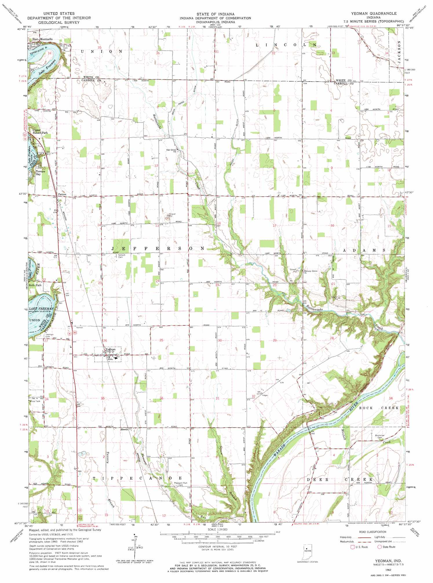
USGS Topo Quad 40086f6 - 1:24,000 scale
| Topo Map Name: | Yeoman |
| USGS Topo Quad ID: | 40086f6 |
| Print Size: | ca. 21 1/4" wide x 27" high |
| Southeast Coordinates: | 40.625° N latitude / 86.625° W longitude |
| Map Center Coordinates: | 40.6875° N latitude / 86.6875° W longitude |
| U.S. State: | IN |
| Filename: | o40086f6.jpg |
| Download Map JPG Image: | Yeoman topo map 1:24,000 scale |
| Map Type: | Topographic |
| Topo Series: | 7.5´ |
| Map Scale: | 1:24,000 |
| Source of Map Images: | United States Geological Survey (USGS) |
| Alternate Map Versions: |
Yeoman IN 1962, updated 1964 Download PDF Buy paper map Yeoman IN 2010 Download PDF Buy paper map Yeoman IN 2014 Download PDF Buy paper map Yeoman IN 2016 Download PDF Buy paper map |
1:24,000 Topo Quads surrounding Yeoman
Francesville |
Monon Ne |
Buffalo |
Star City |
Grass Creek |
Monon |
Monticello North |
Idaville |
Burnettsville |
Lucerne |
Brookston Nw |
Monticello South |
Yeoman |
Burrows |
Clymers |
Brookston Sw |
Brookston |
Delphi |
Flora |
Deer Creek |
Lafayette West |
Lafayette East |
Pyrmont |
Rossville |
Burlington |
> Back to 40086e1 at 1:100,000 scale
> Back to 40086a1 at 1:250,000 scale
> Back to U.S. Topo Maps home
Yeoman topo map: Gazetteer
Yeoman: Canals
Beck Ward Ditch elevation 203m 666′Hardy Ditch elevation 205m 672′
Yeoman: Populated Places
Patton elevation 207m 679′Roth Park elevation 204m 669′
Sleeth elevation 200m 656′
Terrace Bay elevation 205m 672′
Yeoman elevation 202m 662′
Yeoman: Streams
Mitchell Creek elevation 165m 541′Squaw Branch elevation 168m 551′
Yeoman digital topo map on disk
Buy this Yeoman topo map showing relief, roads, GPS coordinates and other geographical features, as a high-resolution digital map file on DVD:
Northern Illinois, Northern Indiana & Southwestern Michigan
Buy digital topo maps: Northern Illinois, Northern Indiana & Southwestern Michigan