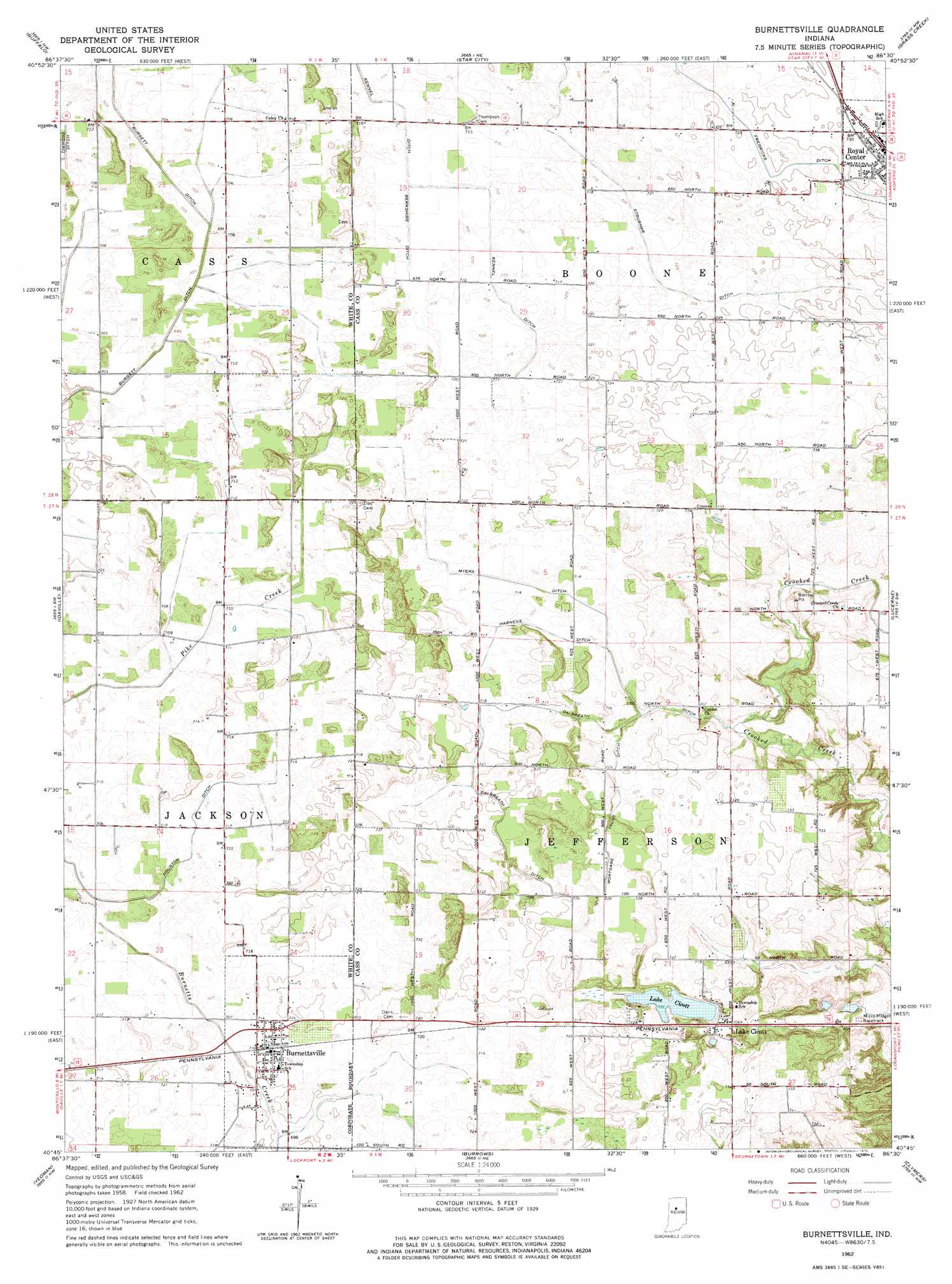
Burnettsville Topo Map Indiana
To zoom in, hover over the map of Burnettsville
USGS Topo Quad 40086g5 - 1:24,000 scale
| Topo Map Name: | Burnettsville |
| USGS Topo Quad ID: | 40086g5 |
| Print Size: | ca. 21 1/4" wide x 27" high |
| Southeast Coordinates: | 40.75° N latitude / 86.5° W longitude |
| Map Center Coordinates: | 40.8125° N latitude / 86.5625° W longitude |
| U.S. State: | IN |
| Filename: | o40086g5.jpg |
| Download Map JPG Image: | Burnettsville topo map 1:24,000 scale |
| Map Type: | Topographic |
| Topo Series: | 7.5´ |
| Map Scale: | 1:24,000 |
| Source of Map Images: | United States Geological Survey (USGS) |
| Alternate Map Versions: |
Burnettsville IN 1962, updated 1964 Download PDF Buy paper map Burnettsville IN 1962, updated 1976 Download PDF Buy paper map Burnettsville IN 2010 Download PDF Buy paper map Burnettsville IN 2013 Download PDF Buy paper map Burnettsville IN 2016 Download PDF Buy paper map |
1:24,000 Topo Quads surrounding Burnettsville
North Judson Se |
Ripley |
Winamac |
Kewanna |
Pershing |
Monon Ne |
Buffalo |
Star City |
Grass Creek |
Fulton |
Monticello North |
Idaville |
Burnettsville |
Lucerne |
Logansport |
Monticello South |
Yeoman |
Burrows |
Clymers |
Anoka |
Brookston |
Delphi |
Flora |
Deer Creek |
Young America |
> Back to 40086e1 at 1:100,000 scale
> Back to 40086a1 at 1:250,000 scale
> Back to U.S. Topo Maps home
Burnettsville topo map: Gazetteer
Burnettsville: Canals
Berkshire Ditch elevation 218m 715′Fredericks Ditch elevation 219m 718′
Galbreath Ditch elevation 218m 715′
Harness Ditch elevation 218m 715′
Houston Ditch elevation 214m 702′
Kennel Ditch elevation 218m 715′
Mortgage Trust Ditch elevation 219m 718′
Myers Ditch elevation 218m 715′
Strubhar Ditch elevation 218m 715′
Burnettsville: Lakes
Lake Cicott elevation 215m 705′Burnettsville: Populated Places
Burnettsville elevation 217m 711′Lake Cicott elevation 214m 702′
Burnettsville: Post Offices
Lake Cicott Post Office elevation 215m 705′Burnettsville digital topo map on disk
Buy this Burnettsville topo map showing relief, roads, GPS coordinates and other geographical features, as a high-resolution digital map file on DVD:
Northern Illinois, Northern Indiana & Southwestern Michigan
Buy digital topo maps: Northern Illinois, Northern Indiana & Southwestern Michigan