Monon Topo Map Indiana
To zoom in, hover over the map of Monon
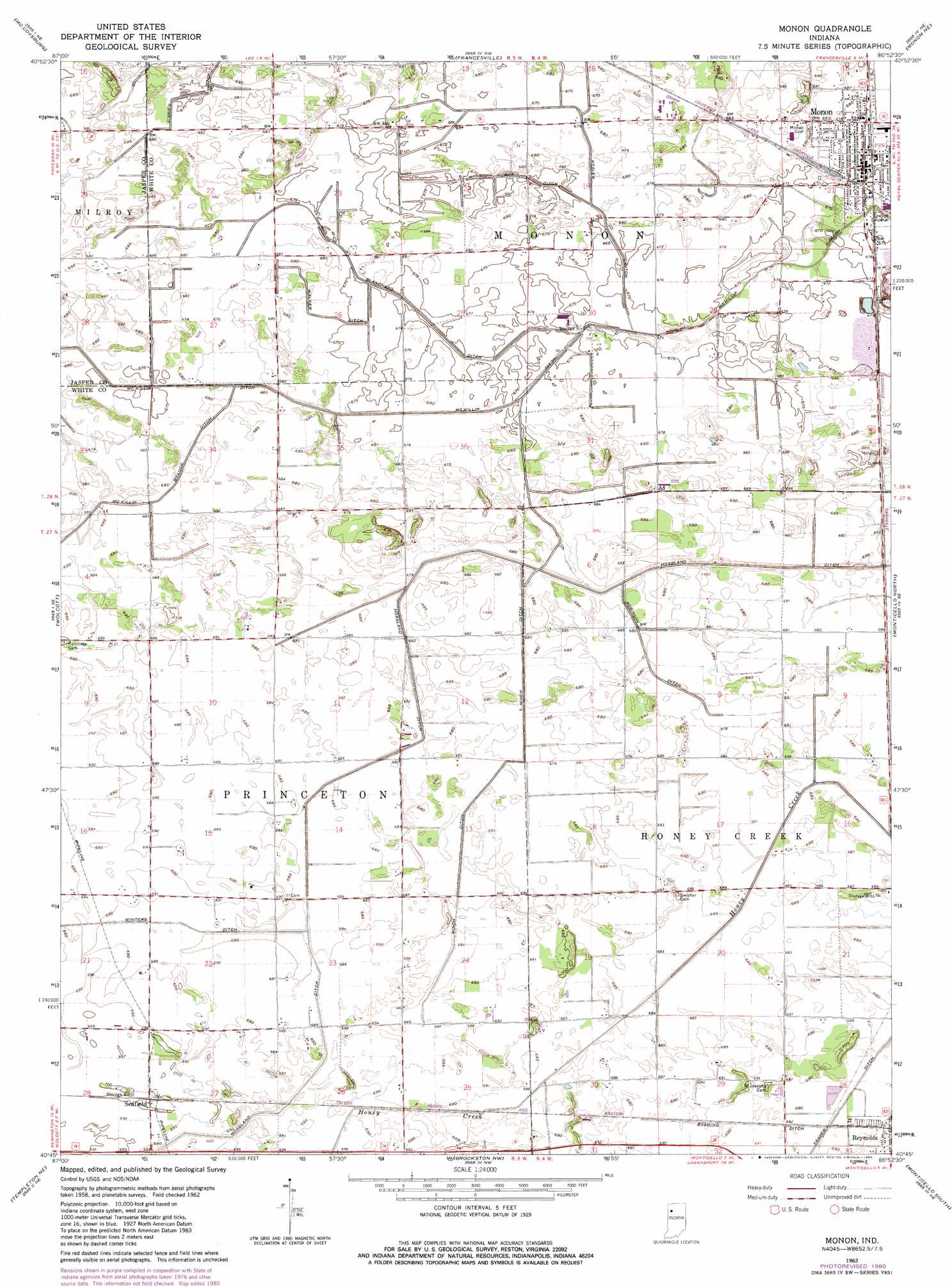
USGS Topo Quad 40086g8 - 1:24,000 scale
| Topo Map Name: | Monon |
| USGS Topo Quad ID: | 40086g8 |
| Print Size: | ca. 21 1/4" wide x 27" high |
| Southeast Coordinates: | 40.75° N latitude / 86.875° W longitude |
| Map Center Coordinates: | 40.8125° N latitude / 86.9375° W longitude |
| U.S. State: | IN |
| Filename: | o40086g8.jpg |
| Download Map JPG Image: | Monon topo map 1:24,000 scale |
| Map Type: | Topographic |
| Topo Series: | 7.5´ |
| Map Scale: | 1:24,000 |
| Source of Map Images: | United States Geological Survey (USGS) |
| Alternate Map Versions: |
Monon IN 1962, updated 1964 Download PDF Buy paper map Monon IN 1962, updated 1980 Download PDF Buy paper map Monon IN 2010 Download PDF Buy paper map Monon IN 2013 Download PDF Buy paper map Monon IN 2016 Download PDF Buy paper map |
1:24,000 Topo Quads surrounding Monon
Parr |
Gifford |
Medaryville |
North Judson Se |
Ripley |
Rensselaer |
Mccoysburg |
Francesville |
Monon Ne |
Buffalo |
Remington |
Wolcott |
Monon |
Monticello North |
Idaville |
Mount Gilboa |
Templeton Ne |
Brookston Nw |
Monticello South |
Yeoman |
Templeton |
Round Grove |
Brookston Sw |
Brookston |
Delphi |
> Back to 40086e1 at 1:100,000 scale
> Back to 40086a1 at 1:250,000 scale
> Back to U.S. Topo Maps home
Monon topo map: Gazetteer
Monon: Airports
Klopfenstein Airport elevation 209m 685′Monon: Canals
Blanchard Ditch elevation 207m 679′Bossung Ditch elevation 211m 692′
Box Ditch elevation 207m 679′
Hoagland Ditch elevation 208m 682′
Kesler Ditch elevation 208m 682′
McKillip Ditch elevation 207m 679′
Minch Ditch elevation 208m 682′
Obrien Ditch elevation 208m 682′
Robinson Ditch elevation 208m 682′
Walker Ditch elevation 206m 675′
Winters Ditch elevation 211m 692′
Monon: Mines
Monon Quarry elevation 165m 541′Monon: Populated Places
Monon elevation 207m 679′Seafield elevation 213m 698′
Monon digital topo map on disk
Buy this Monon topo map showing relief, roads, GPS coordinates and other geographical features, as a high-resolution digital map file on DVD:
Northern Illinois, Northern Indiana & Southwestern Michigan
Buy digital topo maps: Northern Illinois, Northern Indiana & Southwestern Michigan