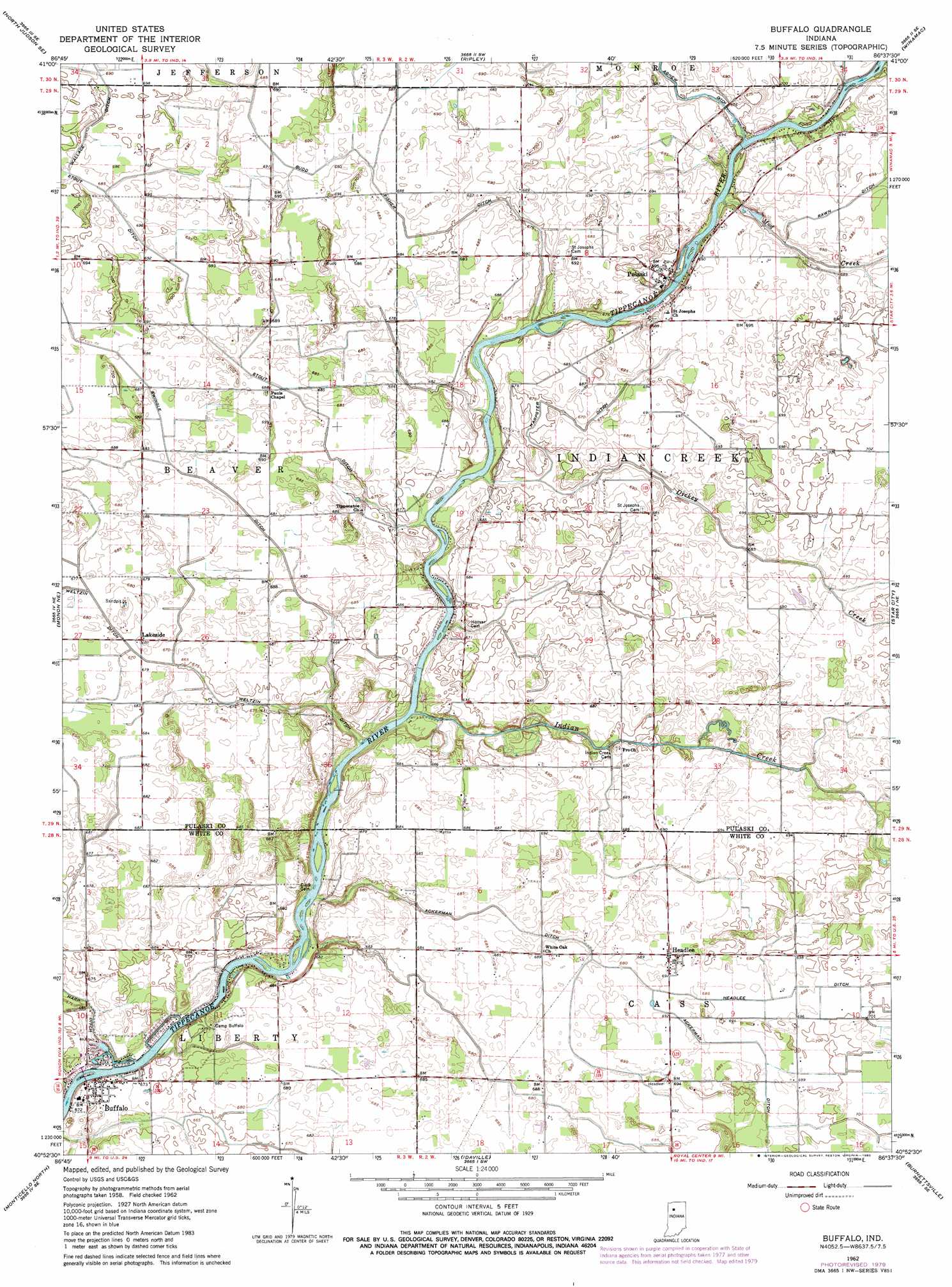
Buffalo Topo Map Indiana
To zoom in, hover over the map of Buffalo
USGS Topo Quad 40086h6 - 1:24,000 scale
| Topo Map Name: | Buffalo |
| USGS Topo Quad ID: | 40086h6 |
| Print Size: | ca. 21 1/4" wide x 27" high |
| Southeast Coordinates: | 40.875° N latitude / 86.625° W longitude |
| Map Center Coordinates: | 40.9375° N latitude / 86.6875° W longitude |
| U.S. State: | IN |
| Filename: | o40086h6.jpg |
| Download Map JPG Image: | Buffalo topo map 1:24,000 scale |
| Map Type: | Topographic |
| Topo Series: | 7.5´ |
| Map Scale: | 1:24,000 |
| Source of Map Images: | United States Geological Survey (USGS) |
| Alternate Map Versions: |
Buffalo IN 1962, updated 1963 Download PDF Buy paper map Buffalo IN 1962, updated 1980 Download PDF Buy paper map Buffalo IN 2010 Download PDF Buy paper map Buffalo IN 2013 Download PDF Buy paper map Buffalo IN 2016 Download PDF Buy paper map |
1:24,000 Topo Quads surrounding Buffalo
San Pierre |
North Judson |
Denham |
Bass Lake |
Culver |
Medaryville |
North Judson Se |
Ripley |
Winamac |
Kewanna |
Francesville |
Monon Ne |
Buffalo |
Star City |
Grass Creek |
Monon |
Monticello North |
Idaville |
Burnettsville |
Lucerne |
Brookston Nw |
Monticello South |
Yeoman |
Burrows |
Clymers |
> Back to 40086e1 at 1:100,000 scale
> Back to 40086a1 at 1:250,000 scale
> Back to U.S. Topo Maps home
Buffalo topo map: Gazetteer
Buffalo: Airports
Allen Airport elevation 210m 688′Buffalo: Canals
Budd Fisher Ditch elevation 208m 682′Harpster Ditch elevation 208m 682′
Headlee Ditch elevation 211m 692′
Radersdorf Ditch elevation 203m 666′
Rawn Ditch elevation 210m 688′
Stout Ditch elevation 211m 692′
Swingle Ditch elevation 209m 685′
Buffalo: Parks
Camp Buffalo elevation 206m 675′Buffalo: Populated Places
Buffalo elevation 204m 669′Headlee elevation 212m 695′
Lakeside elevation 209m 685′
Pulaski elevation 211m 692′
Buffalo: Streams
Dickey Creek elevation 201m 659′Indian Creek elevation 200m 656′
Mud Creek elevation 205m 672′
Buffalo digital topo map on disk
Buy this Buffalo topo map showing relief, roads, GPS coordinates and other geographical features, as a high-resolution digital map file on DVD:
Northern Illinois, Northern Indiana & Southwestern Michigan
Buy digital topo maps: Northern Illinois, Northern Indiana & Southwestern Michigan