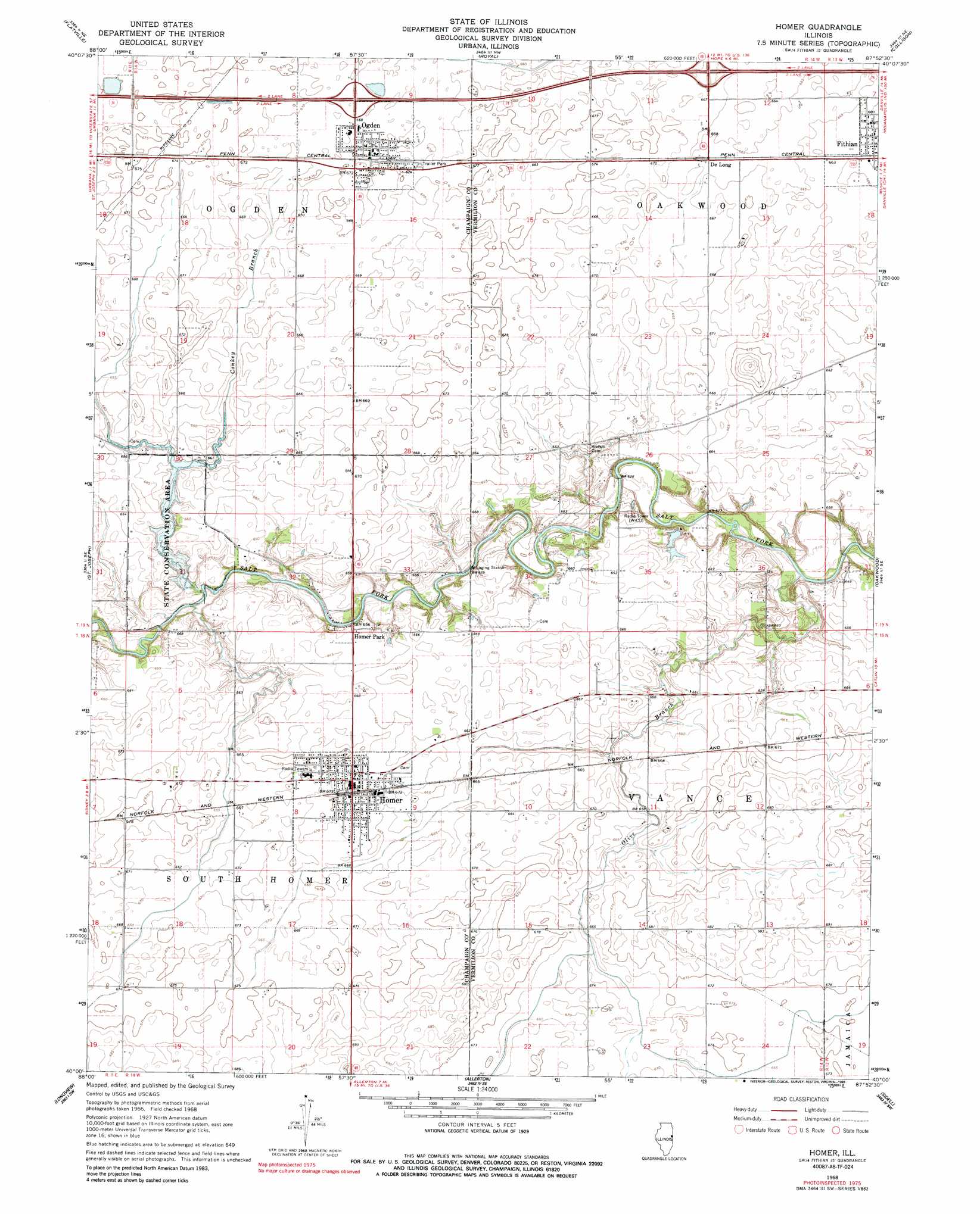
Homer Topo Map Illinois
To zoom in, hover over the map of Homer
USGS Topo Quad 40087a8 - 1:24,000 scale
| Topo Map Name: | Homer |
| USGS Topo Quad ID: | 40087a8 |
| Print Size: | ca. 21 1/4" wide x 27" high |
| Southeast Coordinates: | 40° N latitude / 87.875° W longitude |
| Map Center Coordinates: | 40.0625° N latitude / 87.9375° W longitude |
| U.S. State: | IL |
| Filename: | o40087a8.jpg |
| Download Map JPG Image: | Homer topo map 1:24,000 scale |
| Map Type: | Topographic |
| Topo Series: | 7.5´ |
| Map Scale: | 1:24,000 |
| Source of Map Images: | United States Geological Survey (USGS) |
| Alternate Map Versions: |
Homer IL 1968, updated 1969 Download PDF Buy paper map Homer IL 1968, updated 1989 Download PDF Buy paper map Homer IL 2012 Download PDF Buy paper map Homer IL 2015 Download PDF Buy paper map |
1:24,000 Topo Quads surrounding Homer
Rantoul |
Gifford |
Penfield |
Potomac |
Henning |
Thomasboro |
Flatville |
Royal |
Collison |
Danville Nw |
Urbana |
Saint Joseph |
Homer |
Oakwood |
Danville Sw |
Villa Grove Nw |
Longview |
Allerton |
Sidell |
Georgetown |
Villa Grove |
Murdock |
Newman |
Hume |
Chrisman |
> Back to 40087a1 at 1:100,000 scale
> Back to 40086a1 at 1:250,000 scale
> Back to U.S. Topo Maps home
Homer topo map: Gazetteer
Homer: Airports
Homer Airport (historical) elevation 202m 662′Wilson Airport elevation 203m 666′
Homer: Crossings
Interchange 197 elevation 209m 685′Interchange 200 elevation 206m 675′
Homer: Dams
Homer Lake Dam elevation 202m 662′Timberlake Farms Lake Dam elevation 195m 639′
Homer: Parks
Champaign County Conservation Area elevation 202m 662′Homer: Populated Places
Homer elevation 206m 675′Ogden elevation 204m 669′
Rumpler elevation 207m 679′
State Road elevation 206m 675′
Homer: Reservoirs
Homer Lake elevation 202m 662′Timberlake Farms Lake elevation 195m 639′
Homer: Streams
Conkey Branch elevation 189m 620′Olive Branch elevation 183m 600′
Veazel Branch elevation 189m 620′
Homer digital topo map on disk
Buy this Homer topo map showing relief, roads, GPS coordinates and other geographical features, as a high-resolution digital map file on DVD:
Northern Illinois, Northern Indiana & Southwestern Michigan
Buy digital topo maps: Northern Illinois, Northern Indiana & Southwestern Michigan