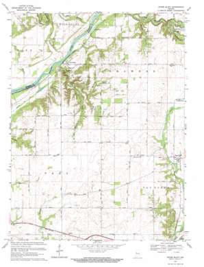
Stone Bluff Topo Map Indiana
To zoom in, hover over the map of Stone Bluff
USGS Topo Quad 40087b3 - 1:24,000 scale
| Topo Map Name: | Stone Bluff |
| USGS Topo Quad ID: | 40087b3 |
| Print Size: | ca. 21 1/4" wide x 27" high |
| Southeast Coordinates: | 40.125° N latitude / 87.25° W longitude |
| Map Center Coordinates: | 40.1875° N latitude / 87.3125° W longitude |
| U.S. State: | IN |
| Filename: | o40087b3.jpg |
| Download Map JPG Image: | Stone Bluff topo map 1:24,000 scale |
| Map Type: | Topographic |
| Topo Series: | 7.5´ |
| Map Scale: | 1:24,000 |
| Source of Map Images: | United States Geological Survey (USGS) |
| Alternate Map Versions: |
Stonebluff IN 1958, updated 1959 Download PDF Buy paper map Stone Bluff IN 1967, updated 1969 Download PDF Buy paper map Stone Bluff IN 2010 Download PDF Buy paper map Stone Bluff IN 2013 Download PDF Buy paper map Stone Bluff IN 2016 Download PDF Buy paper map |
1:24,000 Topo Quads surrounding Stone Bluff
> Back to 40087a1 at 1:100,000 scale
> Back to 40086a1 at 1:250,000 scale
> Back to U.S. Topo Maps home
Stone Bluff topo map: Gazetteer
Stone Bluff: Arches
Portland Arch elevation 153m 501′Stone Bluff: Bends
Portland Arch elevation 153m 501′Stone Bluff: Canals
Wabash and Erie Canal elevation 160m 524′Stone Bluff: Lakes
Scott Pond elevation 152m 498′Stone Bluff: Populated Places
Fountain elevation 168m 551′Layton elevation 196m 643′
Stone Bluff elevation 190m 623′
Stone Bluff: Streams
Bear Creek elevation 152m 498′Bodley Branch elevation 157m 515′
Clear Branch elevation 164m 538′
Dry Branch elevation 150m 492′
Dry Branch elevation 151m 495′
Little Shawnee Creek elevation 166m 544′
Marquess Branch elevation 174m 570′
Rattlesnake Creek elevation 161m 528′
Rock Creek elevation 151m 495′
Stone Bluff: Valleys
Rattlesnake Hollow elevation 163m 534′Stone Bluff digital topo map on disk
Buy this Stone Bluff topo map showing relief, roads, GPS coordinates and other geographical features, as a high-resolution digital map file on DVD:
Northern Illinois, Northern Indiana & Southwestern Michigan
Buy digital topo maps: Northern Illinois, Northern Indiana & Southwestern Michigan


