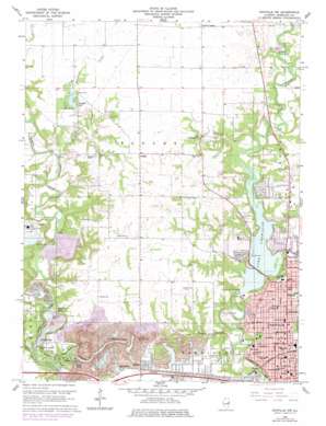
Danville Nw Topo Map Illinois
To zoom in, hover over the map of Danville Nw
USGS Topo Quad 40087b6 - 1:24,000 scale
| Topo Map Name: | Danville Nw |
| USGS Topo Quad ID: | 40087b6 |
| Print Size: | ca. 21 1/4" wide x 27" high |
| Southeast Coordinates: | 40.125° N latitude / 87.625° W longitude |
| Map Center Coordinates: | 40.1875° N latitude / 87.6875° W longitude |
| U.S. State: | IL |
| Filename: | o40087b6.jpg |
| Download Map JPG Image: | Danville Nw topo map 1:24,000 scale |
| Map Type: | Topographic |
| Topo Series: | 7.5´ |
| Map Scale: | 1:24,000 |
| Source of Map Images: | United States Geological Survey (USGS) |
| Alternate Map Versions: |
Danville NW IL 1948, updated 1964 Download PDF Buy paper map Danville NW IL 1950 Download PDF Buy paper map Danville NW IL 1966, updated 1967 Download PDF Buy paper map Danville NW IL 1966, updated 1978 Download PDF Buy paper map Danville NW IL 2012 Download PDF Buy paper map Danville NW IL 2015 Download PDF Buy paper map |
1:24,000 Topo Quads surrounding Danville Nw
> Back to 40087a1 at 1:100,000 scale
> Back to 40086a1 at 1:250,000 scale
> Back to U.S. Topo Maps home
Danville Nw topo map: Gazetteer
Danville Nw: Airports
Flying B Ranch Airport elevation 211m 692′Lakeview Medical Center Heliport elevation 186m 610′
Melody Field elevation 199m 652′
Danville Nw: Dams
Illinois Power Company Lake Dam elevation 209m 685′Lake Vermilion Dam elevation 169m 554′
Windfall Lake Dam elevation 199m 652′
Danville Nw: Lakes
Clear Pond elevation 172m 564′Deep Pond elevation 182m 597′
Emerald Pond elevation 172m 564′
Hidden Pond elevation 168m 551′
High Pond elevation 169m 554′
Inland Sea elevation 170m 557′
Long Pond elevation 167m 547′
Skyline Lake elevation 170m 557′
Danville Nw: Mines
Harmattan Strip Mine elevation 199m 652′Danville Nw: Parks
Cannon Park elevation 195m 639′Elsworth Park elevation 163m 534′
Fairchild Cemetery Savanna Nature Preserve elevation 200m 656′
Harrison Park elevation 173m 567′
Jaycees Park elevation 184m 603′
Kennekuk Cove County Park elevation 184m 603′
Lincoln Park elevation 188m 616′
Middle Fork Woods Nature Preserve elevation 197m 646′
Sunset Memorial Park elevation 214m 702′
Windfall Prairie Nature Preserve elevation 202m 662′
Danville Nw: Populated Places
Beeler Terrace elevation 179m 587′Denmark (historical) elevation 176m 577′
Grumle Corner elevation 205m 672′
Hartshorn elevation 195m 639′
Hillery elevation 197m 646′
Johnsonville elevation 199m 652′
Snider elevation 210m 688′
Wyton elevation 165m 541′
Danville Nw: Post Offices
Danville Post Office elevation 183m 600′Danville Nw: Reservoirs
Illinois Power Company Lake elevation 209m 685′Lake Mingo elevation 182m 597′
Lake Vermilion elevation 169m 554′
Windfall Lake elevation 200m 656′
Danville Nw: Streams
Gimlet Branch elevation 180m 590′Glenburn Creek elevation 171m 561′
Windfall Creek elevation 180m 590′
Danville Nw: Valleys
Cox Hollow elevation 186m 610′Hungry Hollow elevation 168m 551′
Danville Nw digital topo map on disk
Buy this Danville Nw topo map showing relief, roads, GPS coordinates and other geographical features, as a high-resolution digital map file on DVD:
Northern Illinois, Northern Indiana & Southwestern Michigan
Buy digital topo maps: Northern Illinois, Northern Indiana & Southwestern Michigan


