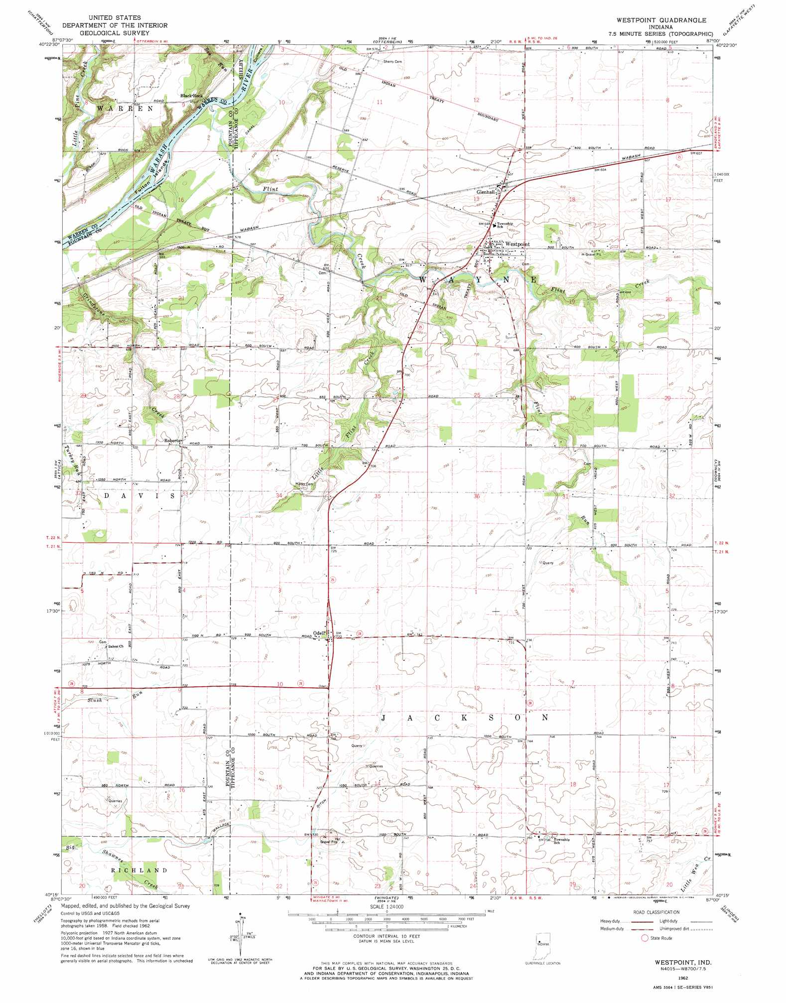
Westpoint Topo Map Indiana
To zoom in, hover over the map of Westpoint
USGS Topo Quad 40087c1 - 1:24,000 scale
| Topo Map Name: | Westpoint |
| USGS Topo Quad ID: | 40087c1 |
| Print Size: | ca. 21 1/4" wide x 27" high |
| Southeast Coordinates: | 40.25° N latitude / 87° W longitude |
| Map Center Coordinates: | 40.3125° N latitude / 87.0625° W longitude |
| U.S. State: | IN |
| Filename: | o40087c1.jpg |
| Download Map JPG Image: | Westpoint topo map 1:24,000 scale |
| Map Type: | Topographic |
| Topo Series: | 7.5´ |
| Map Scale: | 1:24,000 |
| Source of Map Images: | United States Geological Survey (USGS) |
| Alternate Map Versions: |
Westpoint IN 1962, updated 1964 Download PDF Buy paper map Westpoint IN 2010 Download PDF Buy paper map Westpoint IN 2013 Download PDF Buy paper map Westpoint IN 2016 Download PDF Buy paper map |
1:24,000 Topo Quads surrounding Westpoint
Fowler |
Templeton |
Round Grove |
Brookston Sw |
Brookston |
Pine Village |
Chatterton |
Otterbein |
Lafayette West |
Lafayette East |
Williamsport |
Attica |
Westpoint |
Romney |
Stockwell |
Stone Bluff |
Mellott |
Wingate |
Linden |
Kirkpatrick |
Veedersburg |
Hillsboro |
Waynetown |
Crawfordsville |
Darlington |
> Back to 40087a1 at 1:100,000 scale
> Back to 40086a1 at 1:250,000 scale
> Back to U.S. Topo Maps home
Westpoint topo map: Gazetteer
Westpoint: Airports
North Brothers Airport elevation 217m 711′Westpoint: Canals
Wallace Ditch elevation 216m 708′Westpoint: Islands
Fulton Islands elevation 153m 501′Westpoint: Populated Places
Black Rock elevation 160m 524′Glenhall elevation 188m 616′
Odell elevation 224m 734′
Roberts elevation 215m 705′
Westpoint elevation 205m 672′
Westpoint: Streams
Bee Run elevation 156m 511′Flint Creek elevation 153m 501′
Flint Run elevation 195m 639′
Little Flint Creek elevation 178m 583′
Little Wea Creek elevation 218m 715′
Westpoint digital topo map on disk
Buy this Westpoint topo map showing relief, roads, GPS coordinates and other geographical features, as a high-resolution digital map file on DVD:
Northern Illinois, Northern Indiana & Southwestern Michigan
Buy digital topo maps: Northern Illinois, Northern Indiana & Southwestern Michigan