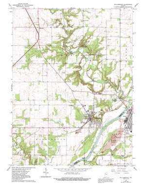
Williamsport Topo Map Indiana
To zoom in, hover over the map of Williamsport
USGS Topo Quad 40087c3 - 1:24,000 scale
| Topo Map Name: | Williamsport |
| USGS Topo Quad ID: | 40087c3 |
| Print Size: | ca. 21 1/4" wide x 27" high |
| Southeast Coordinates: | 40.25° N latitude / 87.25° W longitude |
| Map Center Coordinates: | 40.3125° N latitude / 87.3125° W longitude |
| U.S. State: | IN |
| Filename: | o40087c3.jpg |
| Download Map JPG Image: | Williamsport topo map 1:24,000 scale |
| Map Type: | Topographic |
| Topo Series: | 7.5´ |
| Map Scale: | 1:24,000 |
| Source of Map Images: | United States Geological Survey (USGS) |
| Alternate Map Versions: |
Williamsport IN 1962, updated 1964 Download PDF Buy paper map Williamsport IN 1962, updated 1980 Download PDF Buy paper map Williamsport IN 1962, updated 1992 Download PDF Buy paper map Williamsport IN 2010 Download PDF Buy paper map Williamsport IN 2013 Download PDF Buy paper map Williamsport IN 2016 Download PDF Buy paper map |
1:24,000 Topo Quads surrounding Williamsport
> Back to 40087a1 at 1:100,000 scale
> Back to 40086a1 at 1:250,000 scale
> Back to U.S. Topo Maps home
Williamsport topo map: Gazetteer
Williamsport: Bridges
Paul Dresser Bridge elevation 151m 495′Shawnee Bridge elevation 160m 524′
Twin Bridges elevation 167m 547′
Williamsport: Canals
French Ditch elevation 185m 606′Williamsport: Cliffs
Lovers Leap elevation 200m 656′Williamsport: Dams
Desmond Able Lake Dam elevation 205m 672′Williamsport: Populated Places
Carbondale elevation 210m 688′Five Points elevation 221m 725′
Kramer elevation 200m 656′
Mudlavia Springs elevation 172m 564′
Williamsport elevation 193m 633′
Williamsport: Reservoirs
Desmond Able Lake elevation 205m 672′Shawnee Lake elevation 182m 597′
Williamsport: Streams
Big Pine Creek elevation 150m 492′Big Shawnee Creek elevation 150m 492′
Fall Branch elevation 152m 498′
Fall Creek elevation 168m 551′
Williamsport: Summits
Copeland Hill elevation 206m 675′Hog Back Hill elevation 201m 659′
Williamsport digital topo map on disk
Buy this Williamsport topo map showing relief, roads, GPS coordinates and other geographical features, as a high-resolution digital map file on DVD:
Northern Illinois, Northern Indiana & Southwestern Michigan
Buy digital topo maps: Northern Illinois, Northern Indiana & Southwestern Michigan


