West Lebanon Topo Map Indiana
To zoom in, hover over the map of West Lebanon
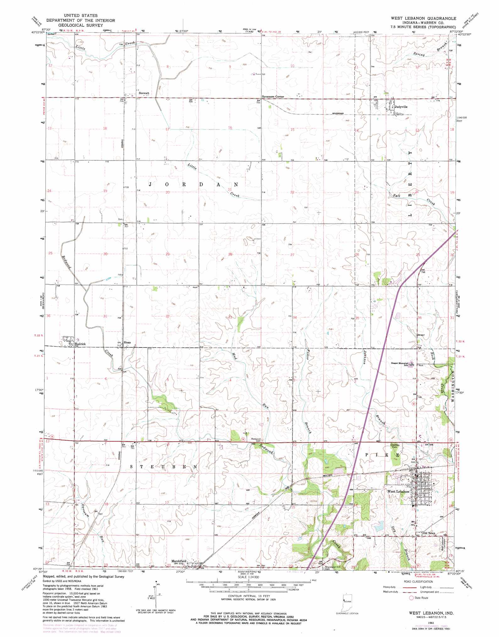
USGS Topo Quad 40087c4 - 1:24,000 scale
| Topo Map Name: | West Lebanon |
| USGS Topo Quad ID: | 40087c4 |
| Print Size: | ca. 21 1/4" wide x 27" high |
| Southeast Coordinates: | 40.25° N latitude / 87.375° W longitude |
| Map Center Coordinates: | 40.3125° N latitude / 87.4375° W longitude |
| U.S. State: | IN |
| Filename: | o40087c4.jpg |
| Download Map JPG Image: | West Lebanon topo map 1:24,000 scale |
| Map Type: | Topographic |
| Topo Series: | 7.5´ |
| Map Scale: | 1:24,000 |
| Source of Map Images: | United States Geological Survey (USGS) |
| Alternate Map Versions: |
West Lebanon IN 1961, updated 1964 Download PDF Buy paper map West Lebanon IN 1961, updated 1981 Download PDF Buy paper map West Lebanon IN 2010 Download PDF Buy paper map West Lebanon IN 2013 Download PDF Buy paper map West Lebanon IN 2016 Download PDF Buy paper map |
1:24,000 Topo Quads surrounding West Lebanon
Wellington |
Stockland |
Boswell |
Fowler |
Templeton |
Hoopeston |
Ambia |
Tab |
Pine Village |
Chatterton |
Henning |
Bismarck |
West Lebanon |
Williamsport |
Attica |
Danville Nw |
Danville Ne |
Covington |
Stone Bluff |
Mellott |
Danville Sw |
Danville Se |
Perrysville |
Veedersburg |
Hillsboro |
> Back to 40087a1 at 1:100,000 scale
> Back to 40086a1 at 1:250,000 scale
> Back to U.S. Topo Maps home
West Lebanon topo map: Gazetteer
West Lebanon: Populated Places
Hedrick elevation 216m 708′Judyville elevation 233m 764′
Old Town elevation 209m 685′
Sloan elevation 217m 711′
Stewart elevation 217m 711′
Sycamore Corner elevation 221m 725′
West Lebanon elevation 219m 718′
West Lebanon: Streams
Foster Branch elevation 194m 636′Johnson Branch elevation 196m 643′
Mud Run elevation 199m 652′
West Lebanon digital topo map on disk
Buy this West Lebanon topo map showing relief, roads, GPS coordinates and other geographical features, as a high-resolution digital map file on DVD:
Northern Illinois, Northern Indiana & Southwestern Michigan
Buy digital topo maps: Northern Illinois, Northern Indiana & Southwestern Michigan