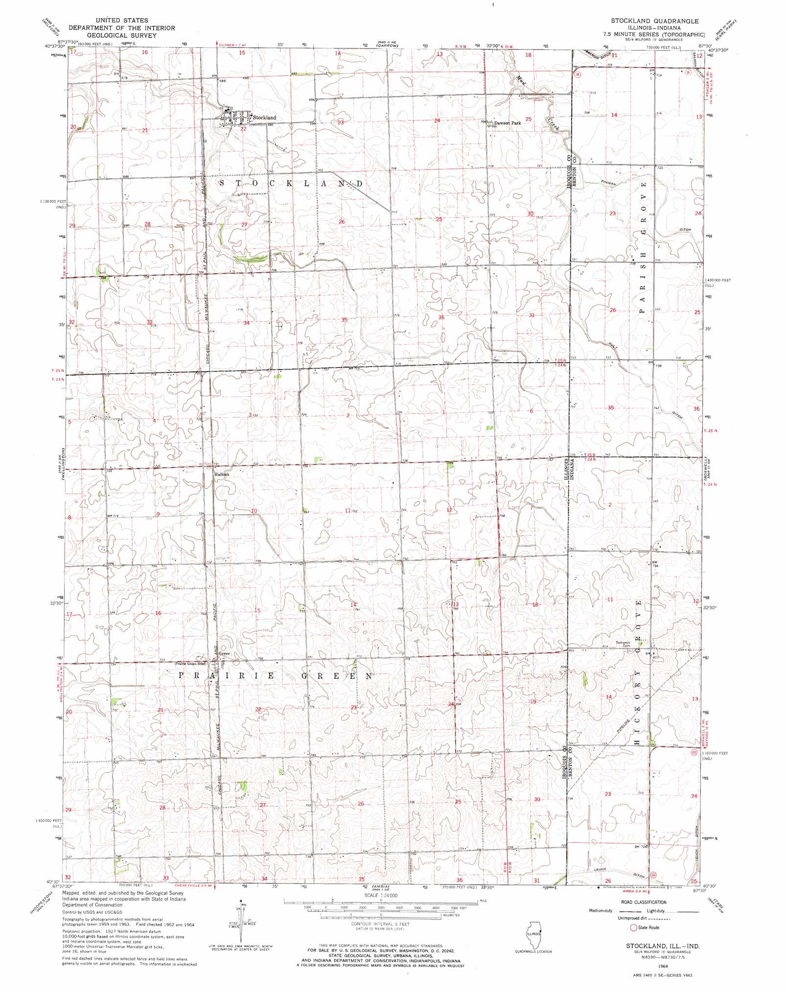
Stockland Topo Map Illinois
To zoom in, hover over the map of Stockland
USGS Topo Quad 40087e5 - 1:24,000 scale
| Topo Map Name: | Stockland |
| USGS Topo Quad ID: | 40087e5 |
| Print Size: | ca. 21 1/4" wide x 27" high |
| Southeast Coordinates: | 40.5° N latitude / 87.5° W longitude |
| Map Center Coordinates: | 40.5625° N latitude / 87.5625° W longitude |
| U.S. States: | IL, IN |
| Filename: | o40087e5.jpg |
| Download Map JPG Image: | Stockland topo map 1:24,000 scale |
| Map Type: | Topographic |
| Topo Series: | 7.5´ |
| Map Scale: | 1:24,000 |
| Source of Map Images: | United States Geological Survey (USGS) |
| Alternate Map Versions: |
Stockland IL 1964, updated 1965 Download PDF Buy paper map Stockland IL 2011 Download PDF Buy paper map Stockland IL 2012 Download PDF Buy paper map Stockland IL 2015 Download PDF Buy paper map |
1:24,000 Topo Quads surrounding Stockland
Crescent |
Watseka |
Sheldon |
Kentland |
Goodland |
Woodworth |
Milford |
Darrow |
Earl Park |
Wadena |
Claytonville |
Wellington |
Stockland |
Boswell |
Fowler |
East Lynn |
Hoopeston |
Ambia |
Tab |
Pine Village |
Potomac |
Henning |
Bismarck |
West Lebanon |
Williamsport |
> Back to 40087e1 at 1:100,000 scale
> Back to 40086a1 at 1:250,000 scale
> Back to U.S. Topo Maps home
Stockland topo map: Gazetteer
Stockland: Airports
Wichman Airport elevation 202m 662′Stockland: Canals
Kult Ditch elevation 225m 738′Stockland: Parks
Dawson Park elevation 211m 692′Stockland: Populated Places
Greer elevation 229m 751′Hallock elevation 223m 731′
Stockland elevation 205m 672′
Stockland: Post Offices
Stockland Post Office elevation 204m 669′Stockland digital topo map on disk
Buy this Stockland topo map showing relief, roads, GPS coordinates and other geographical features, as a high-resolution digital map file on DVD:
Northern Illinois, Northern Indiana & Southwestern Michigan
Buy digital topo maps: Northern Illinois, Northern Indiana & Southwestern Michigan