Weldon West Topo Map Illinois
To zoom in, hover over the map of Weldon West
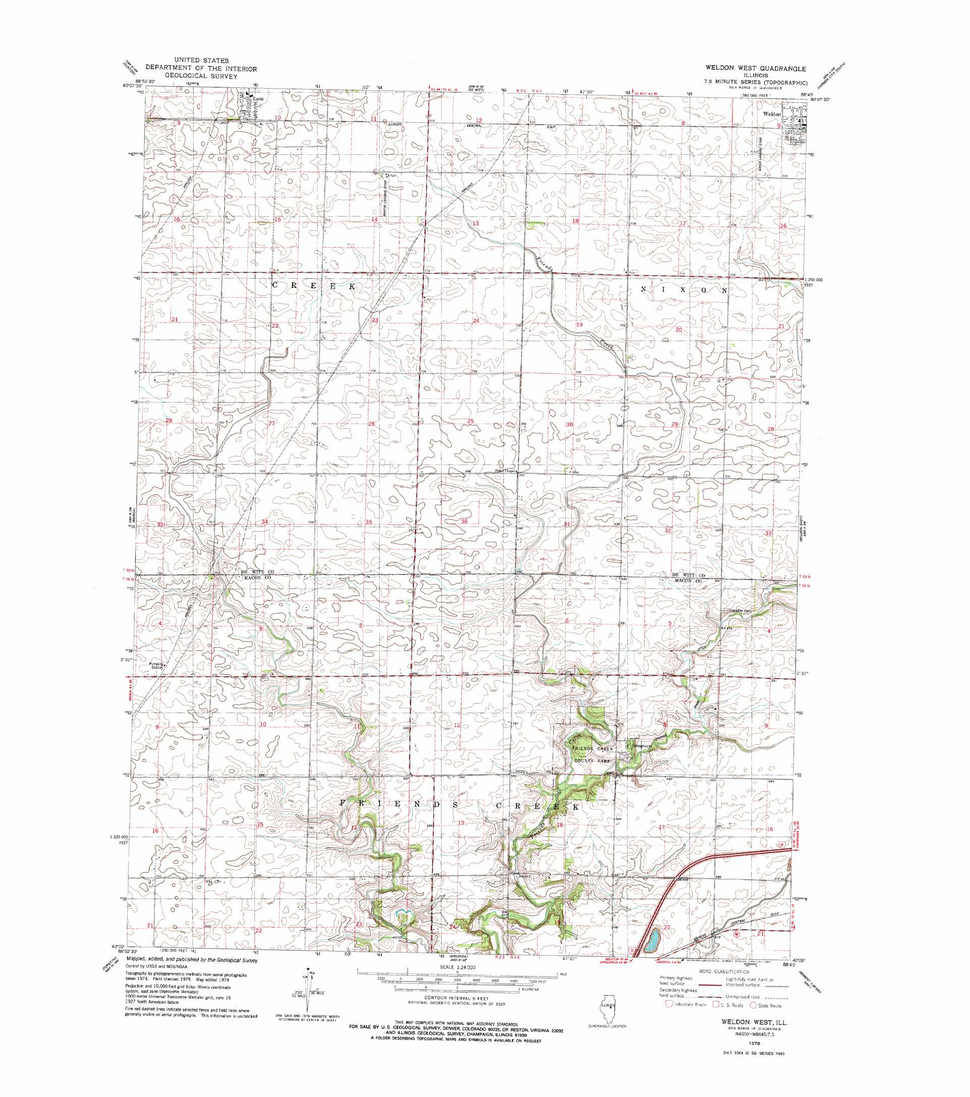
USGS Topo Quad 40088a7 - 1:24,000 scale
| Topo Map Name: | Weldon West |
| USGS Topo Quad ID: | 40088a7 |
| Print Size: | ca. 21 1/4" wide x 27" high |
| Southeast Coordinates: | 40° N latitude / 88.75° W longitude |
| Map Center Coordinates: | 40.0625° N latitude / 88.8125° W longitude |
| U.S. State: | IL |
| Filename: | o40088a7.jpg |
| Download Map JPG Image: | Weldon West topo map 1:24,000 scale |
| Map Type: | Topographic |
| Topo Series: | 7.5´ |
| Map Scale: | 1:24,000 |
| Source of Map Images: | United States Geological Survey (USGS) |
| Alternate Map Versions: |
Weldon West IL 1979, updated 1980 Download PDF Buy paper map Weldon West IL 2012 Download PDF Buy paper map Weldon West IL 2015 Download PDF Buy paper map |
1:24,000 Topo Quads surrounding Weldon West
Funks Grove |
Heyworth |
Le Roy |
Farmer City North |
Belleflower |
Waynesville East |
Clinton |
De Witt |
Farmer City South |
Mansfield |
Kenney |
Maroa |
Weldon West |
Weldon East |
Monticello |
Warrensburg |
Forsyth |
Argenta |
Cerro Gordo |
Bement |
Harristown |
Decatur |
Long Creek |
La Place |
Hammond |
> Back to 40088a1 at 1:100,000 scale
> Back to 40088a1 at 1:250,000 scale
> Back to U.S. Topo Maps home
Weldon West topo map: Gazetteer
Weldon West: Airports
Bakers Strip elevation 218m 715′Martin RLA Airport elevation 219m 718′
Weldon West: Parks
Friends Creek County Park elevation 205m 672′Weldon West: Populated Places
Lane elevation 222m 728′Weldon West digital topo map on disk
Buy this Weldon West topo map showing relief, roads, GPS coordinates and other geographical features, as a high-resolution digital map file on DVD:
Northern Illinois, Northern Indiana & Southwestern Michigan
Buy digital topo maps: Northern Illinois, Northern Indiana & Southwestern Michigan