Maroa Topo Map Illinois
To zoom in, hover over the map of Maroa
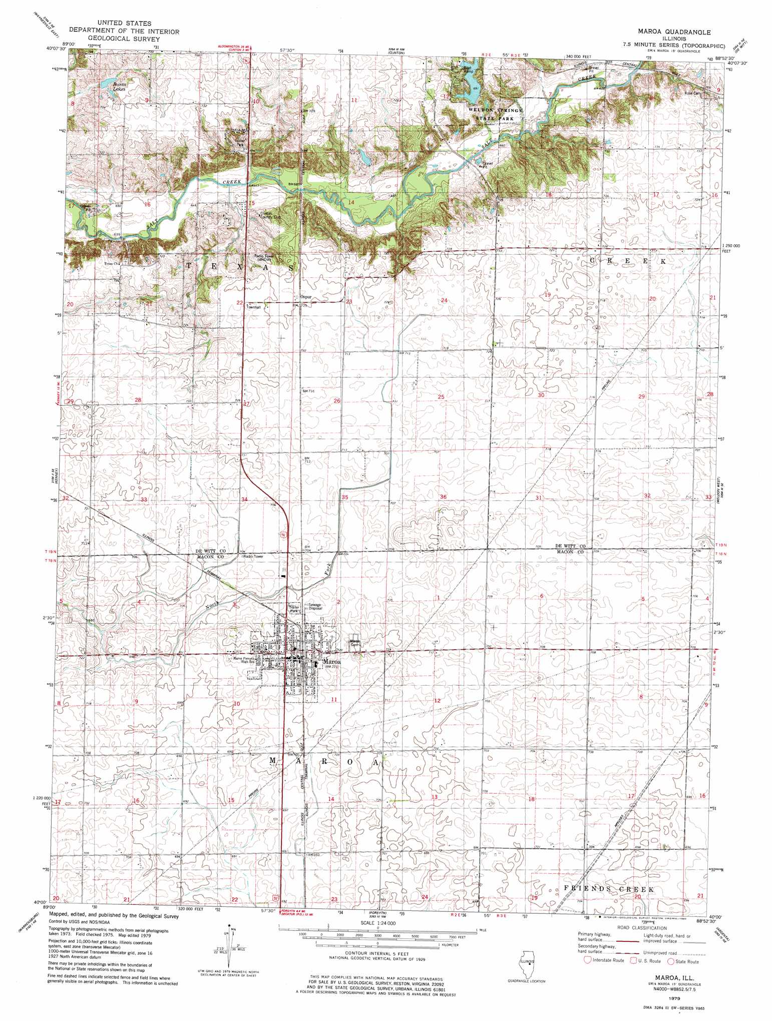
USGS Topo Quad 40088a8 - 1:24,000 scale
| Topo Map Name: | Maroa |
| USGS Topo Quad ID: | 40088a8 |
| Print Size: | ca. 21 1/4" wide x 27" high |
| Southeast Coordinates: | 40° N latitude / 88.875° W longitude |
| Map Center Coordinates: | 40.0625° N latitude / 88.9375° W longitude |
| U.S. State: | IL |
| Filename: | o40088a8.jpg |
| Download Map JPG Image: | Maroa topo map 1:24,000 scale |
| Map Type: | Topographic |
| Topo Series: | 7.5´ |
| Map Scale: | 1:24,000 |
| Source of Map Images: | United States Geological Survey (USGS) |
| Alternate Map Versions: |
Maroa IL 1979, updated 1980 Download PDF Buy paper map Maroa IL 1979, updated 1980 Download PDF Buy paper map Maroa IL 1998, updated 2001 Download PDF Buy paper map Maroa IL 2012 Download PDF Buy paper map Maroa IL 2015 Download PDF Buy paper map |
1:24,000 Topo Quads surrounding Maroa
Mclean |
Funks Grove |
Heyworth |
Le Roy |
Farmer City North |
Waynesville West |
Waynesville East |
Clinton |
De Witt |
Farmer City South |
Chestnut |
Kenney |
Maroa |
Weldon West |
Weldon East |
Latham |
Warrensburg |
Forsyth |
Argenta |
Cerro Gordo |
Niantic |
Harristown |
Decatur |
Long Creek |
La Place |
> Back to 40088a1 at 1:100,000 scale
> Back to 40088a1 at 1:250,000 scale
> Back to U.S. Topo Maps home
Maroa topo map: Gazetteer
Maroa: Airports
Margenthaler Airport elevation 218m 715′Maroa: Dams
Weldon Springs Lake Dam elevation 216m 708′Maroa: Lakes
Banta Lakes elevation 198m 649′Maroa: Parks
Weldon Springs State Park elevation 214m 702′Maroa: Populated Places
Maroa elevation 221m 725′Ospur elevation 221m 725′
Maroa: Reservoirs
Weldon Springs Lake elevation 216m 708′Maroa digital topo map on disk
Buy this Maroa topo map showing relief, roads, GPS coordinates and other geographical features, as a high-resolution digital map file on DVD:
Northern Illinois, Northern Indiana & Southwestern Michigan
Buy digital topo maps: Northern Illinois, Northern Indiana & Southwestern Michigan