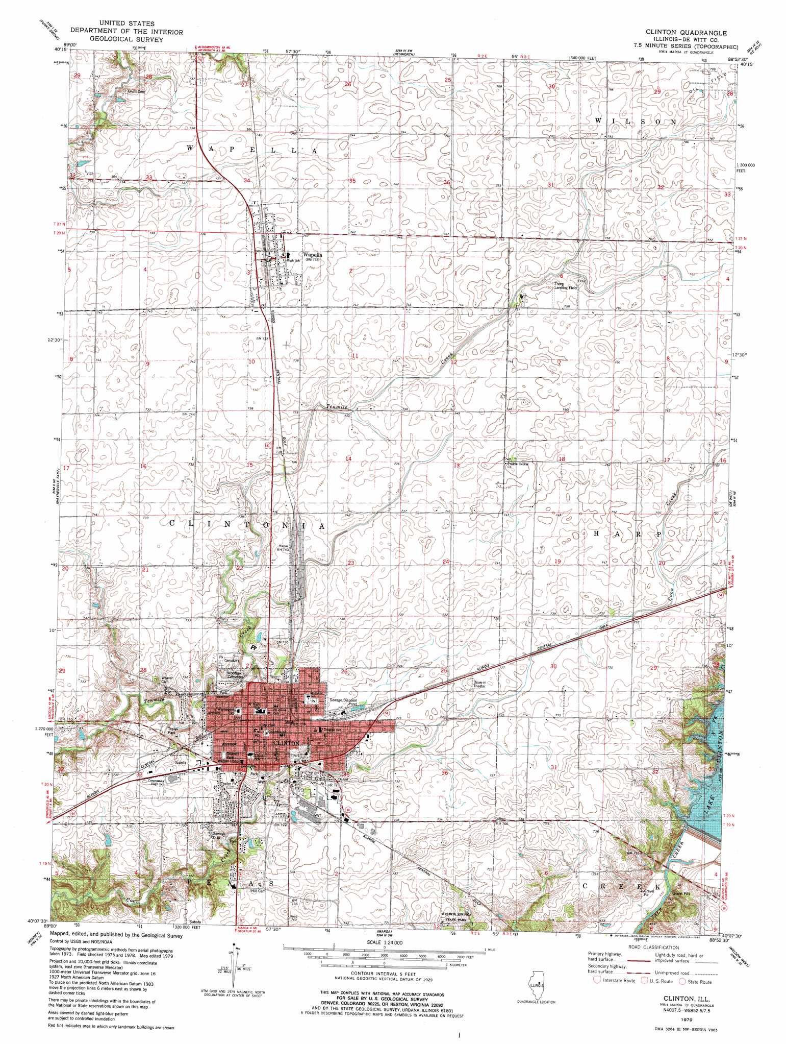
Clinton Topo Map Illinois
To zoom in, hover over the map of Clinton
USGS Topo Quad 40088b8 - 1:24,000 scale
| Topo Map Name: | Clinton |
| USGS Topo Quad ID: | 40088b8 |
| Print Size: | ca. 21 1/4" wide x 27" high |
| Southeast Coordinates: | 40.125° N latitude / 88.875° W longitude |
| Map Center Coordinates: | 40.1875° N latitude / 88.9375° W longitude |
| U.S. State: | IL |
| Filename: | o40088b8.jpg |
| Download Map JPG Image: | Clinton topo map 1:24,000 scale |
| Map Type: | Topographic |
| Topo Series: | 7.5´ |
| Map Scale: | 1:24,000 |
| Source of Map Images: | United States Geological Survey (USGS) |
| Alternate Map Versions: |
Clinton IL 1953, updated 1957 Download PDF Buy paper map Clinton IL 1979, updated 1980 Download PDF Buy paper map Clinton IL 1999, updated 2001 Download PDF Buy paper map Clinton IL 2012 Download PDF Buy paper map Clinton IL 2015 Download PDF Buy paper map |
1:24,000 Topo Quads surrounding Clinton
Stanford |
Bloomington West |
Bloomington East |
Holder |
Arrowsmith |
Mclean |
Funks Grove |
Heyworth |
Le Roy |
Farmer City North |
Waynesville West |
Waynesville East |
Clinton |
De Witt |
Farmer City South |
Chestnut |
Kenney |
Maroa |
Weldon West |
Weldon East |
Latham |
Warrensburg |
Forsyth |
Argenta |
Cerro Gordo |
> Back to 40088a1 at 1:100,000 scale
> Back to 40088a1 at 1:250,000 scale
> Back to U.S. Topo Maps home
Clinton topo map: Gazetteer
Clinton: Airports
Thorp Airport elevation 229m 751′Clinton: Dams
Clinton Lake Dam elevation 210m 688′Clinton: Parks
Downey Park elevation 224m 734′Clinton: Populated Places
Clinton elevation 224m 734′Wapella elevation 229m 751′
Clinton: Post Offices
Gene Vance Post Office Building elevation 225m 738′Clinton: Reservoirs
Lake Clinton elevation 210m 688′Clinton digital topo map on disk
Buy this Clinton topo map showing relief, roads, GPS coordinates and other geographical features, as a high-resolution digital map file on DVD:
Northern Illinois, Northern Indiana & Southwestern Michigan
Buy digital topo maps: Northern Illinois, Northern Indiana & Southwestern Michigan