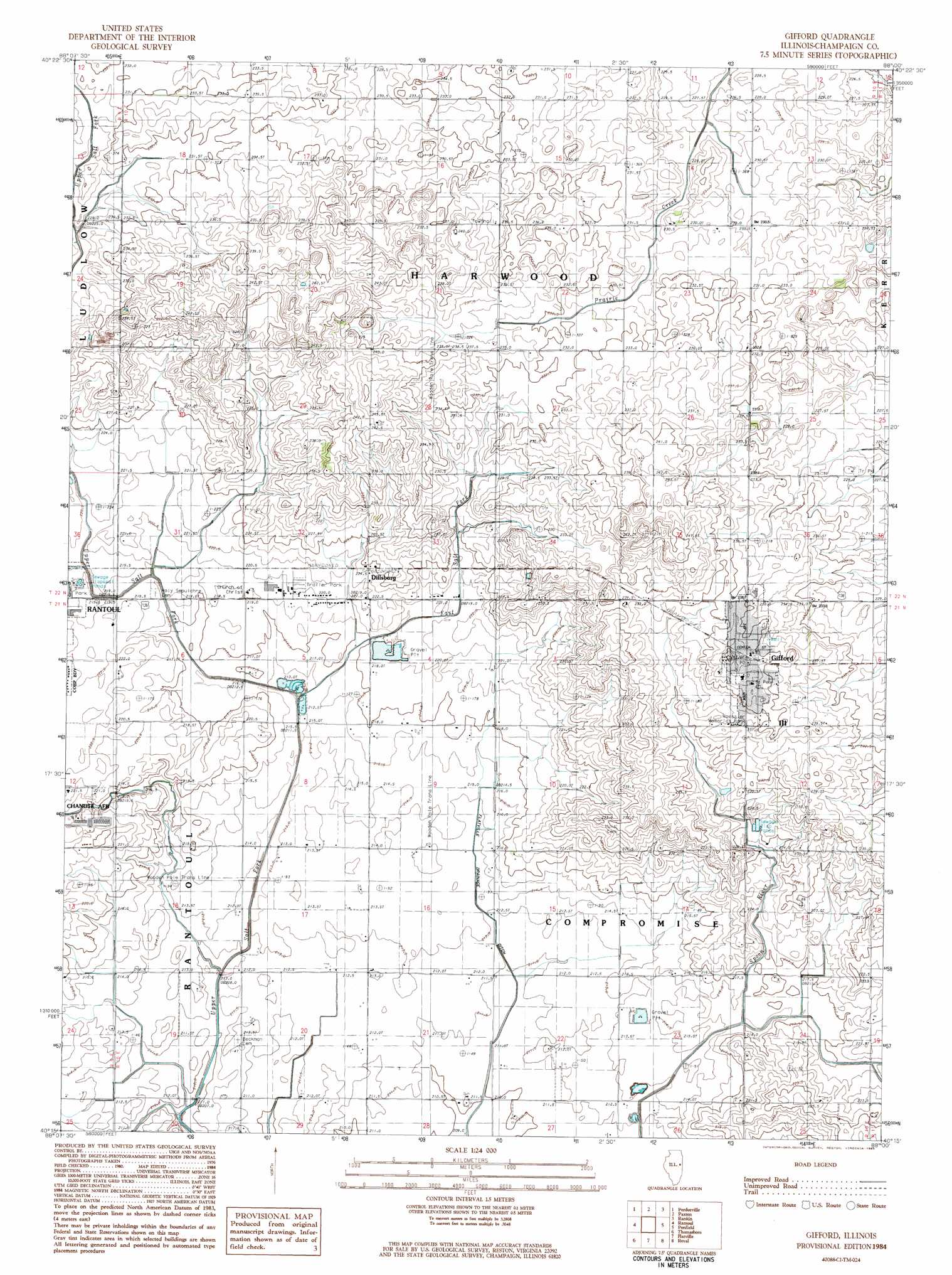
Gifford Topo Map Illinois
To zoom in, hover over the map of Gifford
USGS Topo Quad 40088c1 - 1:24,000 scale
| Topo Map Name: | Gifford |
| USGS Topo Quad ID: | 40088c1 |
| Print Size: | ca. 21 1/4" wide x 27" high |
| Southeast Coordinates: | 40.25° N latitude / 88° W longitude |
| Map Center Coordinates: | 40.3125° N latitude / 88.0625° W longitude |
| U.S. State: | IL |
| Filename: | o40088c1.jpg |
| Download Map JPG Image: | Gifford topo map 1:24,000 scale |
| Map Type: | Topographic |
| Topo Series: | 7.5´ |
| Map Scale: | 1:24,000 |
| Source of Map Images: | United States Geological Survey (USGS) |
| Alternate Map Versions: |
Gifford IL 1984, updated 1985 Download PDF Buy paper map Gifford IL 2012 Download PDF Buy paper map Gifford IL 2015 Download PDF Buy paper map |
1:24,000 Topo Quads surrounding Gifford
Melvin West |
Melvin East |
Buckley |
Cissna Park |
Claytonville |
Gibson City East |
Perdueville |
Paxton |
Rankin |
East Lynn |
Fisher |
Rantoul |
Gifford |
Penfield |
Potomac |
Rising |
Thomasboro |
Flatville |
Royal |
Collison |
Bondville |
Urbana |
Saint Joseph |
Homer |
Oakwood |
> Back to 40088a1 at 1:100,000 scale
> Back to 40088a1 at 1:250,000 scale
> Back to U.S. Topo Maps home
Gifford topo map: Gazetteer
Gifford: Airports
Busboom Airport elevation 238m 780′Gifford: Canals
Flatville Drainage Ditch elevation 210m 688′Gifford: Parks
Roessler Memorial Park elevation 237m 777′Gifford: Populated Places
Dillsburg elevation 224m 734′Gifford elevation 243m 797′
Gifford: Post Offices
Gifford Post Office elevation 244m 800′Gifford digital topo map on disk
Buy this Gifford topo map showing relief, roads, GPS coordinates and other geographical features, as a high-resolution digital map file on DVD:
Northern Illinois, Northern Indiana & Southwestern Michigan
Buy digital topo maps: Northern Illinois, Northern Indiana & Southwestern Michigan