Rantoul Topo Map Illinois
To zoom in, hover over the map of Rantoul
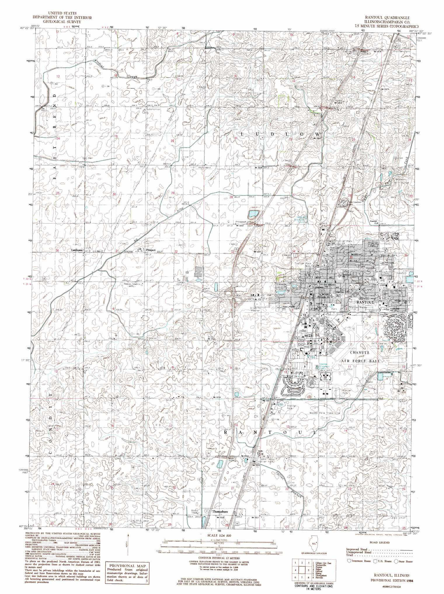
USGS Topo Quad 40088c2 - 1:24,000 scale
| Topo Map Name: | Rantoul |
| USGS Topo Quad ID: | 40088c2 |
| Print Size: | ca. 21 1/4" wide x 27" high |
| Southeast Coordinates: | 40.25° N latitude / 88.125° W longitude |
| Map Center Coordinates: | 40.3125° N latitude / 88.1875° W longitude |
| U.S. State: | IL |
| Filename: | o40088c2.jpg |
| Download Map JPG Image: | Rantoul topo map 1:24,000 scale |
| Map Type: | Topographic |
| Topo Series: | 7.5´ |
| Map Scale: | 1:24,000 |
| Source of Map Images: | United States Geological Survey (USGS) |
| Alternate Map Versions: |
Rantoul IL 1984, updated 1985 Download PDF Buy paper map Rantoul IL 2012 Download PDF Buy paper map Rantoul IL 2015 Download PDF Buy paper map |
1:24,000 Topo Quads surrounding Rantoul
Sibley |
Melvin West |
Melvin East |
Buckley |
Cissna Park |
Gibson City West |
Gibson City East |
Perdueville |
Paxton |
Rankin |
Foosland |
Fisher |
Rantoul |
Gifford |
Penfield |
Mahomet |
Rising |
Thomasboro |
Flatville |
Royal |
Seymour |
Bondville |
Urbana |
Saint Joseph |
Homer |
> Back to 40088a1 at 1:100,000 scale
> Back to 40088a1 at 1:250,000 scale
> Back to U.S. Topo Maps home
Rantoul topo map: Gazetteer
Rantoul: Crossings
Interchange 250 elevation 227m 744′Rantoul: Parks
Brookhill Park elevation 227m 744′Glenwood Park elevation 227m 744′
Hap Parker Pool elevation 226m 741′
Maplewood Sports Complex elevation 227m 744′
Mary Alice Park elevation 229m 751′
North Drive Park elevation 228m 748′
Ryan Park elevation 227m 744′
Wabash Park elevation 226m 741′
Winston Park elevation 221m 725′
Rantoul: Populated Places
Prospect elevation 220m 721′Rantoul elevation 227m 744′
Tomlinson elevation 222m 728′
Rantoul digital topo map on disk
Buy this Rantoul topo map showing relief, roads, GPS coordinates and other geographical features, as a high-resolution digital map file on DVD:
Northern Illinois, Northern Indiana & Southwestern Michigan
Buy digital topo maps: Northern Illinois, Northern Indiana & Southwestern Michigan