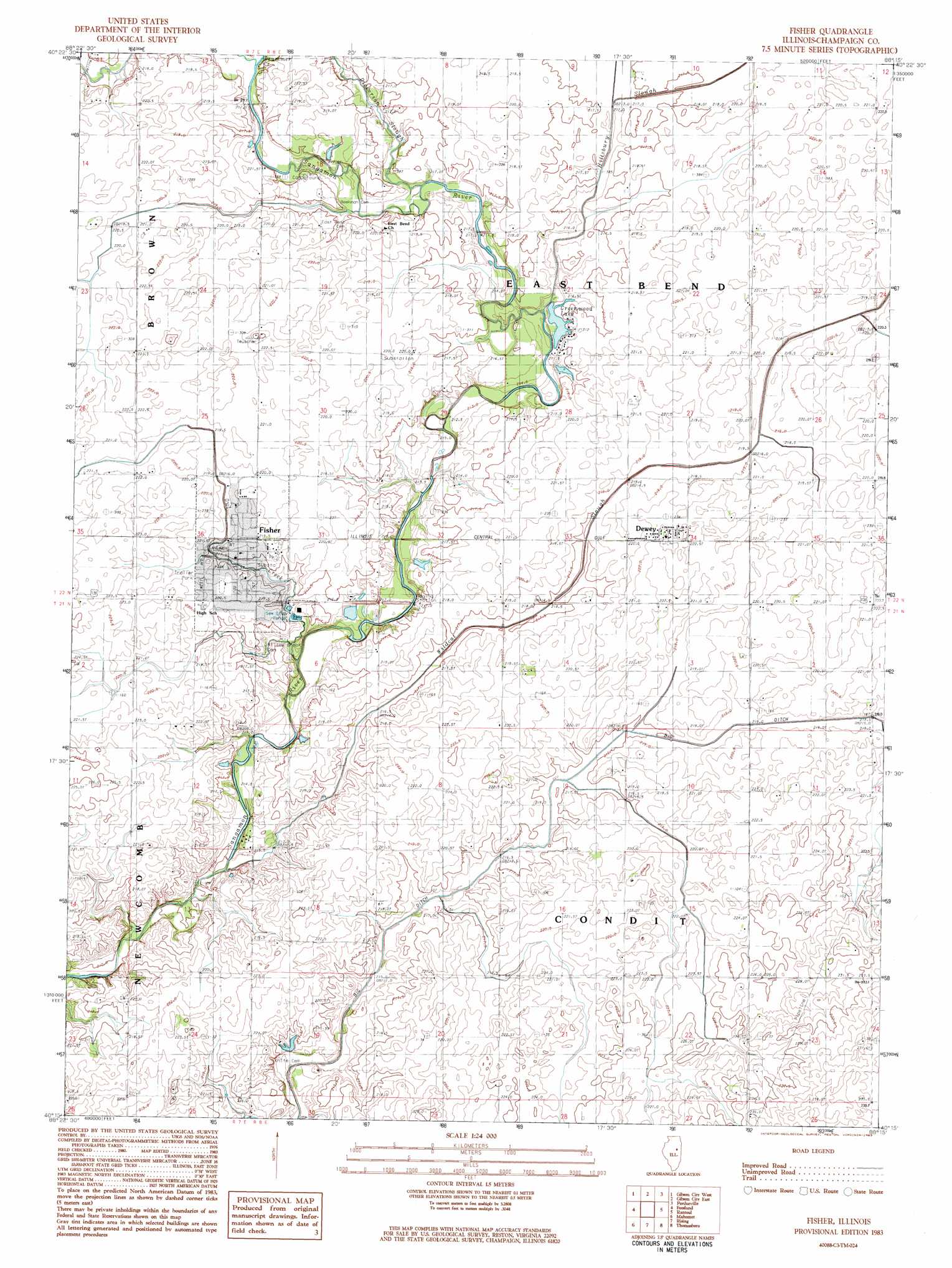
Fisher Topo Map Illinois
To zoom in, hover over the map of Fisher
USGS Topo Quad 40088c3 - 1:24,000 scale
| Topo Map Name: | Fisher |
| USGS Topo Quad ID: | 40088c3 |
| Print Size: | ca. 21 1/4" wide x 27" high |
| Southeast Coordinates: | 40.25° N latitude / 88.25° W longitude |
| Map Center Coordinates: | 40.3125° N latitude / 88.3125° W longitude |
| U.S. State: | IL |
| Filename: | o40088c3.jpg |
| Download Map JPG Image: | Fisher topo map 1:24,000 scale |
| Map Type: | Topographic |
| Topo Series: | 7.5´ |
| Map Scale: | 1:24,000 |
| Source of Map Images: | United States Geological Survey (USGS) |
| Alternate Map Versions: |
Fisher IL 1983, updated 1983 Download PDF Buy paper map Fisher IL 2012 Download PDF Buy paper map Fisher IL 2015 Download PDF Buy paper map |
1:24,000 Topo Quads surrounding Fisher
Colfax |
Sibley |
Melvin West |
Melvin East |
Buckley |
Saybrook |
Gibson City West |
Gibson City East |
Perdueville |
Paxton |
Belleflower |
Foosland |
Fisher |
Rantoul |
Gifford |
Mansfield |
Mahomet |
Rising |
Thomasboro |
Flatville |
Monticello |
Seymour |
Bondville |
Urbana |
Saint Joseph |
> Back to 40088a1 at 1:100,000 scale
> Back to 40088a1 at 1:250,000 scale
> Back to U.S. Topo Maps home
Fisher topo map: Gazetteer
Fisher: Airports
Furtney Airport elevation 221m 725′Fisher: Canals
Big Ditch elevation 214m 702′Fisher: Dams
Greenwood Lake Dam elevation 218m 715′Fisher: Populated Places
Dewey elevation 223m 731′Fisher elevation 217m 711′
Fisher: Post Offices
Dewey Post Office elevation 223m 731′Houstonville Post Office (historical) elevation 220m 721′
Fisher: Reservoirs
Greenwood Lake elevation 215m 705′Greenwood Lake elevation 218m 715′
Fisher: Streams
Dickerson Slough elevation 213m 698′Drummer Creek elevation 215m 705′
Hillsbury Slough elevation 212m 695′
Owl Creek elevation 211m 692′
Wildcat Slough elevation 211m 692′
Fisher digital topo map on disk
Buy this Fisher topo map showing relief, roads, GPS coordinates and other geographical features, as a high-resolution digital map file on DVD:
Northern Illinois, Northern Indiana & Southwestern Michigan
Buy digital topo maps: Northern Illinois, Northern Indiana & Southwestern Michigan