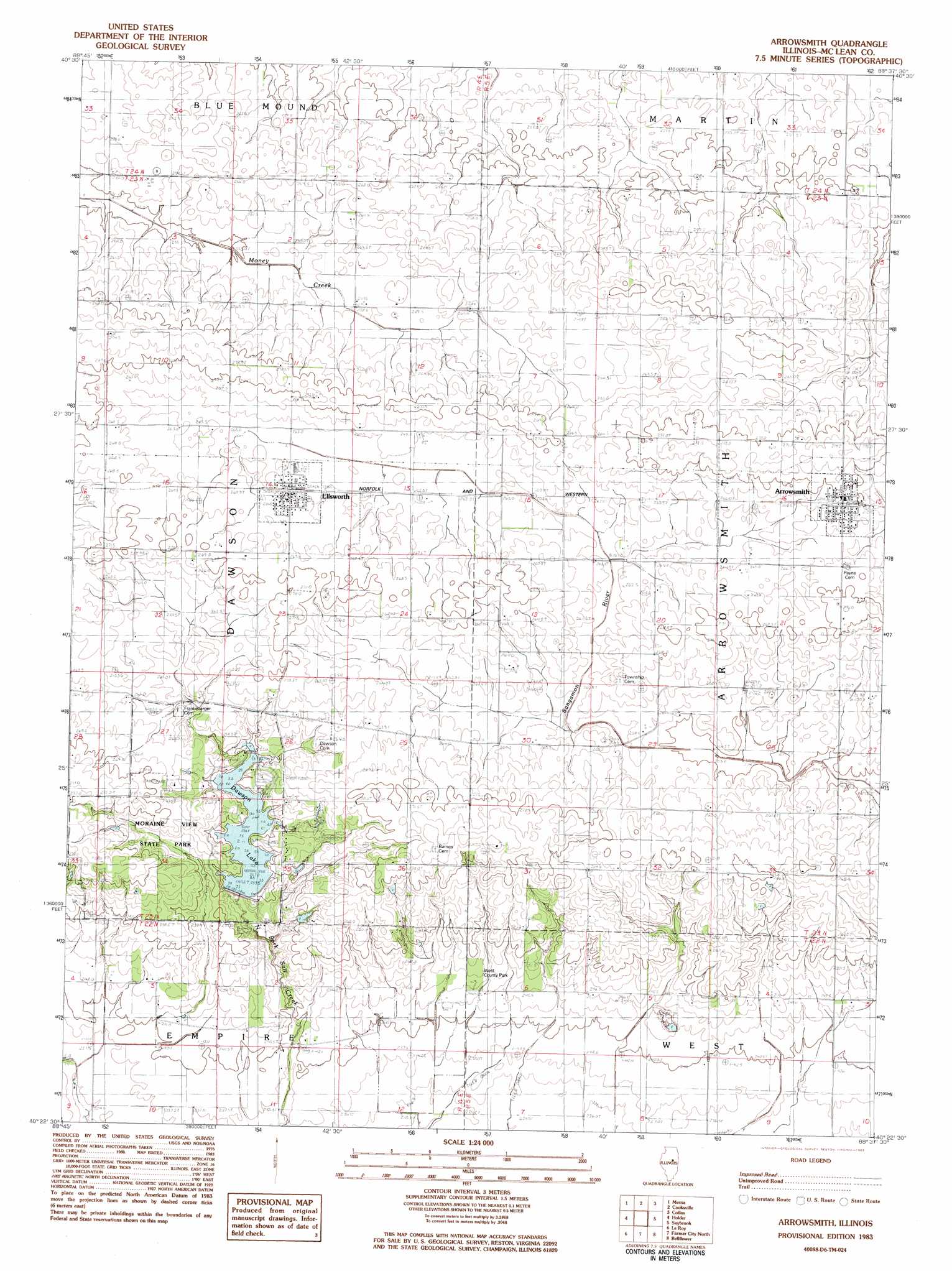
Arrowsmith Topo Map Illinois
To zoom in, hover over the map of Arrowsmith
USGS Topo Quad 40088d6 - 1:24,000 scale
| Topo Map Name: | Arrowsmith |
| USGS Topo Quad ID: | 40088d6 |
| Print Size: | ca. 21 1/4" wide x 27" high |
| Southeast Coordinates: | 40.375° N latitude / 88.625° W longitude |
| Map Center Coordinates: | 40.4375° N latitude / 88.6875° W longitude |
| U.S. State: | IL |
| Filename: | o40088d6.jpg |
| Download Map JPG Image: | Arrowsmith topo map 1:24,000 scale |
| Map Type: | Topographic |
| Topo Series: | 7.5´ |
| Map Scale: | 1:24,000 |
| Source of Map Images: | United States Geological Survey (USGS) |
| Alternate Map Versions: |
Arrowsmith IL 1983, updated 1983 Download PDF Buy paper map Arrowsmith IL 2012 Download PDF Buy paper map Arrowsmith IL 2015 Download PDF Buy paper map |
1:24,000 Topo Quads surrounding Arrowsmith
Gridley |
Lexington |
Chenoa |
Fairbury |
Forrest South |
Normal East |
Merna |
Cooksville |
Colfax |
Sibley |
Bloomington East |
Holder |
Arrowsmith |
Saybrook |
Gibson City West |
Heyworth |
Le Roy |
Farmer City North |
Belleflower |
Foosland |
Clinton |
De Witt |
Farmer City South |
Mansfield |
Mahomet |
> Back to 40088a1 at 1:100,000 scale
> Back to 40088a1 at 1:250,000 scale
> Back to U.S. Topo Maps home
Arrowsmith topo map: Gazetteer
Arrowsmith: Dams
Moraine View Dam elevation 253m 830′Arrowsmith: Parks
Moraine View State Park elevation 267m 875′West County Park elevation 249m 816′
Arrowsmith: Populated Places
Arrowsmith elevation 269m 882′Ellsworth elevation 264m 866′
Arrowsmith: Reservoirs
Dawson Lake elevation 254m 833′Dawson Lake elevation 253m 830′
Arrowsmith digital topo map on disk
Buy this Arrowsmith topo map showing relief, roads, GPS coordinates and other geographical features, as a high-resolution digital map file on DVD:
Northern Illinois, Northern Indiana & Southwestern Michigan
Buy digital topo maps: Northern Illinois, Northern Indiana & Southwestern Michigan