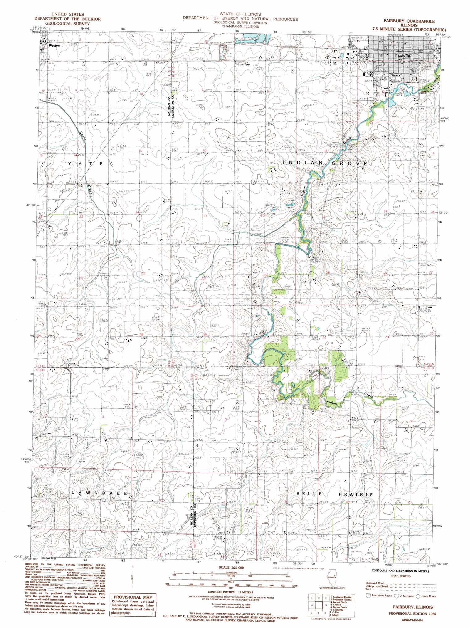
Fairbury Topo Map Illinois
To zoom in, hover over the map of Fairbury
USGS Topo Quad 40088f5 - 1:24,000 scale
| Topo Map Name: | Fairbury |
| USGS Topo Quad ID: | 40088f5 |
| Print Size: | ca. 21 1/4" wide x 27" high |
| Southeast Coordinates: | 40.625° N latitude / 88.5° W longitude |
| Map Center Coordinates: | 40.6875° N latitude / 88.5625° W longitude |
| U.S. State: | IL |
| Filename: | o40088f5.jpg |
| Download Map JPG Image: | Fairbury topo map 1:24,000 scale |
| Map Type: | Topographic |
| Topo Series: | 7.5´ |
| Map Scale: | 1:24,000 |
| Source of Map Images: | United States Geological Survey (USGS) |
| Alternate Map Versions: |
Fairbury IL 1986, updated 1986 Download PDF Buy paper map Fairbury IL 2001, updated 2003 Download PDF Buy paper map Fairbury IL 2012 Download PDF Buy paper map Fairbury IL 2015 Download PDF Buy paper map |
1:24,000 Topo Quads surrounding Fairbury
Flanagan North |
Northwest Pontiac |
Northeast Pontiac |
Saunemin |
Cullom |
Flanagan South |
Southwest Pontiac |
Southeast Pontiac |
Forrest North |
Chatsworth North |
Lexington |
Chenoa |
Fairbury |
Forrest South |
Chatsworth South |
Merna |
Cooksville |
Colfax |
Sibley |
Melvin West |
Holder |
Arrowsmith |
Saybrook |
Gibson City West |
Gibson City East |
> Back to 40088e1 at 1:100,000 scale
> Back to 40088a1 at 1:250,000 scale
> Back to U.S. Topo Maps home
Fairbury topo map: Gazetteer
Fairbury: Airports
Fairbury Hospital Emergency Heliport elevation 205m 672′Fairbury: Dams
Hifer Lake Dam elevation 228m 748′Fairbury: Parks
Livingston Square elevation 208m 682′Weston Cemetery Prairie Nature Preserve elevation 213m 698′
Fairbury: Populated Places
Fairbury elevation 209m 685′Weston elevation 214m 702′
Fairbury: Post Offices
Fairbury Post Office elevation 209m 685′Weston Post Office (historical) elevation 215m 705′
Fairbury: Reservoirs
Hifer Lake elevation 228m 748′Fairbury digital topo map on disk
Buy this Fairbury topo map showing relief, roads, GPS coordinates and other geographical features, as a high-resolution digital map file on DVD:
Northern Illinois, Northern Indiana & Southwestern Michigan
Buy digital topo maps: Northern Illinois, Northern Indiana & Southwestern Michigan