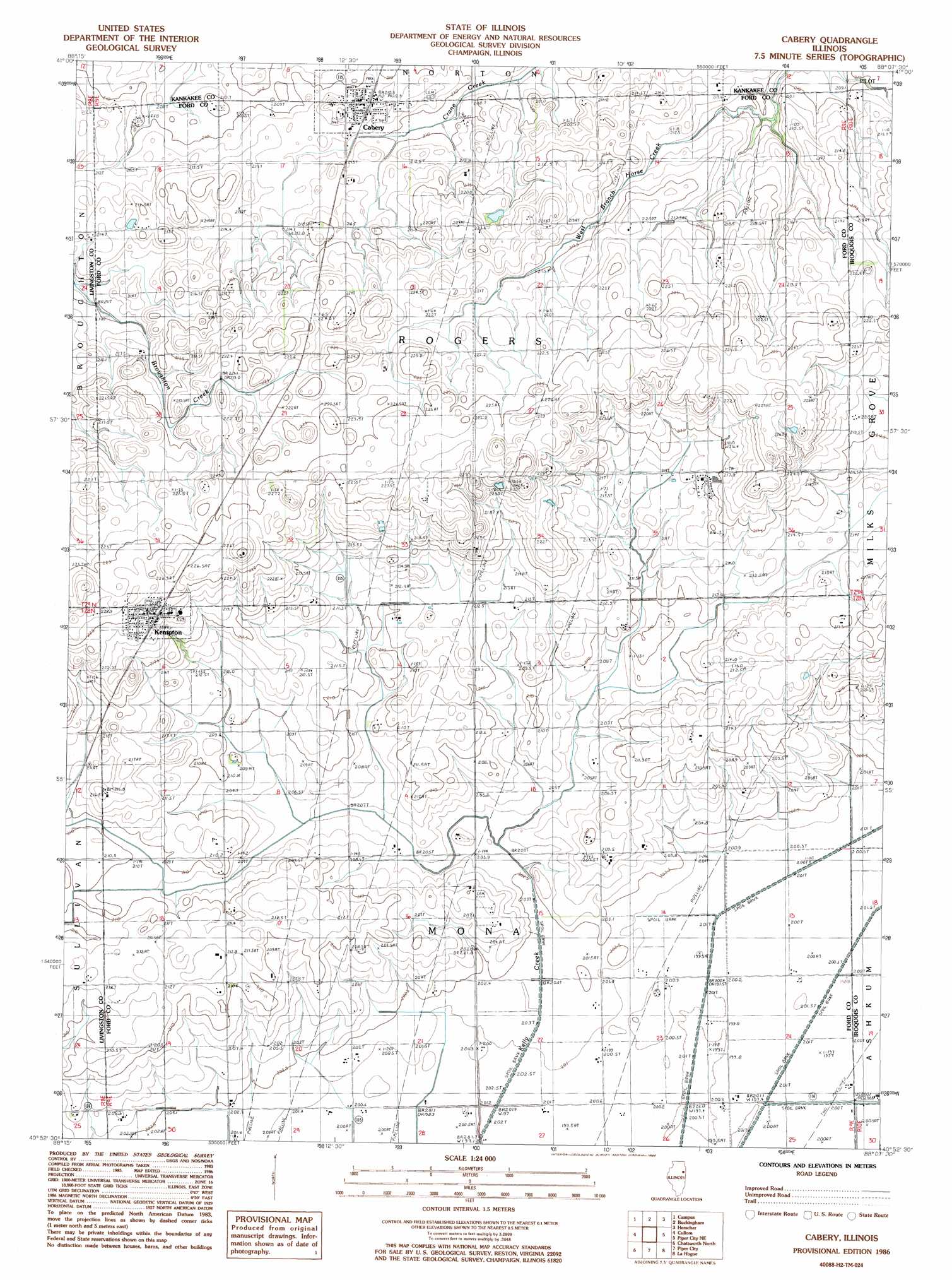
Cabery Topo Map Illinois
To zoom in, hover over the map of Cabery
USGS Topo Quad 40088h2 - 1:24,000 scale
| Topo Map Name: | Cabery |
| USGS Topo Quad ID: | 40088h2 |
| Print Size: | ca. 21 1/4" wide x 27" high |
| Southeast Coordinates: | 40.875° N latitude / 88.125° W longitude |
| Map Center Coordinates: | 40.9375° N latitude / 88.1875° W longitude |
| U.S. State: | IL |
| Filename: | o40088h2.jpg |
| Download Map JPG Image: | Cabery topo map 1:24,000 scale |
| Map Type: | Topographic |
| Topo Series: | 7.5´ |
| Map Scale: | 1:24,000 |
| Source of Map Images: | United States Geological Survey (USGS) |
| Alternate Map Versions: |
Cabery IL 1986, updated 1986 Download PDF Buy paper map Cabery IL 1998, updated 2003 Download PDF Buy paper map Cabery IL 2012 Download PDF Buy paper map Cabery IL 2015 Download PDF Buy paper map |
1:24,000 Topo Quads surrounding Cabery
Mazon |
Gardner |
Essex |
Bonfield |
Bourbonnais |
Dwight |
Campus |
Buckingham |
Herscher |
West Kankakee |
Saunemin |
Cullom |
Cabery |
Piper City Ne |
Clifton |
Forrest North |
Chatsworth North |
Piper City |
La Hogue |
Gilman |
Forrest South |
Chatsworth South |
Buckley Nw |
Onarga West |
Onarga East |
> Back to 40088e1 at 1:100,000 scale
> Back to 40088a1 at 1:250,000 scale
> Back to U.S. Topo Maps home
Cabery topo map: Gazetteer
Cabery: Populated Places
Cabery elevation 212m 695′Kempton elevation 223m 731′
Stelle elevation 214m 702′
Cabery: Post Offices
Cabery Post Office elevation 213m 698′Eldredgeville Post Office (historical) elevation 214m 702′
Sugar Loaf Post Office (historical) elevation 208m 682′
Cabery digital topo map on disk
Buy this Cabery topo map showing relief, roads, GPS coordinates and other geographical features, as a high-resolution digital map file on DVD:
Northern Illinois, Northern Indiana & Southwestern Michigan
Buy digital topo maps: Northern Illinois, Northern Indiana & Southwestern Michigan