Saunemin Topo Map Illinois
To zoom in, hover over the map of Saunemin
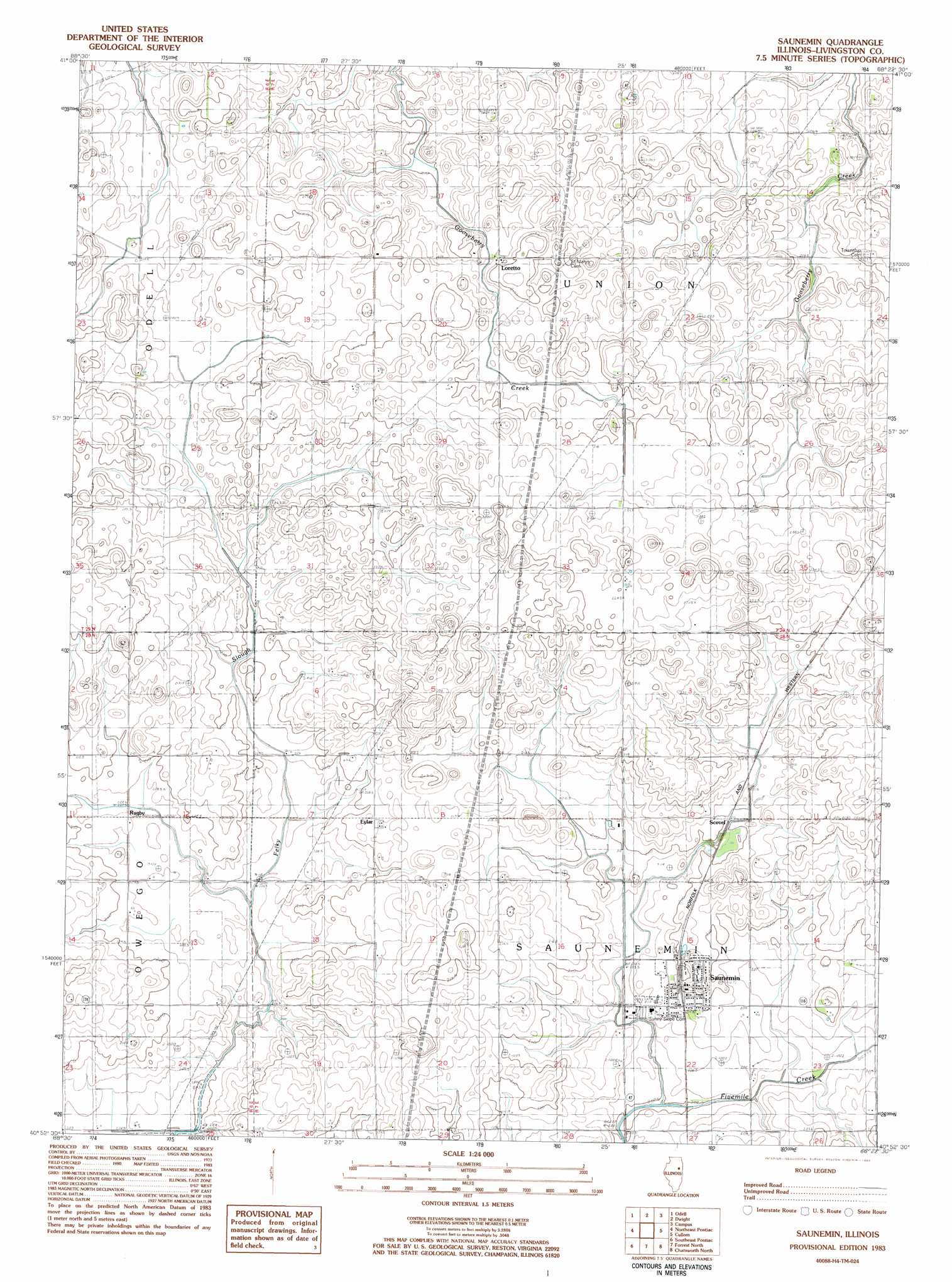
USGS Topo Quad 40088h4 - 1:24,000 scale
| Topo Map Name: | Saunemin |
| USGS Topo Quad ID: | 40088h4 |
| Print Size: | ca. 21 1/4" wide x 27" high |
| Southeast Coordinates: | 40.875° N latitude / 88.375° W longitude |
| Map Center Coordinates: | 40.9375° N latitude / 88.4375° W longitude |
| U.S. State: | IL |
| Filename: | o40088h4.jpg |
| Download Map JPG Image: | Saunemin topo map 1:24,000 scale |
| Map Type: | Topographic |
| Topo Series: | 7.5´ |
| Map Scale: | 1:24,000 |
| Source of Map Images: | United States Geological Survey (USGS) |
| Alternate Map Versions: |
Saunemin IL 1983, updated 1983 Download PDF Buy paper map Saunemin IL 1998, updated 2003 Download PDF Buy paper map Saunemin IL 2012 Download PDF Buy paper map Saunemin IL 2015 Download PDF Buy paper map |
1:24,000 Topo Quads surrounding Saunemin
Ransom |
Kinsman |
Mazon |
Gardner |
Essex |
Blackstone |
Odell |
Dwight |
Campus |
Buckingham |
Northwest Pontiac |
Northeast Pontiac |
Saunemin |
Cullom |
Cabery |
Southwest Pontiac |
Southeast Pontiac |
Forrest North |
Chatsworth North |
Piper City |
Chenoa |
Fairbury |
Forrest South |
Chatsworth South |
Buckley Nw |
> Back to 40088e1 at 1:100,000 scale
> Back to 40088a1 at 1:250,000 scale
> Back to U.S. Topo Maps home
Saunemin digital topo map on disk
Buy this Saunemin topo map showing relief, roads, GPS coordinates and other geographical features, as a high-resolution digital map file on DVD:
Northern Illinois, Northern Indiana & Southwestern Michigan
Buy digital topo maps: Northern Illinois, Northern Indiana & Southwestern Michigan