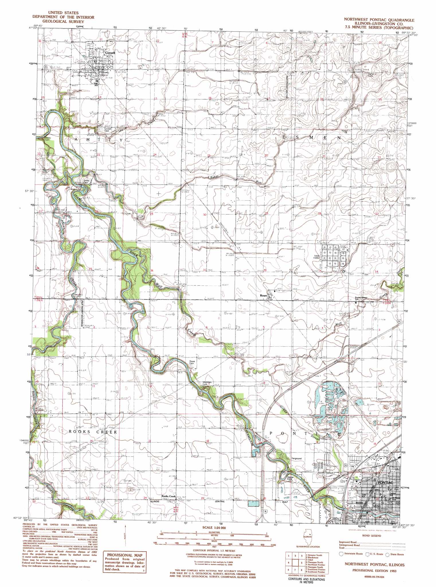
Northwest Pontiac Topo Map Illinois
To zoom in, hover over the map of Northwest Pontiac
USGS Topo Quad 40088h6 - 1:24,000 scale
| Topo Map Name: | Northwest Pontiac |
| USGS Topo Quad ID: | 40088h6 |
| Print Size: | ca. 21 1/4" wide x 27" high |
| Southeast Coordinates: | 40.875° N latitude / 88.625° W longitude |
| Map Center Coordinates: | 40.9375° N latitude / 88.6875° W longitude |
| U.S. State: | IL |
| Filename: | o40088h6.jpg |
| Download Map JPG Image: | Northwest Pontiac topo map 1:24,000 scale |
| Map Type: | Topographic |
| Topo Series: | 7.5´ |
| Map Scale: | 1:24,000 |
| Source of Map Images: | United States Geological Survey (USGS) |
| Alternate Map Versions: |
Northwest Pontiac IL 1983, updated 1983 Download PDF Buy paper map Northwest Pontiac IL 1998, updated 2003 Download PDF Buy paper map Northwest Pontiac IL 2012 Download PDF Buy paper map Northwest Pontiac IL 2015 Download PDF Buy paper map |
1:24,000 Topo Quads surrounding Northwest Pontiac
Leonore |
Streator North |
Ransom |
Kinsman |
Mazon |
Long Point |
Streator South |
Blackstone |
Odell |
Dwight |
Dana |
Flanagan North |
Northwest Pontiac |
Northeast Pontiac |
Saunemin |
Flanagan Sw |
Flanagan South |
Southwest Pontiac |
Southeast Pontiac |
Forrest North |
Gridley |
Lexington |
Chenoa |
Fairbury |
Forrest South |
> Back to 40088e1 at 1:100,000 scale
> Back to 40088a1 at 1:250,000 scale
> Back to U.S. Topo Maps home
Northwest Pontiac topo map: Gazetteer
Northwest Pontiac: Airports
Pennington Landing Strip elevation 192m 629′Pulliam Airport elevation 203m 666′
Northwest Pontiac: Crossings
Interchange 201 elevation 200m 656′Northwest Pontiac: Islands
Heisner Island elevation 187m 613′Northwest Pontiac: Mines
I-55 Quarry Number 311 elevation 197m 646′North Quarry elevation 196m 643′
Northwest Pontiac: Parks
Fell Park elevation 195m 639′North Park elevation 192m 629′
South Park elevation 191m 626′
Northwest Pontiac: Populated Places
Cornell elevation 192m 629′Pontiac elevation 196m 643′
Rooks Creek elevation 198m 649′
Rowe elevation 195m 639′
Northwest Pontiac: Post Offices
Pontiac Post Office elevation 196m 643′Northwest Pontiac: Streams
Baker Run elevation 181m 593′Deer Creek elevation 197m 646′
Ida Creek elevation 182m 597′
North Creek elevation 187m 613′
Rooks Creek elevation 191m 626′
Rooks Creek elevation 182m 597′
The Slough elevation 192m 629′
Turtle Creek elevation 192m 629′
Wolf Creek elevation 185m 606′
Northwest Pontiac digital topo map on disk
Buy this Northwest Pontiac topo map showing relief, roads, GPS coordinates and other geographical features, as a high-resolution digital map file on DVD:
Northern Illinois, Northern Indiana & Southwestern Michigan
Buy digital topo maps: Northern Illinois, Northern Indiana & Southwestern Michigan