Mason City Topo Map Illinois
To zoom in, hover over the map of Mason City
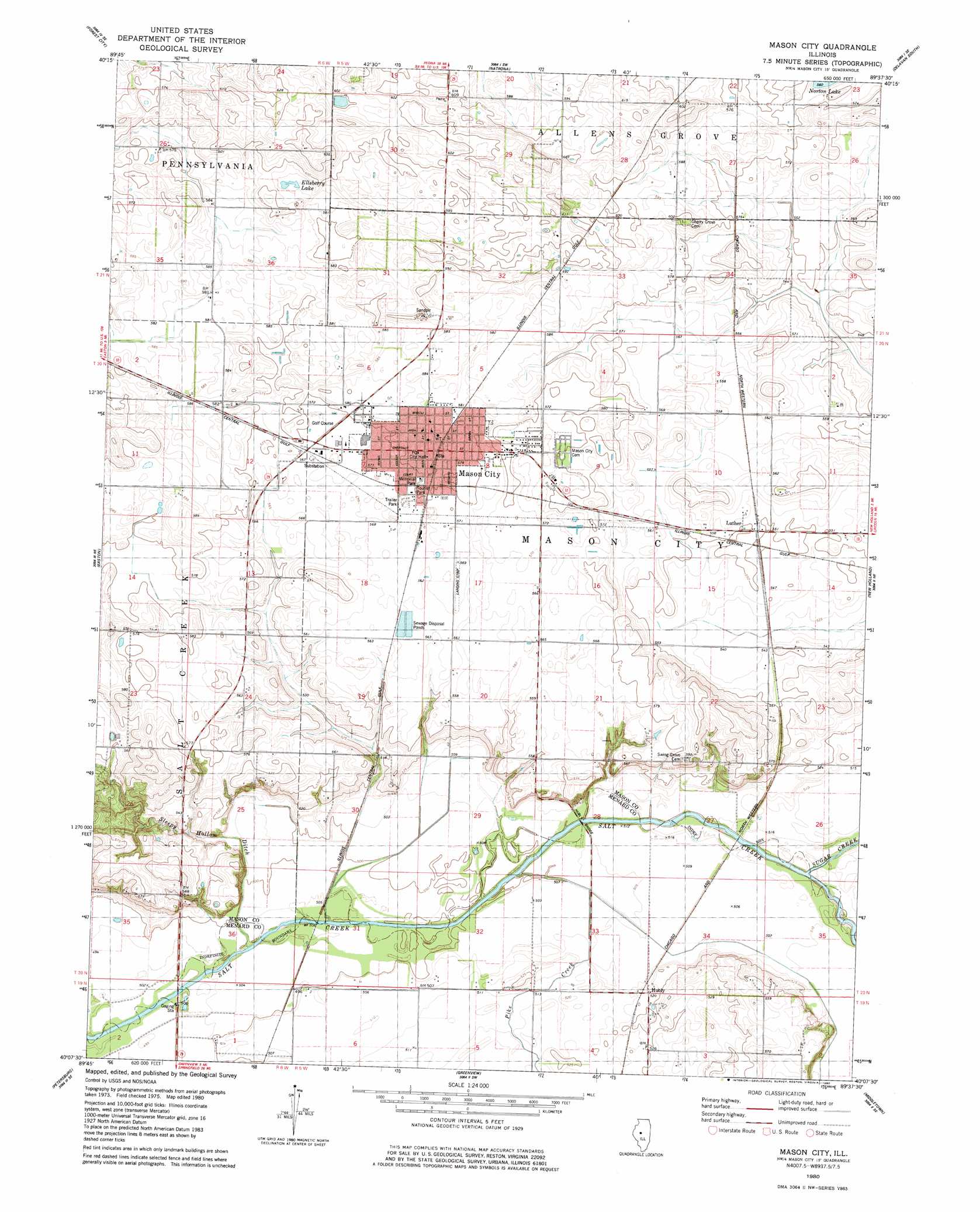
USGS Topo Quad 40089b6 - 1:24,000 scale
| Topo Map Name: | Mason City |
| USGS Topo Quad ID: | 40089b6 |
| Print Size: | ca. 21 1/4" wide x 27" high |
| Southeast Coordinates: | 40.125° N latitude / 89.625° W longitude |
| Map Center Coordinates: | 40.1875° N latitude / 89.6875° W longitude |
| U.S. State: | IL |
| Filename: | o40089b6.jpg |
| Download Map JPG Image: | Mason City topo map 1:24,000 scale |
| Map Type: | Topographic |
| Topo Series: | 7.5´ |
| Map Scale: | 1:24,000 |
| Source of Map Images: | United States Geological Survey (USGS) |
| Alternate Map Versions: |
Mason City IL 1980, updated 1980 Download PDF Buy paper map Mason City IL 2012 Download PDF Buy paper map Mason City IL 2015 Download PDF Buy paper map |
1:24,000 Topo Quads surrounding Mason City
Duck Island |
Manito |
South Pekin |
Delavan North |
Hopedale |
Topeka |
Forest City |
Natrona |
Delavan South |
Emden |
Biggs |
Easton |
Mason City |
New Holland |
Lincoln West |
Oakford |
Petersburg |
Greenview |
Middleton |
Broadwell |
Tallula |
Salisbury |
Athens |
Williamsville |
Cornland |
> Back to 40089a1 at 1:100,000 scale
> Back to 40088a1 at 1:250,000 scale
> Back to U.S. Topo Maps home
Mason City topo map: Gazetteer
Mason City: Bridges
Hubly Bridge elevation 150m 492′Mason City: Lakes
Ellsberry Lake elevation 180m 590′Mason City: Parks
Memorial Park elevation 175m 574′Tourist Park elevation 175m 574′
Mason City: Populated Places
Hubly elevation 158m 518′Luther elevation 169m 554′
Mason City elevation 177m 580′
Mason City: Post Offices
Mason City Post Office elevation 176m 577′Mason City: Streams
Pike Creek elevation 150m 492′Sleepy Hollow Ditch elevation 150m 492′
Sugar Creek elevation 152m 498′
Mason City digital topo map on disk
Buy this Mason City topo map showing relief, roads, GPS coordinates and other geographical features, as a high-resolution digital map file on DVD:
Northern Illinois, Northern Indiana & Southwestern Michigan
Buy digital topo maps: Northern Illinois, Northern Indiana & Southwestern Michigan