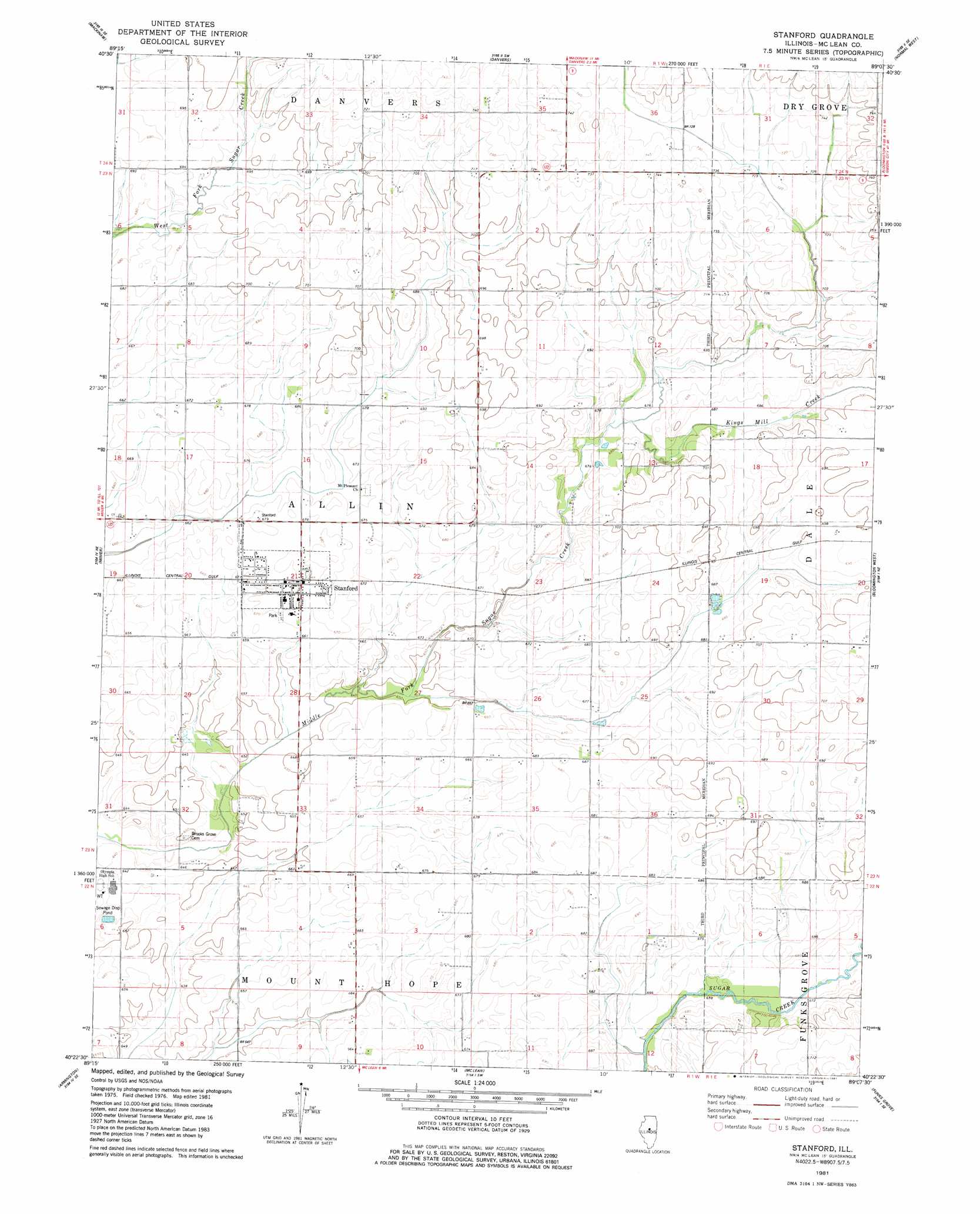
Stanford Topo Map Illinois
To zoom in, hover over the map of Stanford
USGS Topo Quad 40089d2 - 1:24,000 scale
| Topo Map Name: | Stanford |
| USGS Topo Quad ID: | 40089d2 |
| Print Size: | ca. 21 1/4" wide x 27" high |
| Southeast Coordinates: | 40.375° N latitude / 89.125° W longitude |
| Map Center Coordinates: | 40.4375° N latitude / 89.1875° W longitude |
| U.S. State: | IL |
| Filename: | o40089d2.jpg |
| Download Map JPG Image: | Stanford topo map 1:24,000 scale |
| Map Type: | Topographic |
| Topo Series: | 7.5´ |
| Map Scale: | 1:24,000 |
| Source of Map Images: | United States Geological Survey (USGS) |
| Alternate Map Versions: |
Stanford IL 1981, updated 1981 Download PDF Buy paper map Stanford IL 2012 Download PDF Buy paper map Stanford IL 2015 Download PDF Buy paper map |
1:24,000 Topo Quads surrounding Stanford
Washington |
Eureka |
Secor |
El Paso |
Gridley |
Morton |
Mackinaw |
Danvers |
Normal West |
Normal East |
Hopedale |
Minier |
Stanford |
Bloomington West |
Bloomington East |
Emden |
Armington |
Mclean |
Funks Grove |
Heyworth |
Lincoln West |
Lincoln East |
Waynesville West |
Waynesville East |
Clinton |
> Back to 40089a1 at 1:100,000 scale
> Back to 40088a1 at 1:250,000 scale
> Back to U.S. Topo Maps home
Stanford topo map: Gazetteer
Stanford: Populated Places
Stanford elevation 207m 679′Stanford: Streams
Kings Mill Creek elevation 205m 672′Stanford digital topo map on disk
Buy this Stanford topo map showing relief, roads, GPS coordinates and other geographical features, as a high-resolution digital map file on DVD:
Northern Illinois, Northern Indiana & Southwestern Michigan
Buy digital topo maps: Northern Illinois, Northern Indiana & Southwestern Michigan