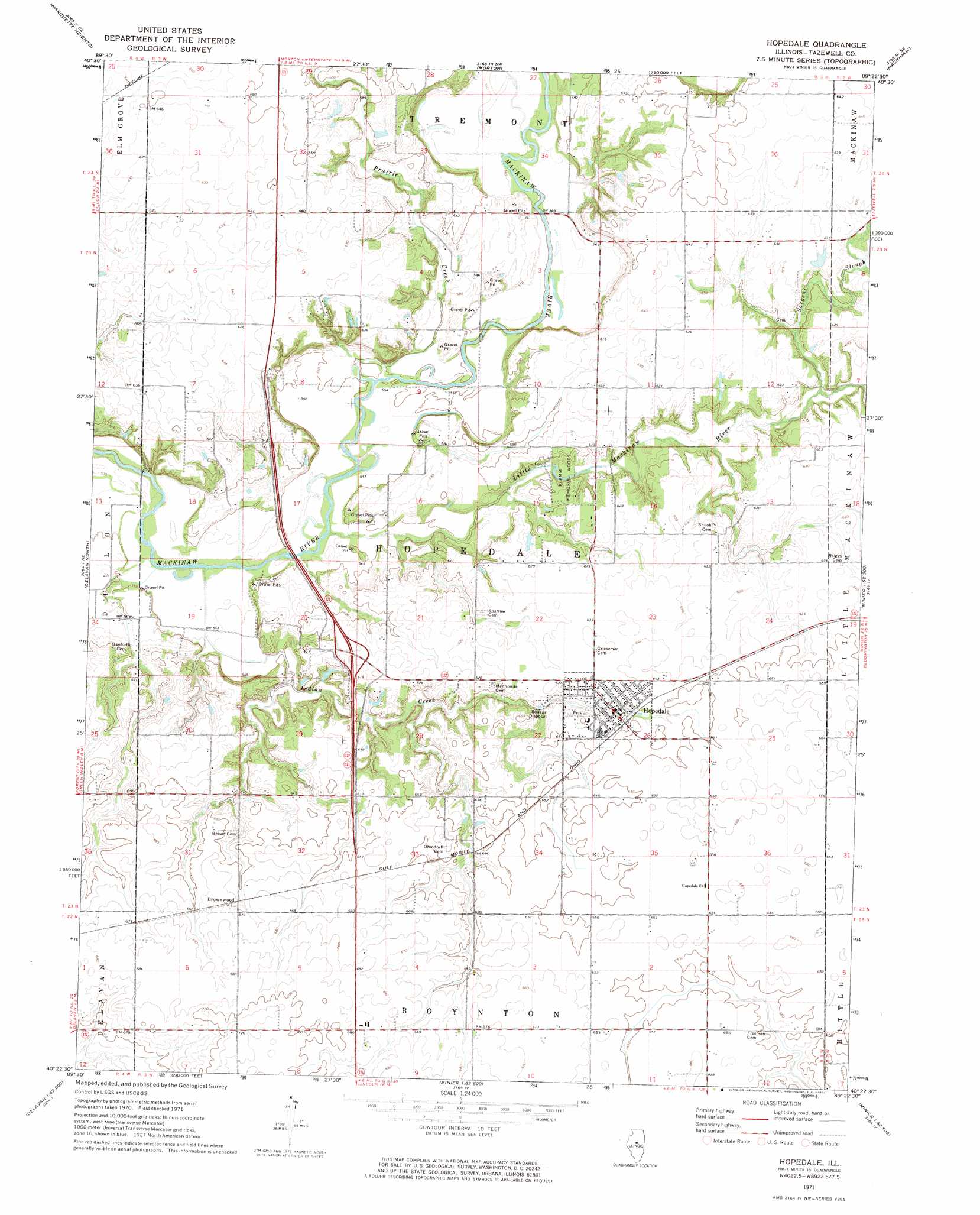
Hopedale Topo Map Illinois
To zoom in, hover over the map of Hopedale
USGS Topo Quad 40089d4 - 1:24,000 scale
| Topo Map Name: | Hopedale |
| USGS Topo Quad ID: | 40089d4 |
| Print Size: | ca. 21 1/4" wide x 27" high |
| Southeast Coordinates: | 40.375° N latitude / 89.375° W longitude |
| Map Center Coordinates: | 40.4375° N latitude / 89.4375° W longitude |
| U.S. State: | IL |
| Filename: | o40089d4.jpg |
| Download Map JPG Image: | Hopedale topo map 1:24,000 scale |
| Map Type: | Topographic |
| Topo Series: | 7.5´ |
| Map Scale: | 1:24,000 |
| Source of Map Images: | United States Geological Survey (USGS) |
| Alternate Map Versions: |
Hopedale IL 1971, updated 1973 Download PDF Buy paper map Hopedale IL 1995, updated 1996 Download PDF Buy paper map Hopedale IL 2012 Download PDF Buy paper map Hopedale IL 2015 Download PDF Buy paper map |
1:24,000 Topo Quads surrounding Hopedale
Peoria West |
Peoria East |
Washington |
Eureka |
Secor |
Pekin |
Marquette Heights |
Morton |
Mackinaw |
Danvers |
South Pekin |
Delavan North |
Hopedale |
Minier |
Stanford |
Natrona |
Delavan South |
Emden |
Armington |
Mclean |
Mason City |
New Holland |
Lincoln West |
Lincoln East |
Waynesville West |
> Back to 40089a1 at 1:100,000 scale
> Back to 40088a1 at 1:250,000 scale
> Back to U.S. Topo Maps home
Hopedale topo map: Gazetteer
Hopedale: Crossings
Interchange 19 elevation 187m 613′Hopedale: Populated Places
Brownwood elevation 203m 666′Hopedale elevation 196m 643′
Hopedale: Streams
Indian Creek elevation 161m 528′Little Mackinaw River elevation 165m 541′
Prairie Creek elevation 168m 551′
Sargent Slough elevation 177m 580′
Hopedale: Woods
Klemm Memorial Woods elevation 171m 561′Hopedale digital topo map on disk
Buy this Hopedale topo map showing relief, roads, GPS coordinates and other geographical features, as a high-resolution digital map file on DVD:
Northern Illinois, Northern Indiana & Southwestern Michigan
Buy digital topo maps: Northern Illinois, Northern Indiana & Southwestern Michigan