Danvers Topo Map Illinois
To zoom in, hover over the map of Danvers
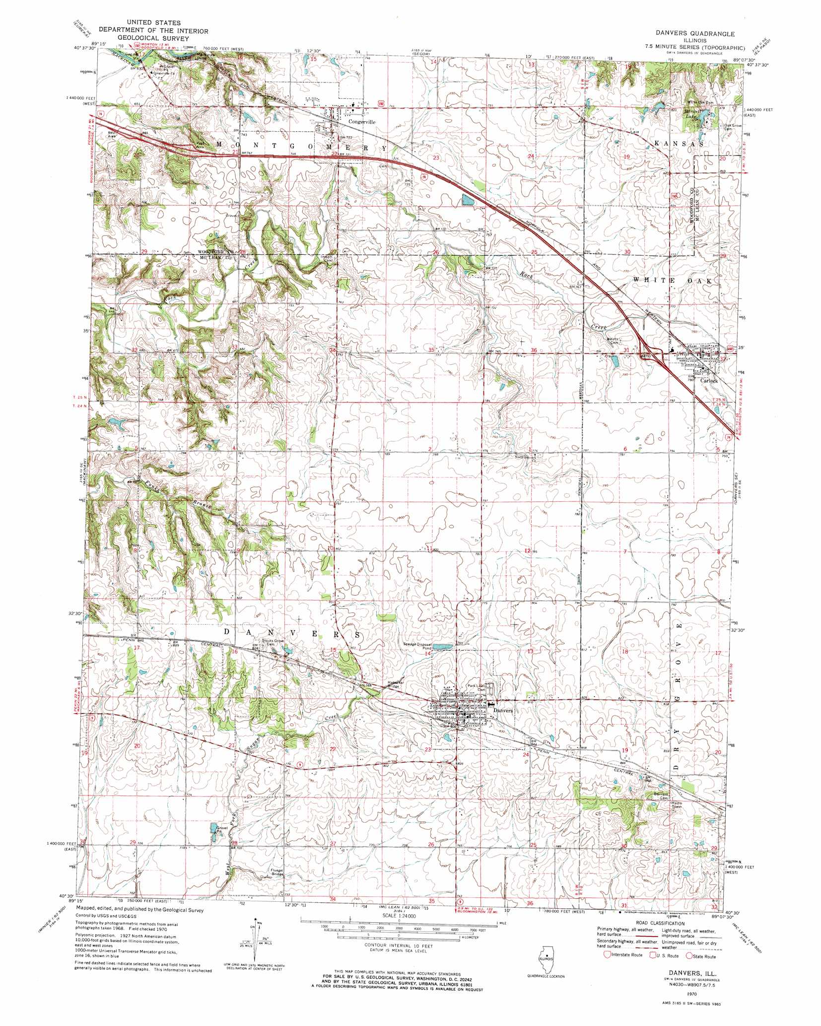
USGS Topo Quad 40089e2 - 1:24,000 scale
| Topo Map Name: | Danvers |
| USGS Topo Quad ID: | 40089e2 |
| Print Size: | ca. 21 1/4" wide x 27" high |
| Southeast Coordinates: | 40.5° N latitude / 89.125° W longitude |
| Map Center Coordinates: | 40.5625° N latitude / 89.1875° W longitude |
| U.S. State: | IL |
| Filename: | o40089e2.jpg |
| Download Map JPG Image: | Danvers topo map 1:24,000 scale |
| Map Type: | Topographic |
| Topo Series: | 7.5´ |
| Map Scale: | 1:24,000 |
| Source of Map Images: | United States Geological Survey (USGS) |
| Alternate Map Versions: |
Danvers IL 1970, updated 1972 Download PDF Buy paper map Danvers IL 2012 Download PDF Buy paper map Danvers IL 2015 Download PDF Buy paper map |
1:24,000 Topo Quads surrounding Danvers
Germantown Hills |
Metamora |
Roanoke |
Benson |
Flanagan Sw |
Washington |
Eureka |
Secor |
El Paso |
Gridley |
Morton |
Mackinaw |
Danvers |
Normal West |
Normal East |
Hopedale |
Minier |
Stanford |
Bloomington West |
Bloomington East |
Emden |
Armington |
Mclean |
Funks Grove |
Heyworth |
> Back to 40089e1 at 1:100,000 scale
> Back to 40088a1 at 1:250,000 scale
> Back to U.S. Topo Maps home
Danvers topo map: Gazetteer
Danvers: Bridges
Fluegel Bridge elevation 216m 708′Habecker Bridge elevation 229m 751′
Danvers: Crossings
Interchange 120 elevation 237m 777′Danvers: Dams
Barwell Lake Dam elevation 244m 800′Cross Lake Dam elevation 222m 728′
Sears Lake Dam elevation 232m 761′
Danvers: Populated Places
Carlock elevation 235m 770′Congerville elevation 227m 744′
Danvers elevation 248m 813′
Farmsville (historical) elevation 195m 639′
Mackinaw Dells elevation 211m 692′
Woodruff elevation 257m 843′
Danvers: Reservoirs
Barwell Lake elevation 244m 800′Cross Lake elevation 222m 728′
Sears Lake elevation 232m 761′
Danvers digital topo map on disk
Buy this Danvers topo map showing relief, roads, GPS coordinates and other geographical features, as a high-resolution digital map file on DVD:
Northern Illinois, Northern Indiana & Southwestern Michigan
Buy digital topo maps: Northern Illinois, Northern Indiana & Southwestern Michigan