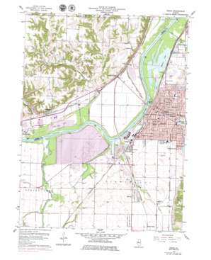
Pekin Topo Map Illinois
To zoom in, hover over the map of Pekin
USGS Topo Quad 40089e6 - 1:24,000 scale
| Topo Map Name: | Pekin |
| USGS Topo Quad ID: | 40089e6 |
| Print Size: | ca. 21 1/4" wide x 27" high |
| Southeast Coordinates: | 40.5° N latitude / 89.625° W longitude |
| Map Center Coordinates: | 40.5625° N latitude / 89.6875° W longitude |
| U.S. State: | IL |
| Filename: | o40089e6.jpg |
| Download Map JPG Image: | Pekin topo map 1:24,000 scale |
| Map Type: | Topographic |
| Topo Series: | 7.5´ |
| Map Scale: | 1:24,000 |
| Source of Map Images: | United States Geological Survey (USGS) |
| Alternate Map Versions: |
Pekin IL 1960, updated 1961 Download PDF Buy paper map Pekin IL 1960, updated 1968 Download PDF Buy paper map Pekin IL 1960, updated 1979 Download PDF Buy paper map Pekin IL 1996, updated 1997 Download PDF Buy paper map Pekin IL 2012 Download PDF Buy paper map Pekin IL 2015 Download PDF Buy paper map |
1:24,000 Topo Quads surrounding Pekin
> Back to 40089e1 at 1:100,000 scale
> Back to 40088a1 at 1:250,000 scale
> Back to U.S. Topo Maps home
Pekin topo map: Gazetteer
Pekin: Airports
Pekin Memorial Hospital Heliport elevation 164m 538′Pekin: Dams
Hollis Park Dam elevation 173m 567′Powerton Cooling Lake Dam elevation 137m 449′
Pekin: Islands
Coopers Island elevation 137m 449′Pekin: Lakes
Dead Lake (historical) elevation 137m 449′Pekin Lake elevation 135m 442′
Pond Lily Lake elevation 135m 442′
Pekin: Parks
Blinkiron Park elevation 154m 505′James Park elevation 154m 505′
Mineral Springs Park elevation 165m 541′
Pekin Lake Conservation Area elevation 135m 442′
Powerton Fish and Wildlife Area elevation 137m 449′
Willow Park elevation 145m 475′
Pekin: Populated Places
Crescent elevation 145m 475′Grove elevation 140m 459′
Hawley (historical) elevation 147m 482′
Hollis elevation 138m 452′
Mapleton elevation 144m 472′
Midway elevation 157m 515′
Pekin elevation 153m 501′
Powerton elevation 144m 472′
Schaeferville elevation 163m 534′
Stoehrs elevation 150m 492′
Tuscarora elevation 168m 551′
Pekin: Post Offices
Pekin Post Office elevation 149m 488′Pekin: Reservoirs
Hollis Park Lake elevation 173m 567′Powerton Cooling Lake elevation 137m 449′
Worley Lake elevation 135m 442′
Pekin: Streams
East Branch Lamarsh Creek elevation 142m 465′Lamarsh Creek elevation 135m 442′
Lick Creek elevation 136m 446′
Little Lamarsh Creek elevation 135m 442′
Lost Creek elevation 135m 442′
Mackinaw River elevation 135m 442′
West Branch Lamarsh Creek elevation 142m 465′
Pekin digital topo map on disk
Buy this Pekin topo map showing relief, roads, GPS coordinates and other geographical features, as a high-resolution digital map file on DVD:
Northern Illinois, Northern Indiana & Southwestern Michigan
Buy digital topo maps: Northern Illinois, Northern Indiana & Southwestern Michigan


