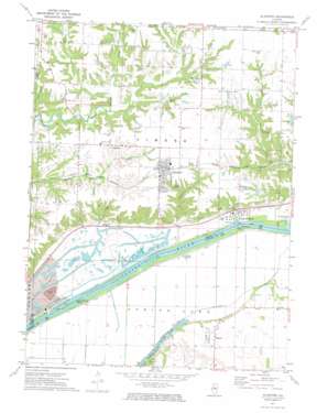
Glasford Topo Map Illinois
To zoom in, hover over the map of Glasford
USGS Topo Quad 40089e7 - 1:24,000 scale
| Topo Map Name: | Glasford |
| USGS Topo Quad ID: | 40089e7 |
| Print Size: | ca. 21 1/4" wide x 27" high |
| Southeast Coordinates: | 40.5° N latitude / 89.75° W longitude |
| Map Center Coordinates: | 40.5625° N latitude / 89.8125° W longitude |
| U.S. State: | IL |
| Filename: | o40089e7.jpg |
| Download Map JPG Image: | Glasford topo map 1:24,000 scale |
| Map Type: | Topographic |
| Topo Series: | 7.5´ |
| Map Scale: | 1:24,000 |
| Source of Map Images: | United States Geological Survey (USGS) |
| Alternate Map Versions: |
Glasford IL 1971, updated 1974 Download PDF Buy paper map Glasford IL 2012 Download PDF Buy paper map Glasford IL 2015 Download PDF Buy paper map |
1:24,000 Topo Quads surrounding Glasford
> Back to 40089e1 at 1:100,000 scale
> Back to 40088a1 at 1:250,000 scale
> Back to U.S. Topo Maps home
Glasford topo map: Gazetteer
Glasford: Guts
Brown Slough elevation 133m 436′Ferry Lake Slough elevation 135m 442′
Glasford: Islands
Coon Hollow Island elevation 136m 446′Glasford: Lakes
Jackass Pond (historical) elevation 132m 433′Kingston Lake elevation 135m 442′
Norman Slough elevation 133m 436′
Redbird Slough elevation 136m 446′
Thompsons Lake (historical) elevation 131m 429′
Glasford: Mines
Canton Road Mine elevation 156m 511′Kingston Mines elevation 149m 488′
Lightbody Mine elevation 145m 475′
Newsome Mine elevation 152m 498′
Glasford: Parks
Manito Prairie Nature Preserve elevation 142m 465′Glasford: Populated Places
Glasford elevation 187m 613′Kingston Mines elevation 141m 462′
Lancaster elevation 182m 597′
Talbott elevation 147m 482′
Glasford: Streams
Dry Run elevation 136m 446′Peyton Creek elevation 140m 459′
Glasford digital topo map on disk
Buy this Glasford topo map showing relief, roads, GPS coordinates and other geographical features, as a high-resolution digital map file on DVD:
Northern Illinois, Northern Indiana & Southwestern Michigan
Buy digital topo maps: Northern Illinois, Northern Indiana & Southwestern Michigan


