Banner Topo Map Illinois
To zoom in, hover over the map of Banner
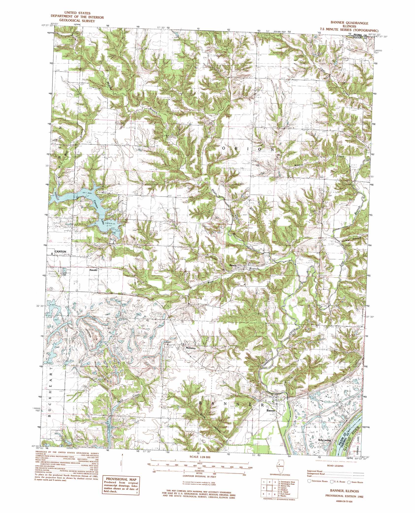
USGS Topo Quad 40089e8 - 1:24,000 scale
| Topo Map Name: | Banner |
| USGS Topo Quad ID: | 40089e8 |
| Print Size: | ca. 21 1/4" wide x 27" high |
| Southeast Coordinates: | 40.5° N latitude / 89.875° W longitude |
| Map Center Coordinates: | 40.5625° N latitude / 89.9375° W longitude |
| U.S. State: | IL |
| Filename: | o40089e8.jpg |
| Download Map JPG Image: | Banner topo map 1:24,000 scale |
| Map Type: | Topographic |
| Topo Series: | 7.5´ |
| Map Scale: | 1:24,000 |
| Source of Map Images: | United States Geological Survey (USGS) |
| Alternate Map Versions: |
Banner IL 1982, updated 1982 Download PDF Buy paper map Banner IL 2012 Download PDF Buy paper map Banner IL 2015 Download PDF Buy paper map |
1:24,000 Topo Quads surrounding Banner
Maquon |
Yates City |
Elmwood |
Oak Hill |
Dunlap |
Fairview |
Farmington West |
Farmington East |
Hanna City |
Peoria West |
Fiatt |
Canton |
Banner |
Glasford |
Pekin |
Lewiston |
Saint David |
Duck Island |
Manito |
South Pekin |
Duncan Mills |
Havana |
Topeka |
Forest City |
Natrona |
> Back to 40089e1 at 1:100,000 scale
> Back to 40088a1 at 1:250,000 scale
> Back to U.S. Topo Maps home
Banner topo map: Gazetteer
Banner: Dams
Canton City Lake Dam elevation 174m 570′Banner: Islands
King Island elevation 136m 446′Banner: Mines
Baxter Mine elevation 191m 626′G and L Mine elevation 159m 521′
Banner: Populated Places
Banner elevation 144m 472′Breeds elevation 147m 482′
Monterey elevation 183m 600′
Rawalts elevation 191m 626′
Banner: Reservoirs
Canton City Lake elevation 174m 570′Canton Lake elevation 174m 570′
Banner: Streams
East Branch Copperas Creek elevation 150m 492′Hinkle Branch elevation 146m 479′
Middle Branch Copperas Creek elevation 143m 469′
Parker Branch elevation 149m 488′
Tiber Creek elevation 152m 498′
West Branch Copperas Creek elevation 150m 492′
Wildcat Creek elevation 149m 488′
Banner: Valleys
Baker Hollow elevation 147m 482′Banner digital topo map on disk
Buy this Banner topo map showing relief, roads, GPS coordinates and other geographical features, as a high-resolution digital map file on DVD:
Northern Illinois, Northern Indiana & Southwestern Michigan
Buy digital topo maps: Northern Illinois, Northern Indiana & Southwestern Michigan