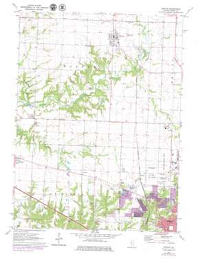
Dunlap Topo Map Illinois
To zoom in, hover over the map of Dunlap
USGS Topo Quad 40089g6 - 1:24,000 scale
| Topo Map Name: | Dunlap |
| USGS Topo Quad ID: | 40089g6 |
| Print Size: | ca. 21 1/4" wide x 27" high |
| Southeast Coordinates: | 40.75° N latitude / 89.625° W longitude |
| Map Center Coordinates: | 40.8125° N latitude / 89.6875° W longitude |
| U.S. State: | IL |
| Filename: | o40089g6.jpg |
| Download Map JPG Image: | Dunlap topo map 1:24,000 scale |
| Map Type: | Topographic |
| Topo Series: | 7.5´ |
| Map Scale: | 1:24,000 |
| Source of Map Images: | United States Geological Survey (USGS) |
| Alternate Map Versions: |
Dunlap IL 1971, updated 1973 Download PDF Buy paper map Dunlap IL 1971, updated 1979 Download PDF Buy paper map Dunlap IL 1996, updated 1997 Download PDF Buy paper map Dunlap IL 2012 Download PDF Buy paper map Dunlap IL 2015 Download PDF Buy paper map |
1:24,000 Topo Quads surrounding Dunlap
> Back to 40089e1 at 1:100,000 scale
> Back to 40088a1 at 1:250,000 scale
> Back to U.S. Topo Maps home
Dunlap topo map: Gazetteer
Dunlap: Airports
Frye Ultralight Airport elevation 213m 698′Warren Frye Farms Heliport elevation 213m 698′
Dunlap: Bridges
Evans Mill Bridge elevation 175m 574′Dunlap: Dams
Charter Oak North Lake Dam elevation 183m 600′Charter Oak Village Lake Dam elevation 195m 639′
Lake Lynnhurst Dam elevation 207m 679′
Radnor Rod and Gun Club Lake Dam elevation 210m 688′
Dunlap: Mines
Big Hollow Mine elevation 201m 659′Lucky Strike Mine elevation 172m 564′
Dunlap: Parks
Glen Oak Park elevation 190m 623′Leslie Rutherford Park elevation 193m 633′
Markwoodlands Park elevation 207m 679′
North Park elevation 216m 708′
Dunlap: Populated Places
Alta elevation 229m 751′Dunlap elevation 224m 734′
Orange Prairie elevation 213m 698′
Pioneer elevation 219m 718′
Dunlap: Post Offices
Dunlap Post Office elevation 221m 725′Dunlap: Reservoirs
Charter Oak North Lake elevation 183m 600′Charter Oak Village Lake elevation 195m 639′
Lake Lynnhurst elevation 207m 679′
Radnor Rod and Gun Club Lake elevation 210m 688′
Dunlap: Streams
Hickory Run elevation 171m 561′Dunlap digital topo map on disk
Buy this Dunlap topo map showing relief, roads, GPS coordinates and other geographical features, as a high-resolution digital map file on DVD:
Northern Illinois, Northern Indiana & Southwestern Michigan
Buy digital topo maps: Northern Illinois, Northern Indiana & Southwestern Michigan


